
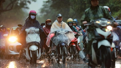
On the morning of September 16, radar data showed that the North had two centers of heavy rain in the Lao Cai - Tuyen Quang area and Thanh Hoa - Southern Northern Delta. The thunderstorms lasted for a long time and tended to spread deep inland.
In the Central and Southern regions, there will be little rain this morning, but from the evening, thunderstorms will return in the Central Highlands and the South, with the same frequency as on September 15. The main cause is the strong activity of the Southwest monsoon combined with the equatorial low pressure trough and East wind disturbances from the sea, causing heavy rain in the evening, in some places accompanied by whirlwinds, strong gusts of wind and lightning.

Notably, meteorological experts say that from now until the end of September, the East Sea may see at least two tropical depressions or storms. Currently, the international low pressure area #98W in the East Sea has a 60% chance of strengthening into a tropical depression before September 23. In addition, another low pressure area (#99W) off the coast of the Philippines has an 80% chance of developing into a storm when it enters the East Sea between September 23 and 26.
People need to closely monitor weather forecasts to proactively respond to heavy rain, thunderstorms and tropical depressions.
Source: https://www.sggp.org.vn/hom-nay-16-9-nhieu-noi-co-mua-to-nguy-co-lien-tiep-ap-thap-nhiet-doi-post813180.html

![[Photo] Cutting hills to make way for people to travel on route 14E that suffered landslides](https://vphoto.vietnam.vn/thumb/1200x675/vietnam/resource/IMAGE/2025/11/08/1762599969318_ndo_br_thiet-ke-chua-co-ten-2025-11-08t154639923-png.webp)


![[Video] Hue Monuments reopen to welcome visitors](https://vphoto.vietnam.vn/thumb/402x226/vietnam/resource/IMAGE/2025/11/05/1762301089171_dung01-05-43-09still013-jpg.webp)


Comment (0)