
On the afternoon of November 26th, Mr. Hoang Phuc Lam, Deputy Director of the National Center for Meteorological and Hydrological Forecasting (Department of Meteorology and Hydrology, Ministry of Agriculture and Environment ), provided the latest assessment regarding the predicted movement, intensity, and impact of Typhoon No. 15 on Vietnam.
Reasons why storms weaken as they approach land.
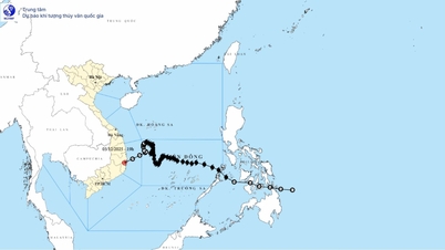
According to Mr. Lam, as of 4 PM on November 26th, Typhoon Koto was at level 10 and is likely to strengthen to level 11. Currently, due to the influence of the subtropical high-pressure system, the typhoon is moving fairly steadily in a west-northwest direction, at a speed of about 20-25 km/h.
However, as the storm gradually moves away from the subtropical high-pressure system, its speed will slow down. Notably, a cold front will intensify on the night of November 27th, which is unfavorable for the storm's development. Initially, the storm will maintain its strong intensity, but upon encountering cold seas and the cold air penetrating deep into its circulation, its structure will be disrupted. This is the main reason why the storm will weaken significantly from around late afternoon and night of November 29th onwards.
, commented on Typhoon No. 15. Photo: Trung Nguyen.")
Mr. Hoang Phuc Lam, Deputy Director of the National Center for Meteorological and Hydrological Forecasting (Department of Meteorology and Hydrology, Ministry of Agriculture and Environment), commented on Typhoon No. 15. Photo: Trung Nguyen.
The storm is forecast to weaken to level 9-10 on November 30th and December 1st. Another point to note is that as it moves towards the northwestern sea area of the Truong Sa Special Administrative Region (about 500km east of the Gia Lai - Khanh Hoa coast), the storm's trajectory tends to gradually shift northward. This will change the impact of Typhoon No. 15 on the sea areas as well as the mainland of Vietnam.
Currently, the meteorological and hydrological agency has presented two scenarios. The scenario with the highest probability (80%) is: The storm changes direction northward and gradually weakens into a low-pressure area. This low-pressure area is then likely to drift towards the mainland of the central provinces before weakening further over the sea. Under this scenario, from November 27th, the central area of the East Sea (including the sea area north of the Truong Sa special administrative region) is likely to experience strong winds of force 10-11, gusting to force 14, with waves 6-8 meters high, and extremely rough seas.
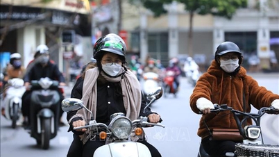
On land, storms are unlikely. The area from Da Nang to Lam Dong is likely to experience a period of widespread heavy rain in the first days of December 2025, with the focus on coastal areas, and the rain is highly unlikely to be as extreme as the rain from November 16-21.

According to the National Center for Hydro-Meteorological Forecasting's forecast, based on the scenario with the highest probability of occurrence, the storm will change direction and move along the coastal areas of the South Central provinces. Photo: NCHMF.
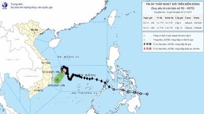
The worst-case scenario is that the storm does not change direction and enters the Gia Lai - Khanh Hoa area (20% probability). In this scenario, the storm could cause strong winds exceeding level 6 inland, and coastal areas of provinces from Da Nang to Lam Dong could experience winds of level 8, gusting to level 10, starting from November 29th. Sea waves could reach 3-5 meters in height, with rough seas. Rainfall could reach 150-250mm between November 29th and December 1st, and the likelihood of extreme rainfall is high.
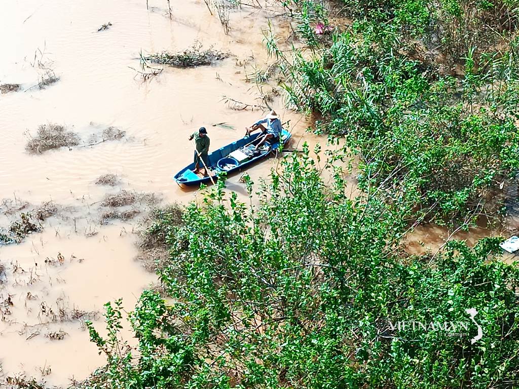
However, because this region has experienced prolonged heavy rain and flooding, even a less heavy rain could trigger landslides. Therefore, localities need to comply with the directives of the National Civil Defense Steering Committee and guide communes/wards in implementing specific disaster preparedness measures.
“The National Center for Hydro-Meteorological Forecasting will continue to closely monitor the development of the storm as well as the factors influencing its trajectory and intensity to provide full and timely updates in subsequent bulletins. It can be confirmed immediately that the sea and coastal areas will certainly be affected. Ships operating in this area are advised to proactively move out of the danger zone and seek safe shelter on land to avoid risks from strong winds of level 6 or higher,” Mr. Lam emphasized.
The storm's impact lasted for an extended period.
Explaining why the forecasting agency predicted less extreme rainfall, Mr. Lam said: For the Central region, the main factor causing rain is the topography, with the Truong Son mountain range extending in a northwest-southeast direction acting as a "wall" to block the wind. Specifically for typhoon No. 15, the area of the South Central region where the typhoon is expected to make landfall is not a high-altitude windbreak like the North Central region. The typhoon will mainly be offshore during its peak, so the impact on the South Central region will be much smaller compared to areas near the typhoon's center or those directly hit by the typhoon.
According to Mr. Lam, a notable characteristic of Typhoon No. 15 is its prolonged impact due to its slow movement. While many typhoons in 2025 moved very quickly, at speeds of 25–30 km/hour, reaching land and dissipating within just 2 to 3 days, Typhoon Koto showed a distinctly slower pace.
It is expected that from the afternoon of November 28th onwards, the storm will move mainly at a speed of about 5-10 km/hour. Therefore, the duration of the storm, as well as the time for monitoring and responding to it, will extend into the beginning of December.
Looking further ahead, there is still a possibility of another tropical depression or typhoon forming in the South China Sea between now and the end of December. This indicates that this year's typhoon season is not yet over, and even after typhoon number 15, close monitoring is still necessary.
According to the usual pattern, storms occurring in November and December tend to have a greater impact on the South Central and Southern regions of Vietnam. Therefore, it cannot be ruled out that any storms following Typhoon No. 15, if they occur, will still primarily affect these two areas.
Including Typhoon Koto, the total number of tropical cyclones this year has reached 20, comprising 15 typhoons and 5 tropical depressions, significantly higher than the multi-year average. With forecasts indicating the possibility of more typhoons/tropical depressions in the coming month, 2025 could become the year with the highest number of tropical cyclones in the last 30 years.
Source: https://nongnghiepmoitruong.vn/kich-ban-bao-so-15-tac-dong-den-dat-lien-d786697.html


Comment (0)