
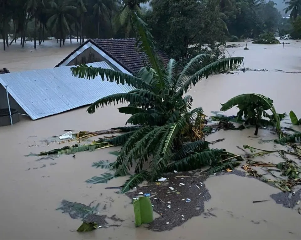
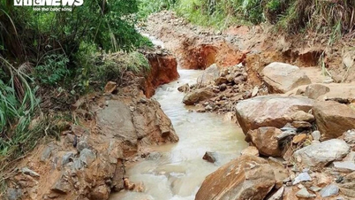
According to the National Center for Hydro-Meteorological Forecasting, on the same morning, water levels in many rivers from Hue to Khanh Hoa and the Central Highlands were at very high levels and continued to develop complicatedly. Floods on the Ba River, Kon River and Krong Ana River were rising rapidly.
At Cung Son station (Ba river), the water level exceeded alarm level 3 by 1.42m; at Phu Lam station, it exceeded alarm level 3 by 0.24m. Kon river at Thach Hoa station reached alarm level 3.
Many other rivers from Hue, Da Nang , Quang Ngai, Gia Lai to Khanh Hoa are also fluctuating at warning levels 1-3, including Dinh River (Khanh Hoa) at warning level 3.
Mr. Hoang Van Dai, Deputy Director of the National Center for Hydro-Meteorological Forecasting, said: "Warning level 4 is issued when the area faces a dangerous combination of large floods, flash floods, and landslides, which pose a risk of causing great damage to people and property."
It is forecasted that by the evening of November 19, the flood on the Ba River at Phu Lam station may reach the historical level of 1993 (5.21m). Floods on major rivers such as Kon, Krong Ana, Tra Khuc, Thu Bon will continue to remain at high levels. In the next 24 hours, there is a possibility of widespread flooding in the provinces from Hue to Khanh Hoa.
According to the National Center for Hydro-Meteorological Forecasting, the risk of flash floods on small rivers and streams and landslides on steep slopes in the Central and Central Highlands regions is currently at a very high level. Many residential areas, especially low-lying areas, downstream areas of reservoirs and riverside areas, are likely to be deeply flooded in the coming hours.
The Meteorological and Hydrological Agency recommends that people in flood-prone areas limit their movement through deeply flooded areas, underground overflow areas, and landslide-prone slopes; and proactively evacuate dangerous areas as requested by local authorities. The Meteorological and Hydrological Agency will continuously update information warning of natural disasters in this area.
Source: https://www.sggp.org.vn/lu-dac-biet-lon-tren-song-ba-nang-muc-rui-ro-thien-tai-len-cap-do-4-tai-dak-lak-post824270.html


![[Photo] Next to the "mountain of trash" after the flood, Tuy Hoa residents strive to rebuild their lives](/_next/image?url=https%3A%2F%2Fvphoto.vietnam.vn%2Fthumb%2F1200x675%2Fvietnam%2Fresource%2FIMAGE%2F2025%2F11%2F24%2F1763951389752_image-1-jpg.webp&w=3840&q=75)


Comment (0)