
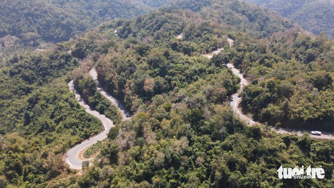
Among the routes connecting the two provinces, National Highway 28B is currently the most anticipated as the Ministry of Construction (formerly the Ministry of Transport) is upgrading and expanding it, with a total investment of more than VND1,400 billion. In the photo is the Dai Ninh Pass section, National Highway 28B - Photo: DUC TRONG
The draft submission on the resolution of the National Assembly Standing Committee on the arrangement of administrative units states: “Prioritize the arrangement of mountainous and delta units with coastal administrative units; harmoniously and reasonably combine adjacent units…”. Lam Dong and Binh Thuan are within the scope of this criterion and are analyzed and proposed by experts to be merged.
According to the traffic axis, Binh Thuan has National Highway 1 and the North-South Expressway in the east, Lam Dong has National Highway 20 running along the two provinces.
To travel between the two provinces, there are many provincial roads, "fishbone" national roads connecting the expressway, national highway 1 and national highway 20. The two provinces are bordered by plateaus, hills, old forests...
Currently, all the roads connecting the "sea and flowers" go through winding, winding mountain passes under the canopy of old forests such as Da Mi, Gia Bac, Dai Ninh...
On Highway 55 there is Da Mi Pass, located between the two hydroelectric reservoirs Ham Thuan - Da Mi - Photo: DUC TRONG
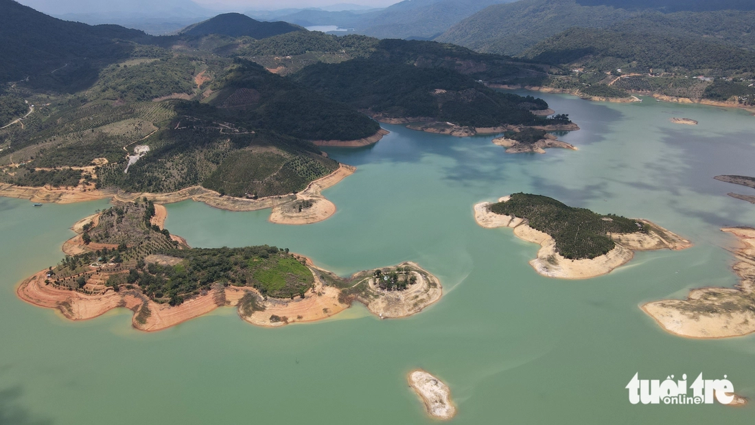
Traveling on Highway 55 through Da Mi Pass, people will capture the beautiful scenery of Ham Thuan - Da Mi hydroelectric lake - Photo: DUC TRONG
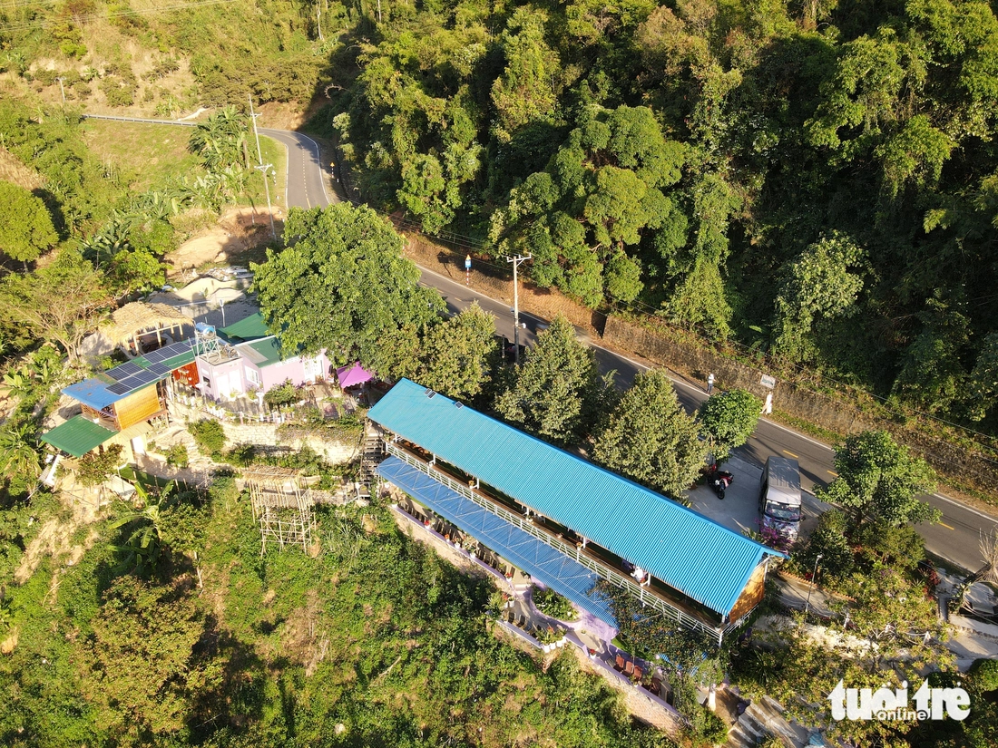
Currently, Highway 55 is mainly a two-lane road. Landslides often occur on Da Mi Pass during the rainy season - Photo: DUC TRONG
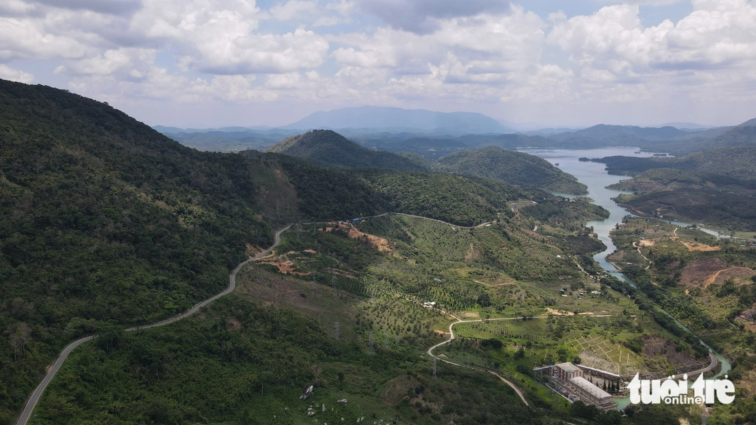
In the central localities of Binh Thuan province, there is National Highway 28 connecting with Lam Dong province - Photo: DUC TRONG
Traveling on National Highway 28 from Phan Thiet City, through Ham Thuan Bac District, over Gia Bac Pass to reach the center of Di Linh District, Lam Dong Province. And further to Gia Nghia City, Dak Nong Province - Photo: DUC TRONG
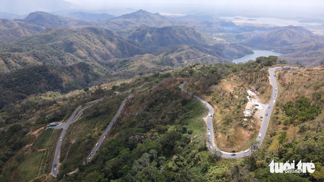
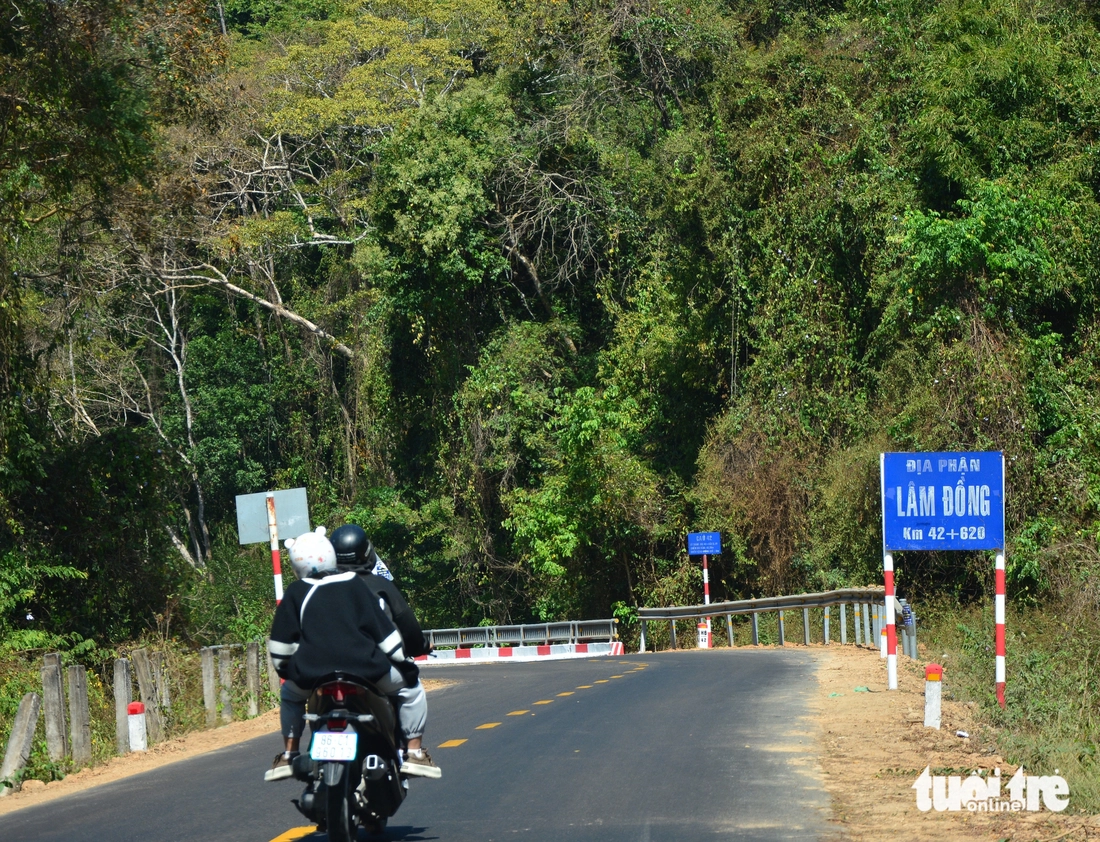
National Highway 28B starts at Luong Son town, Bac Binh district, Binh Thuan province and borders National Highway 20 at Ta Hine commune, Duc Trong district, Lam Dong province. This is the shortest route connecting the two provincial capitals, the coastal city of Phan Thiet and the city of thousands of flowers, Da Lat - Photo: DUC TRONG
The pass that borders two provinces via this national highway is Dai Ninh. Especially since the North-South expressway sections connecting Ho Chi Minh City to Vinh Hao, many people have chosen the route via Dai Ninh Pass to Da Lat - Photo: DUC TRONG
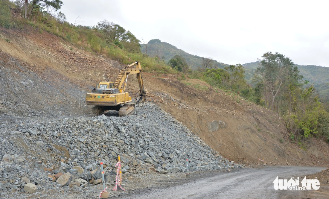
Among the routes connecting the two provinces, National Highway 28B is currently the most anticipated as the Ministry of Construction (formerly the Ministry of Transport) is upgrading and expanding it, with a total investment of more than 1,400 billion VND - Photo: DUC TRONG
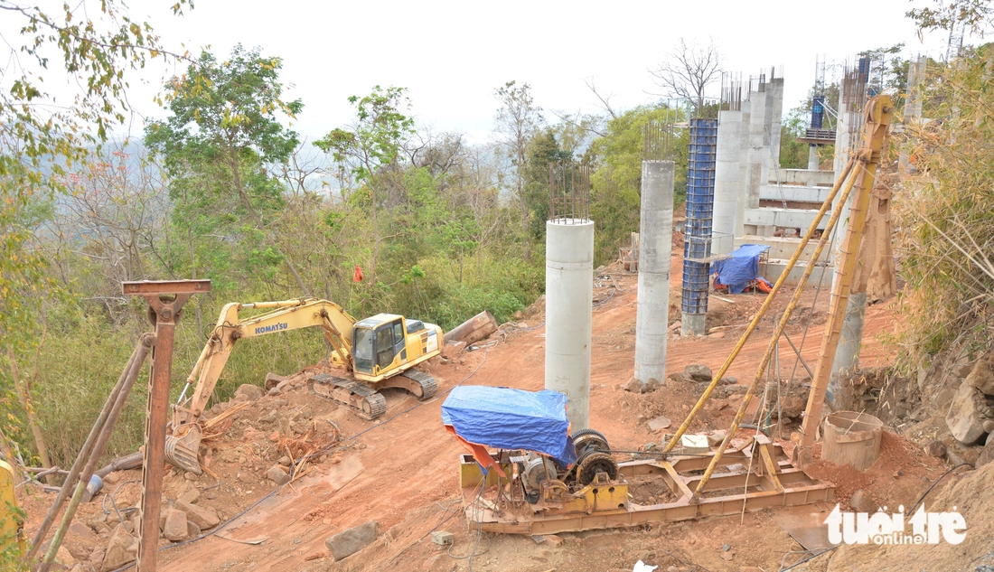
According to the investor, the project to renovate and upgrade National Highway 28B through Binh Thuan and Lam Dong provinces is about 68km long, especially Dai Ninh Pass, which is currently of great significance for regional connectivity, forming a tourism triangle "Ho Chi Minh City - Phan Thiet - Da Lat". In the photo are the footbridge sections of the Dai Ninh Pass curve - Photo: DUC TRONG
Source: https://tuoitre.vn/toan-canh-nhung-cung-deo-noi-binh-thuan-lam-dong-20250401111712661.htm


Comment (0)