
 |
Askja is a volcano located in the remote highlands of Iceland. It lies within the Odadahraun lava field, a vast, desert-like wasteland covering 5,000 square kilometers within Vatnajokull National Park. (Image: Craters from the 1961 eruption of Askja. Source: Reuters) |
The Republic of Iceland, also known as the Island of Ice, is an island nation in Europe, with an area of 103,000 km2 and a population of only about 337,000 (according to Worldometers).
Located in the middle of the Atlantic Ocean, bordering the Arctic Circle, Iceland has a very cold climate with many glaciers and icebergs.
According to National Geographic , approximately 11% of Iceland's land area is covered by permafrost. The Vatnajökull glacier in Iceland is the largest in Europe and the third largest in the world (after glaciers in Antarctica and Greenland), with a surface area of approximately 8,100 km2.
Besides glaciers and icebergs, Iceland also has many volcanoes, hot springs, and vast geothermal resources due to its location on the Atlantic volcanic belt. According to Reference , it is precisely because of the presence of both glaciers and volcanoes that Iceland is known as the land of fire and ice.
Let's admire the unique beauty of Iceland in these images published by Reuters .
 |
| The pristine white landscape of Fjallsarlon, one of Iceland's two most famous glaciers, alongside Jokulsarlon. (Source: Reuters) |
 |
| Lake Askja is Iceland's deepest lake, with a depth of over 200 m (656 ft). The lake was formed in 1875 when a powerful eruption occurred in the southern part of the crater of the volcano of the same name. (Image: Tourists swim in the lake formed in the crater of the Askja volcano in Vatnajokull National Park, Iceland. Source: Reuters) |
 |
| Volcanic gases escape from vents at a crater on the Askja volcano. (Source: Reuters) |
 |
| Bubbles of gas rise from a pool of heated water at the Askja volcano. (Source: Reuters) |
 |
| Icebergs with unusual shapes float on the Jokulsarlon glacier in southern Iceland. (Source: Reuters) |
 |
| Lake Oskjuvatn was created during the 1875 eruption of Mount Askja in Vatnajokull National Park, Iceland. (Source: Reuters) |
 |
| Icebergs float on Lake Fjallsarlon, part of the Fjallsjokull glacier in southern Iceland. (Source: Reuters) |
 |
| The landscape surrounding the Askja volcano resembles an alien planet, due to its desert-like terrain covered in ash and lava. (Source: Reuters) |
 |
| In fact, NASA's Apollo program used this area to prepare for astronauts to carry out missions to the moon. (Source: Reuters) |
 |
| NASA believes the landscape and geology may be similar to the moon. In 2015, some of these astronauts returned to Askja. In the photo: Tourists walk along the edge of the Viti crater of the Askja volcano. (Source: Reuters) |
 |
| A block of ice melts at Diamond Beach, near the Jokulsarlon glacier in southern Iceland. |
 |
| Lake Viti was formed at the end of the 1875 eruption of Mount Askja. The water temperature here varies depending on the amount of meltwater from glaciers flowing into the crater. On average, the temperature is around 30°C. The deepest area in the center of the crater is over 8 meters. (Source: Reuters) |
 |
Once a training ground for the Apollo 11 crew, the spectacular Eldhraun moss carpet was formed between 1783 and 1784, following the most devastating volcanic eruption in Iceland's history. (Source: Reuters) |
 |
| Icebergs, fragments broken off from a larger ice mass, float on the surface of Jokulsarlon, a glacier in southern Iceland. (Source: Reuters) |
 |
| Skaftafellsjokull, a glacier that broke off from the Vatnajokull ice cap, in southern Iceland. (Source: Reuters) |
Source: https://baoquocte.vn/du-lich-iceland-tram-tro-truc-khung-canh-sieu-thuc-nhu-hanh-tinh-la-o-vung-dat-lua-va-bang-292190.html


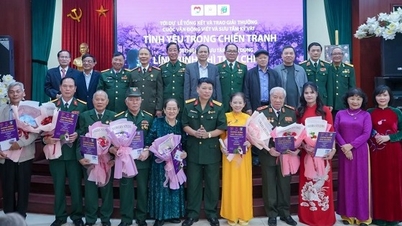
![[Photo] Prime Minister Pham Minh Chinh receives the Governor of Tochigi Province (Japan)](/_next/image?url=https%3A%2F%2Fvphoto.vietnam.vn%2Fthumb%2F1200x675%2Fvietnam%2Fresource%2FIMAGE%2F2025%2F12%2F16%2F1765892133176_dsc-8082-6425-jpg.webp&w=3840&q=75)
![[Live] 2025 Community Action Awards Gala](/_next/image?url=https%3A%2F%2Fvphoto.vietnam.vn%2Fthumb%2F1200x675%2Fvietnam%2Fresource%2FIMAGE%2F2025%2F12%2F16%2F1765899631650_ndo_tr_z7334013144784-9f9fe10a6d63584c85aff40f2957c250-jpg.webp&w=3840&q=75)
![[Image] Leaked images ahead of the 2025 Community Action Awards gala.](/_next/image?url=https%3A%2F%2Fvphoto.vietnam.vn%2Fthumb%2F1200x675%2Fvietnam%2Fresource%2FIMAGE%2F2025%2F12%2F16%2F1765882828720_ndo_br_thiet-ke-chua-co-ten-45-png.webp&w=3840&q=75)
![[Photo] Prime Minister Pham Minh Chinh receives Lao Minister of Education and Sports Thongsalith Mangnormek](/_next/image?url=https%3A%2F%2Fvphoto.vietnam.vn%2Fthumb%2F1200x675%2Fvietnam%2Fresource%2FIMAGE%2F2025%2F12%2F16%2F1765876834721_dsc-7519-jpg.webp&w=3840&q=75)


![[Video] Independence and self-reliance linked with international integration through 40 years of reform](https://vphoto.vietnam.vn/thumb/402x226/vietnam/resource/IMAGE/2025/12/16/1765899635777_1-1-8054-png.webp)


Comment (0)