
Early morning of June 11, Deputy Director of the National Center for Hydro-Meteorological Forecasting Nguyen Xuan Hien said that the tropical depression currently has very strong winds (level 7, gusting to level 9).
The tropical depression is moving in a West Northwest direction and is likely to strengthen into a storm on June 12.
Tropical depression moving slowly in the West Northwest direction
According to the National Center for Hydro-Meteorological Forecasting, at 1:00 a.m. on June 11, the center of the tropical depression was located at about 15.5 degrees North latitude; 113.8 degrees East longitude, about 240km East Southeast of the Hoang Sa area.
The strongest wind near the center of the tropical depression is level 7 (50-61km/h), gusting to level 9. The tropical depression moves slowly in the West Northwest direction at a speed of about 5-10km/h.
Providing specific information about the developments, Deputy Director of the National Center for Hydro-Meteorological Forecasting Nguyen Xuan Hien said that at 1:00 a.m. on June 12, the tropical depression was moving in a West-Northwest direction over the Hoang Sa area at a speed of about 10 km/h.
The strongest wind of the tropical depression is level 8-9, gusting to level 11 and is likely to strengthen into a storm. The dangerous area is the North East Sea (including the Hoang Sa area) and the North of the central East Sea. The natural disaster risk level is level 3.
At 1:00 a.m. on June 13, the tropical depression moved northwestward over the sea south of Hainan Island (China) at a speed of about 10-15 km/h. The strongest wind of the tropical depression was level 9-10, gusting to level 13 and was likely to strengthen further.
The dangerous area is the North East Sea (including Hoang Sa area), the North of the area between the East Sea and the offshore waters from Quang Tri to Quang Ngai . Disaster risk level 3.
Warning: In the next 48 to 72 hours, the storm is likely to change direction and move to the North Northwest at a speed of about 10km/h.
Due to the influence of the tropical depression, the North East Sea area (including the Hoang Sa sea area), the North of the central East Sea area has thunderstorms and strong winds of level 6-7, then increasing to level 8-9, gusting to level 11, waves 2.5-4.5m high, very rough seas.
In the South of the central East Sea area, the South East Sea area (including the sea area of Truong Sa) there is strong southwest wind level 6, sometimes level 7, gusting to level 8-9, waves 2-4m, rough sea.
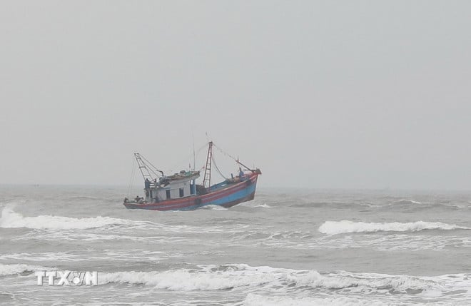
Ships operating in the above mentioned dangerous areas are likely to be affected by storms, whirlwinds, strong winds and large waves.
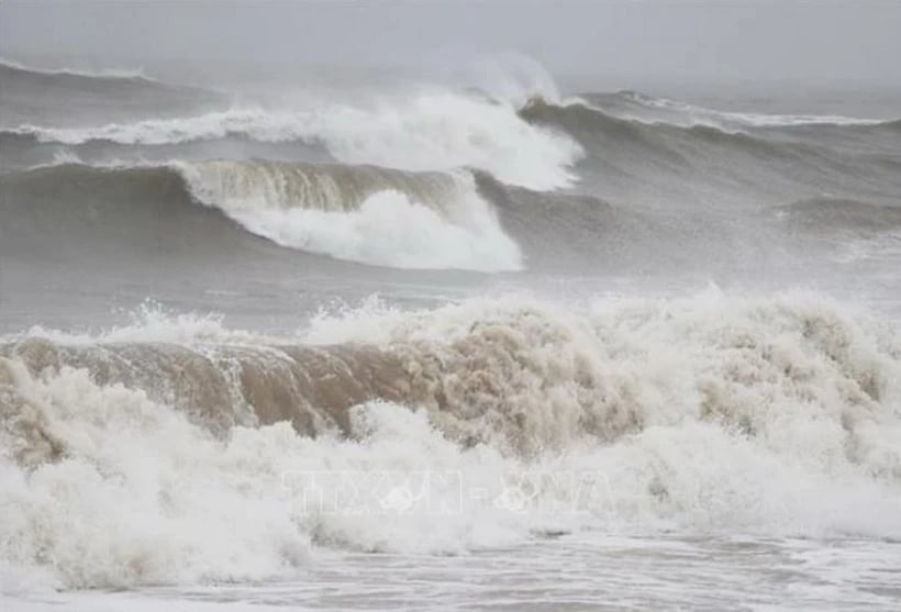
Tropical depression causes rough seas. (Photo: Xuan Tien/VNA)
To proactively respond to the tropical depression, on June 10, the Minister of Agriculture and Environment issued Official Dispatch No. 2969/CD-BNNMT, requesting ministries, branches, and Chairmen of People's Committees of coastal provinces and cities from Quang Ninh to Khanh Hoa to closely monitor the developments of the tropical depression; strictly manage means of transport going to sea; organize counting and notify owners of means of transport, captains of ships and boats operating at sea of the location, direction of movement and developments of the tropical depression to proactively avoid, escape or not move into dangerous areas.
Ministries, sectors and localities are ready with forces and means for rescue when required. Ministries, sectors and localities, according to their functions, state management tasks and assigned tasks, proactively direct and coordinate with localities to respond to tropical depressions.
Vietnam News Agency, Vietnam Television, Voice of Vietnam , the coastal information station system and mass media agencies from central to local levels should increase information about the developments of the tropical depression to authorities at all levels, owners of means of transport operating at sea and people to proactively prevent and respond.
The above units organize serious duty and regularly report to the Ministry of Agriculture and Environment (through the Department of Dyke Management and Disaster Prevention and Control).
Heavy rain in South Central, Central Highlands and South
On land, during the day and night of June 11, the South Central, Central Highlands and Southern regions will have moderate rain, heavy rain and thunderstorms, locally very heavy rain with common rainfall of 30-70mm, in some places over 150mm.
From the night of June 11 to June 13, the Central Central region and the Northern Central Highlands will have moderate rain, heavy rain and thunderstorms, locally very heavy rain with common rainfall such as the Central Central region from 100-300mm, some places over 450mm.
Northern Central Highlands region from 70-150mm, some places over 200mm. Warning of risk of localized heavy rain over 200mm in 6 hours.
Warning: From June 14, heavy rain in the above areas will decrease. During thunderstorms, there is a possibility of tornadoes, lightning, hail and strong gusts of wind. Natural disaster risk level due to heavy rain is level 1.
Heavy rains are likely to cause flooding in low-lying areas, urban and industrial areas; flash floods on small rivers and streams, landslides on steep slopes (real-time warning information on areas at risk of flash floods and landslides is provided online on the website of the Department of Hydrometeorology at: https://luquetsatlo.nchmf.gov.vn and in separate bulletins warning of flash floods and landslides).
On the night of June 10 and early morning of June 11, the Central Central, Central Highlands and Southern regions will have showers and thunderstorms, with some places experiencing heavy to very heavy rain. The rainfall from 7:00 p.m. on June 10 to 3:00 a.m. on June 11 was over 70mm in some places, such as Hai Lam (Quang Tri) 95.8mm, Ia Dom (Kon Tum) 88.6mm, Ayun Trung Dam-Hydropower Plant (Hue) 78.2mm, Nhon Hoa (Gia Lai) 156.4mm...
Weather in regions day and night 11-6
Northwest
- Sunny day, showers and thunderstorms in the late afternoon and night, with the possibility of tornadoes, lightning and strong gusts of wind during thunderstorms.
- Lowest temperature 23-26 degrees Celsius, some places below 22 degrees Celsius. Highest temperature 31-34 degrees Celsius, some places above 34 degrees Celsius.
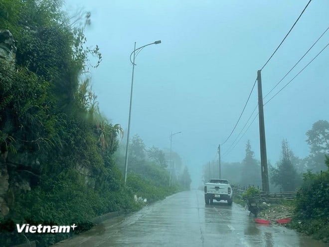
Thunderstorms in mountainous areas. (Photo: Vietnam+)
Northeast
- Sunny day, scattered showers and thunderstorms in the late afternoon and night, with the possibility of tornadoes, lightning and strong gusts of wind during thunderstorms. North to Northwest wind level 2-3.
- Lowest temperature 24-27 degrees Celsius, mountainous areas below 24 degrees Celsius. Highest temperature 31-34 degrees Celsius.
Hanoi capital
- Sunny day, occasional showers and thunderstorms in the late afternoon and night, with the possibility of tornadoes, lightning and strong gusts of wind during thunderstorms. North to Northwest wind level 2-3.
- Lowest temperature 24-26 degrees Celsius. Highest temperature 32-34 degrees Celsius.
From Thanh Hoa-Hue
- In the North, there will be showers and thunderstorms in some places during the day, scattered showers and thunderstorms in the evening and at night. In the South, there will be showers and scattered thunderstorms during the day, locally heavy rain in some places, moderate rain, heavy rain and thunderstorms at night, locally very heavy rain in some places, during thunderstorms there is a possibility of tornadoes, lightning, hail and strong gusts of wind. North to Northwest wind level 2-3.
- Lowest temperature 23-26 degrees Celsius. Highest temperature in the North 31-34 degrees Celsius, in the South 29-32 degrees Celsius.
From Da Nang-Binh Thuan
- There will be moderate to heavy rain, locally very heavy rain; in the North, there will be scattered showers and thunderstorms, locally heavy rain, with the possibility of tornadoes, lightning, hail and strong gusts of wind during the storm. West to southwest wind level 3-4, gusts level 6-7 in some places.
- Lowest temperature 24-27 degrees Celsius. Highest temperature in the North 28-31 degrees Celsius, some places above 31 degrees.
Central Highlands
- There will be moderate to heavy rain and scattered thunderstorms, locally very heavy rain, with the possibility of tornadoes, lightning, hail and strong gusts of wind during thunderstorms. Southwesterly wind level 3.
- Lowest temperature 20-23 degrees Celsius. Highest temperature 27-30 degrees Celsius.
Southern Vietnam
- There will be moderate to heavy rain and scattered thunderstorms, locally very heavy rain, with the possibility of tornadoes, lightning, hail and strong gusts of wind during thunderstorms. Southwesterly wind level 3.
- Lowest temperature 24-27 degrees Celsius. Highest temperature 30-33 degrees Celsius.
Source: https://baobinhphuoc.com.vn/news/9/173860/ap-thap-nhiet-doi-manh-len-mua-lon-tren-nhieu-khu-vuc-tren-ca-nuoc


Comment (0)