
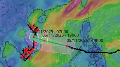
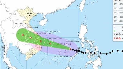
The National Center for Hydro-Meteorological Forecasting warns that in the next 72 to 120 hours, the storm will move north, then northeast, at a speed of 10-15km per hour, then increase to 20-25km and its intensity will gradually decrease. Strong winds and big waves.

The path of the storm.
Forecast:
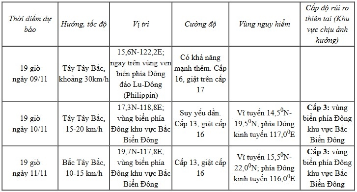
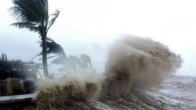
Meanwhile, the eastern sea areas of the North East Sea have winds gradually increasing to level 6-7, then increasing to level 8-9; the area near the storm center has strong winds of level 10-12, gusting to level 14-15, waves 3.0-5.0m high, then increasing to 6.0-8.0m. The sea is very rough.
During November 10-12, the eastern sea area of the North East Sea is likely to be affected by strong storm winds of level 11-13, gusts of level 16, and waves of 8.0-10.0m high. The sea will be very rough.
Therefore, the National Center for Hydro-Meteorological Forecasting recommends that all boats operating in the above-mentioned dangerous areas are likely to be affected by storms, whirlwinds, strong winds, and large waves.
Source: https://baolaocai.vn/bao-fung-wong-manh-cap-14-giat-cap-17-dang-di-chuyen-vao-bien-dong-post886364.html


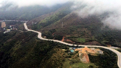
![[Photo] Cutting hills to make way for people to travel on route 14E that suffered landslides](https://vphoto.vietnam.vn/thumb/1200x675/vietnam/resource/IMAGE/2025/11/08/1762599969318_ndo_br_thiet-ke-chua-co-ten-2025-11-08t154639923-png.webp)


![[Video] Hue Monuments reopen to welcome visitors](https://vphoto.vietnam.vn/thumb/402x226/vietnam/resource/IMAGE/2025/11/05/1762301089171_dung01-05-43-09still013-jpg.webp)


Comment (0)