
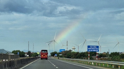
The planning of Ca Mau province for the period 2021-2030, with a vision to 2050, clearly defines the goal of "making Ca Mau soon become one of the marine economic centers, the renewable energy center of the Mekong Delta, the renewable energy export center of the whole country", and affirms that Ca Mau will "have three economic zones and five growth poles".
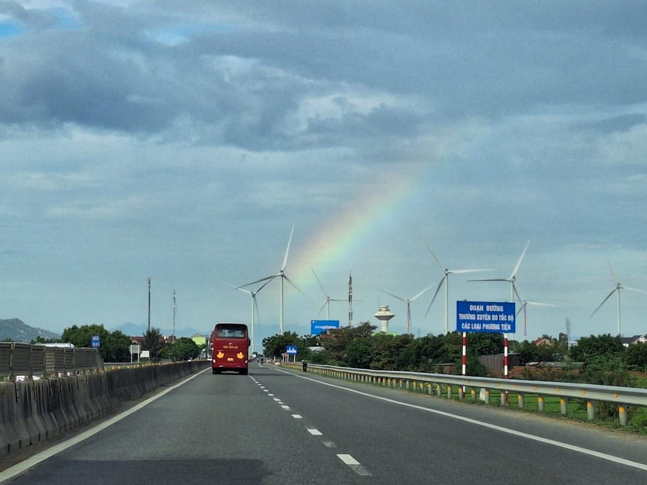
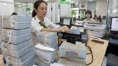
Ca Mau aims to become the country's renewable energy export center. Illustration photo: Thanh Tung/VNS
The country's renewable energy export center
Deputy Prime Minister Tran Hong Ha has just signed Decision No. 1386/QD-TTg approving the Planning of Ca Mau province for the period of 2021-2030, with a vision to 2050. One of the important development perspectives stated in this planning is to "promote rationally and effectively the potential, comparative advantages, outstanding and unique opportunities, and advantages of the sea and islands as the foundation for rapid, sustainable and comprehensive socio-economic development of Ca Mau province, making Ca Mau soon become one of the marine economic centers, the renewable energy center of the Mekong Delta, the renewable energy export center of the whole country; apply science and technology, innovation, digital transformation and transform the growth model towards developing a green economy, a circular economy associated with growth drivers, focusing on developing the marine economy, tourism, and industries with potential and advantages".
On that basis, the Planning of Ca Mau province for the period 2021-2030, with a vision to 2050, has determined the general goal that "by 2030, Ca Mau will become a fairly developed province in the Mekong Delta; have a synchronous and gradually modern infrastructure system; have human resources to meet development needs; the ecosystem is preserved and effectively adapted to climate change. National defense, security, order and social safety are ensured, people have a prosperous and happy life".
The plan also clearly states Ca Mau's specific goals such as striving to achieve an average economic growth rate (GRDP) of over 7.5% per year in the 2021-2030 period. The scale of GRDP in 2030 is 2-2.5 times higher than in 2020. GRDP per capita is over 146 million VND. In terms of society, the rate of schools meeting national standards is over 80%. The rate of trained workers is over 65%, of which the rate of trained workers with degrees and certificates is over 30%.
In the vision to 2050, Ca Mau will be a province with a developed economy, a civilized and modern society, adapting to climate change; cultural values bearing the identity of Ca Mau people are preserved and promoted. The ecological environment and biodiversity are protected and preserved. Economic - social infrastructure and digital infrastructure are developed synchronously and modernly. Politics, national defense and security are maintained, social order and safety are ensured.
Ca Mau will have three economic zones and five growth poles.
According to the Planning of Ca Mau province for the period 2021-2030, with a vision to 2050, Ca Mau will have three economic zones including: Central service-urban-industrial development zone; West coastal urban-industrial-fishery, agriculture and forestry economic development zone; and East coastal industrial-urban-fishery, agriculture and forestry economic development zone.

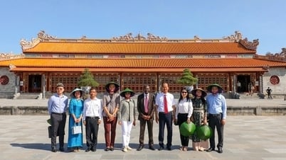
Tourists experience the sunrise at Dat Mui - the southernmost point of the country. Photo: Hong Dat/VNA
With Ca Mau city as the growth pole, the central service-urban-industrial development area will be the area with the central urban area of the province; the administrative, economic, scientific-technological, educational and training, and medical center of the province; the hub for distributing goods and providing services for the entire province.
With the growth pole being Song Doc urban area, the urban-industrial-economic development area of fisheries, agriculture and forestry along the West coast will be an area for aquaculture, fishing, seafood processing, and fishery logistics services; an alternating freshwater-brackish water agricultural area; and a forestry area developed according to a sustainable model associated with the conservation of U Minh Ha National Park.
With the growth poles being Nam Can urban area - Nam Can Economic Zone, Tan Thuan urban area and Dat Mui urban area - Hon Khoai general seaport, the industrial-urban-economic development area of fisheries, agriculture and forestry along the East coast will be the hub for sea freight circulation and logistics services through Hon Khoai general seaport, Nam Can Economic Zone; aquaculture area, production forest; key tourism development area of the province.
In addition, Ca Mau will form and develop two economic corridors along the North-South and East-West axes based on expressways, cross-axis roads, coastal roads, connecting seaports, airports, economic zones, industrial parks, industrial clusters associated with urban areas, development linkage axes and growth poles; connecting with the southern coastal corridor of the Greater Mekong Subregion (Ha Tien - Rach Gia - Ca Mau Economic Corridor) contributing to promoting the socio-economic development of Ca Mau province and the entire Mekong Delta region.
These economic corridors include: North-South Economic Corridor (Ca Mau City - Cai Nuoc - Nam Can - Dat Mui) and East-West Economic Corridor (Tan Thuan - Song Doc). The North-South Economic Corridor is a dynamic and important economic corridor that contributes greatly to socio-economic development, based on the connection of the province's development areas including: Ca Mau City, Cai Nuoc District, Nam Can Economic Zone, Mui Ca Mau National Tourist Area and connecting Hon Khoai general seaport; is the basis for developing a transport network connecting the development of urban systems and main functional areas; is the development axis along the Can Tho - Ca Mau City - Nam Can - Dat Mui expressway.
Meanwhile, the East-West Economic Corridor will be an economic corridor connecting the eastern and western regions of the province through the East-West axis route from Tan Thuan connecting to Song Doc, creating a driving force for investment in infrastructure to promote the development of industrial parks, clusters, tourism centers, logistics services, agriculture, processing industry, renewable energy to effectively exploit the potentials and advantages of the sea; develop urban areas, coastal residential areas, forming a chain of coastal urban areas.
The development linkage axes of Ca Mau include: National Highway 1, National Highway 63 economic-urban axis, Southern coastal economic-urban axis connecting Ca Mau city with Rach Gia city (Kien Giang province) and other coastal economic axes.
Ca Mau City will become a class 1 urban area.
The planning of Ca Mau province for the period 2021-2030, with a vision to 2050, also mentions the urban system development plan. Specifically, Ca Mau will "develop and reasonably distribute a sustainable urban system with modern, green, and smart urban architecture; form a dynamic urban chain, a coastal urban chain connected to the urban system of the Mekong Delta and the country; invest in developing urban infrastructure, especially synchronous and modern technical and social infrastructure. When meeting the prescribed conditions, by 2030, Ca Mau province strives to have 29 urban areas, with an urbanization rate of 36%".
Based on the above orientation, Ca Mau plans to build Ca Mau city into a comprehensive, specialized development center commensurate with the function of a type I urban area under the province. In addition, the province will establish Song Doc town (type III urban area) as a marine economic urban area and a driving force of the western coastal sub-region, ecological and modern, adapting to climate change, developing infrastructure and marine economic services; establish Nam Can town (type III urban area) as a driving force of the eastern coastal sub-region, with a unique riverine and modern identity, adapting to climate change, linking development with Nam Can Economic Zone and being a stopover on the Ca Mau city - Dat Mui axis in economic and tourism activities; establish Tan Thuan town (Dam Doi district) as a type IV urban area, specializing in energy, industry, fisheries and logistics.
In addition, the province will develop Rach Goc town (Ngoc Hien district) as a type IV urban area, the administrative and economic center of Ngoc Hien district, developing trade services, aquaculture and fishing./.
Yellow River

![[Photo] 12th grade students say goodbye at the closing ceremony, preparing to embark on a new journey](https://vphoto.vietnam.vn/thumb/1200x675/vietnam/resource/IMAGE/2025/5/28/42ac3d300d214e7b8db4a03feeed3f6a)
![[Photo] Vietnamese and Hungarian leaders attend the opening of the exhibition by photographer Bozoky Dezso](https://vphoto.vietnam.vn/thumb/1200x675/vietnam/resource/IMAGE/2025/5/28/b478be84f13042aebc74e077c4756e4b)
![[Photo] General Secretary To Lam works with the Central Policy and Strategy Committee](https://vphoto.vietnam.vn/thumb/1200x675/vietnam/resource/IMAGE/2025/5/28/7b31a656d8a148d4b7e7ca66463a6894)
![[Photo] Prime Minister Pham Minh Chinh receives a bipartisan delegation of US House of Representatives](https://vphoto.vietnam.vn/thumb/1200x675/vietnam/resource/IMAGE/2025/5/28/468e61546b664d3f98dc75f6a3c2c880)


Comment (0)