
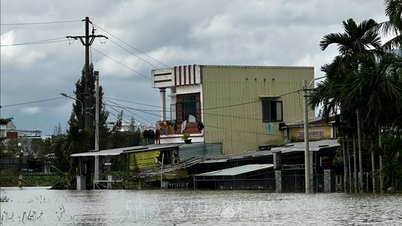
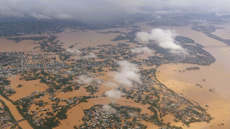
This morning (October 30), the National Center for Hydro-Meteorological Forecasting said that the flood on the Thu Bon River ( Da Nang ) is fluctuating at a high level. The flood on the Huong River (Hue), Vu Gia River (Da Nang) and Tra Khuc River (Quang Ngai) is receding.
At 2:00 a.m., the flood level on Thu Bon River at Cau Lau station rose to 5.62m, about 1.62m above alert level 3; exceeding the historical peak of 5.48m recorded in the year of the Dragon 1964 by 12cm. At Hoi An station, the water level was 3.39m, about 1.39m above alert level 3 - 1cm lower than the historical flood peak in 1964 (3.4m).
On Vu Gia River at Ai Nghia station, it is 10.22m, about 1.22m above alarm level 3; on Huong River at Kim Long station, it is 4.56m, about 1.06m above alarm level 3.
It is forecasted that this morning, the flood on Thu Bon River at Cau Lau station will fluctuate at a high level and above alert level 3 from 1.6-1.7m, higher than the historical flood in 1964 (historical flood was 5.48m).

Flood risk map of the downstream Vu Gia - Thu Bon river (Da Nang). Source: NCHMF
By noon and afternoon, the flood on Thu Bon River at Cau Lau station continued to fluctuate at a high level and was 1.5m above alert level 3; the flood on Huong River and Vu Gia River continued to fall and was 0.6-0.65m above alert level 3; the flood on Bo River continued to fall and was about 0.3m below alert level 3; the flood on Tra Khuc River continued to fall and was 0.10m above alert level 2.
This afternoon and tonight, flood on Thu Bon River at Cau Lau station fluctuates at a high level and is 1.1m above alert level 3; flood on Huong River continues to fall and is 0.1m above alert level 3; flood on Bo River and Vu Gia River continues to fall and is 0.2-0.7m below alert level 3; flood on Tra Khuc River continues to fall and is about 0.5m below alert level 2.
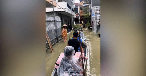
The meteorological agency has warned that the risk of natural disasters due to floods is at level 3, the highest level. Deep and widespread flooding from Hue to Quang Ngai will continue for the next few days; there is a high risk of flash floods on rivers and streams and landslides on steep slopes in these areas.

List of communes and wards at risk of flooding in the next 24 hours. Source: NCHMF
Source: https://vietnamnet.vn/lu-tren-song-thu-bon-tai-da-nang-vuot-muc-lich-su-nam-thin-1964-2456303.html


![[Photo] Standing member of the Secretariat Tran Cam Tu visits and encourages people in the flooded areas of Da Nang](https://vphoto.vietnam.vn/thumb/1200x675/vietnam/resource/IMAGE/2025/10/30/1761808671991_bt4-jpg.webp)


![[Photo] Fall Fair 2025 - An attractive experience](https://vphoto.vietnam.vn/thumb/1200x675/vietnam/resource/IMAGE/2025/10/30/1761791564603_1761738410688-jpg.webp)


![[Photo] New-era Party members in the "Green Industrial Park"](https://vphoto.vietnam.vn/thumb/1200x675/vietnam/resource/IMAGE/2025/10/30/1761789456888_1-dsc-5556-jpg.webp)


Comment (0)