
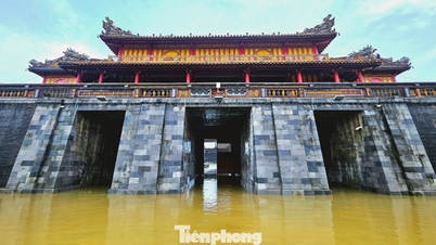
According to the report of the Department of Dyke Management and Natural Disaster Prevention, National Center for Hydro-Meteorological Forecasting ( Ministry of Agriculture and Environment ), Thu Bon River recorded a new historical flood peak, when the water level measured this morning, October 30, was higher than the flood peak recorded in the "great flood" of 1964 in the Central region.
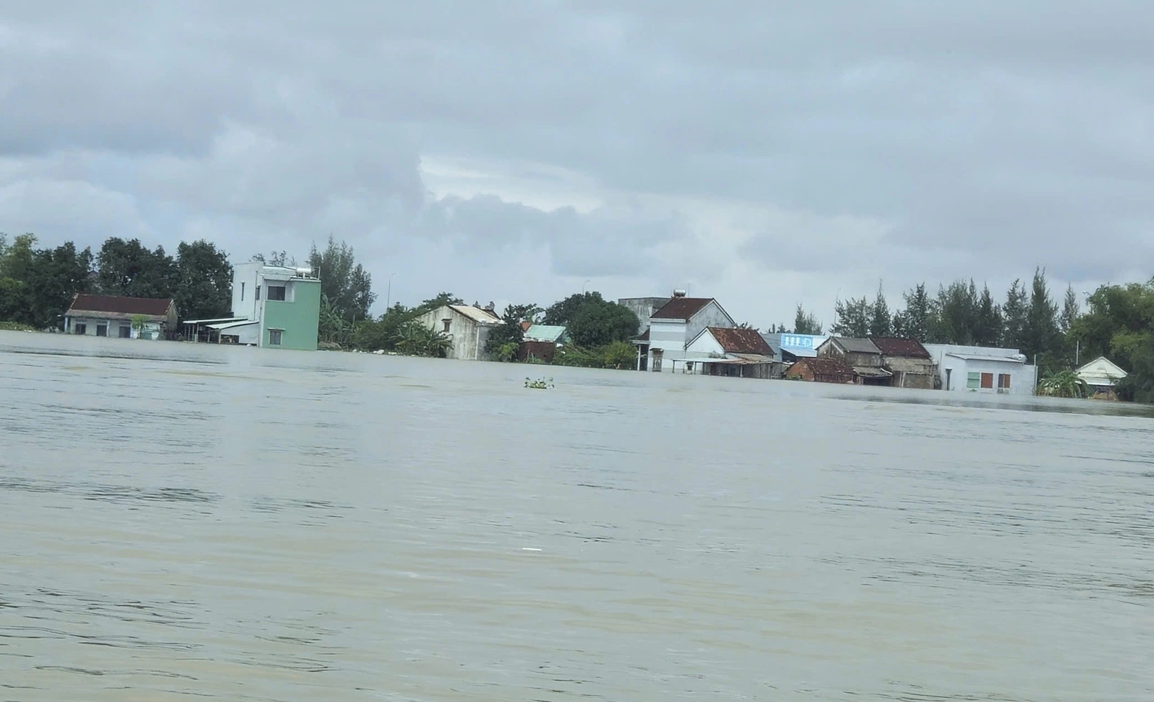
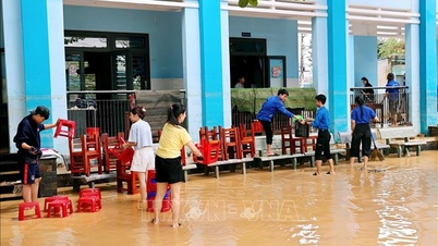
Houses in Thang Binh commune ( Da Nang ) were deeply flooded on the morning of October 30.
PHOTO: MINH NGOC
Specifically, at 2:00 a.m. on October 30, the flood on the Thu Bon River at Cau Lau station peaked at 5.62 m, 1.62 m above alert level 3, exceeding the historical flood in 1964 by 0.14 m.
After reaching its peak, the flood of Thu Bon River at Cau Lau station is slowly receding. At 6:00 a.m., the water level was 5.54 m, 1.54 m above alert level 3, 0.06 m higher than the historical flood in 1964.
'Great flood' on Thu Bon River: Flood exceeds historical mark of 1964 by 0.14 meters
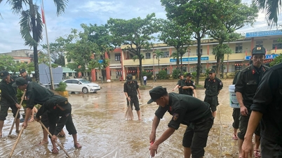
According to the Department of Dyke Management and Natural Disaster Prevention, Da Nang is the locality most severely damaged by the floods in the Central region in recent days.
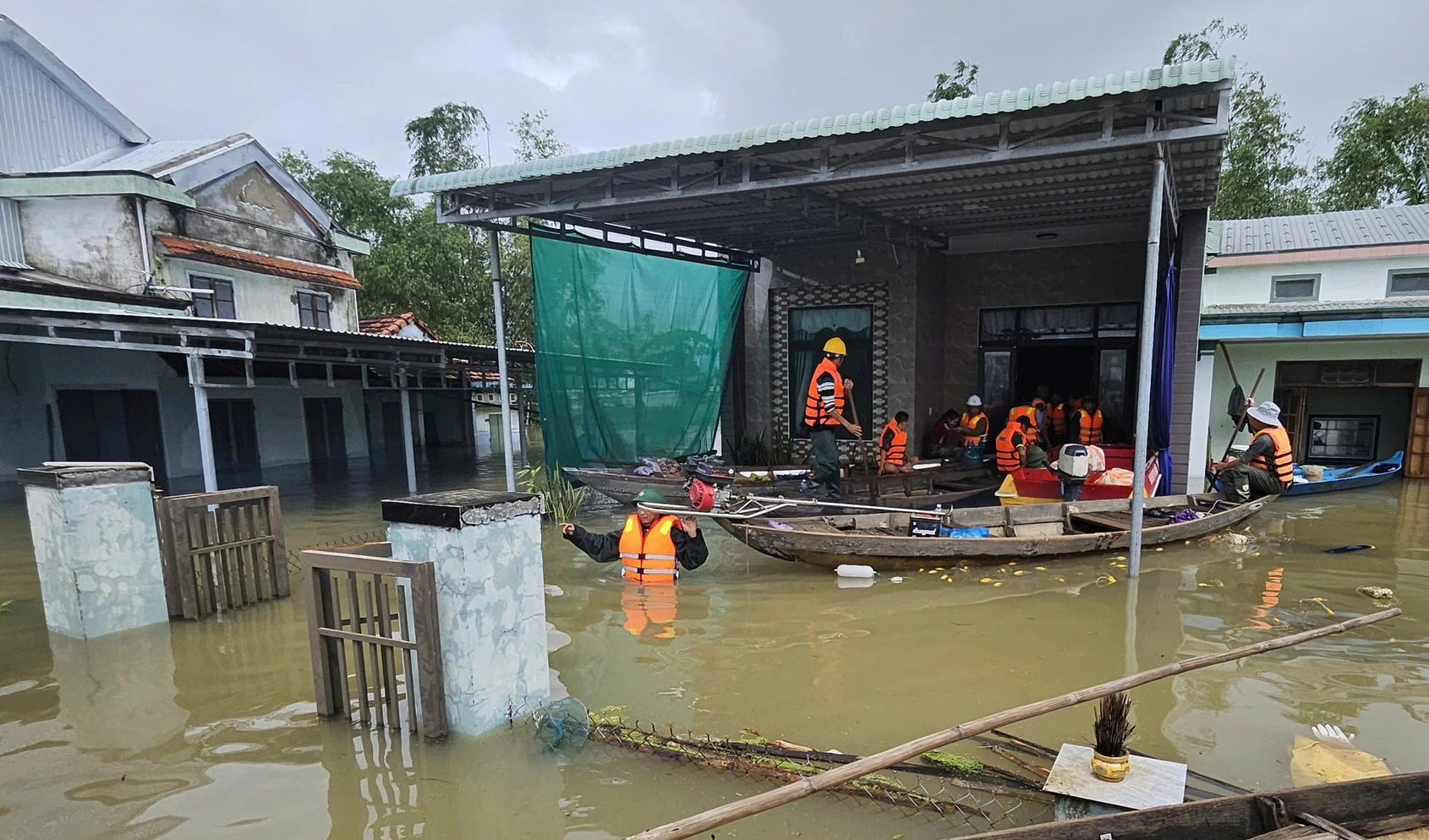
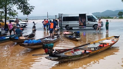
Authorities provide food and drinking water to people in Thang Binh commune (Da Nang)
PHOTO: MINH NGOC
According to statistics, Da Nang has 7 dead, 4 missing and 21 injured. The flood swept away and completely collapsed 50 houses; damaged 94 houses and 76,427 houses are still flooded.
"Great flood" isolates 10 communes and wards in Da Nang
The Department of Dyke Management and Natural Disaster Prevention said that as of this morning, about 90 communes and wards in the Central region were still flooded. Of these, Quang Tri had 4 communes, flooded from 0.2 to 1 meter deep. Hue had 32 communes and wards, flooded from 0.5 to 2 meters deep. Quang Ngai had 15 communes and wards, flooded from 0.3 to 3 meters deep.
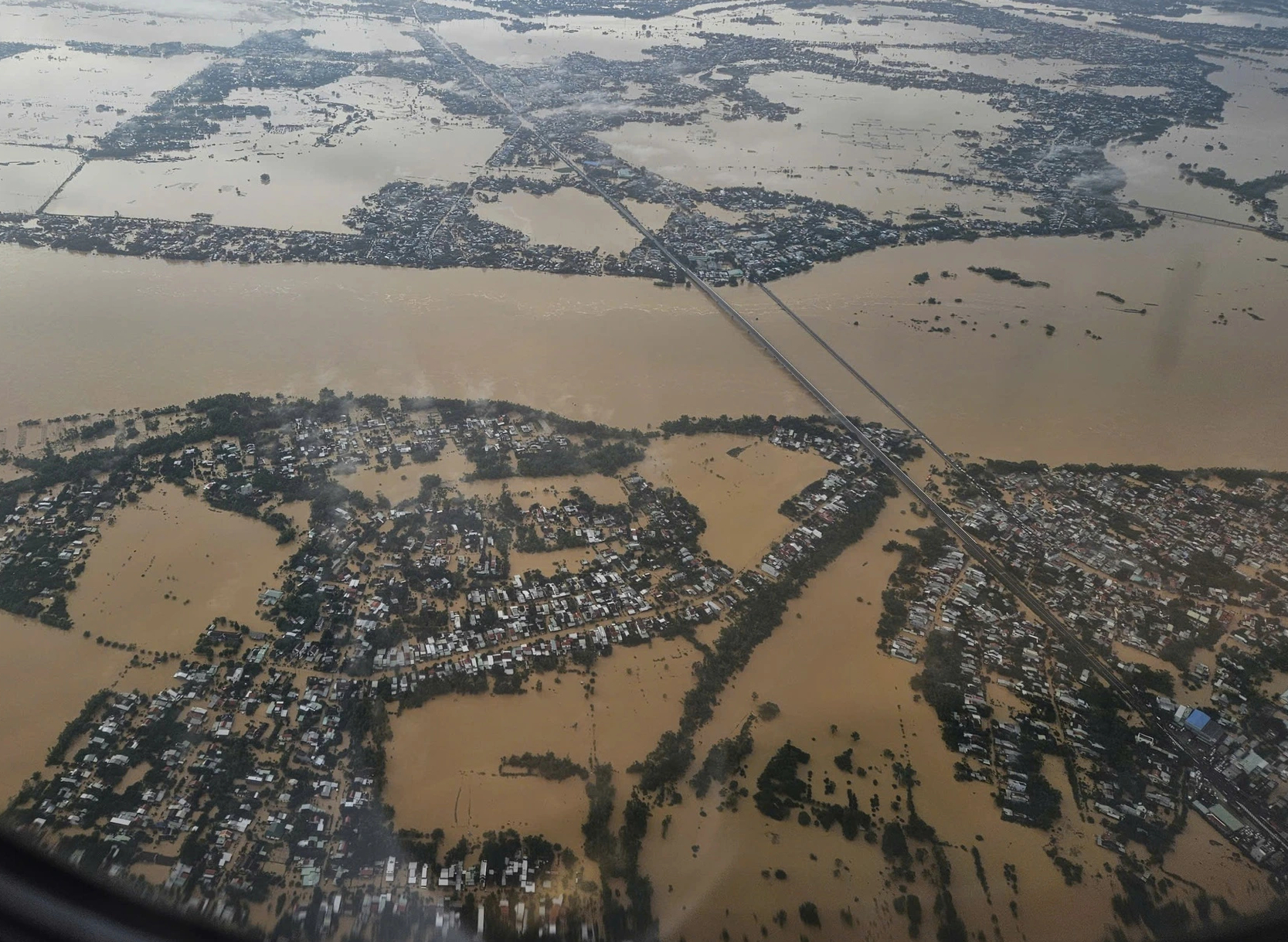
Seen from an airplane, Da Nang has many areas deeply submerged in floodwaters.
PHOTO: MINH NGOC
In particular, Da Nang has 40 communes and wards that are deeply flooded and isolated. According to statistics from the Da Nang People's Committee, there are 10 communes and wards that are completely isolated, including: Go Noi, Thuong Duc, Vu Gia, Ha Nha, Dai Loc, Nong Son, Que Phuoc, Duy Xuyen, Thu Bon, and Phu Thuan.
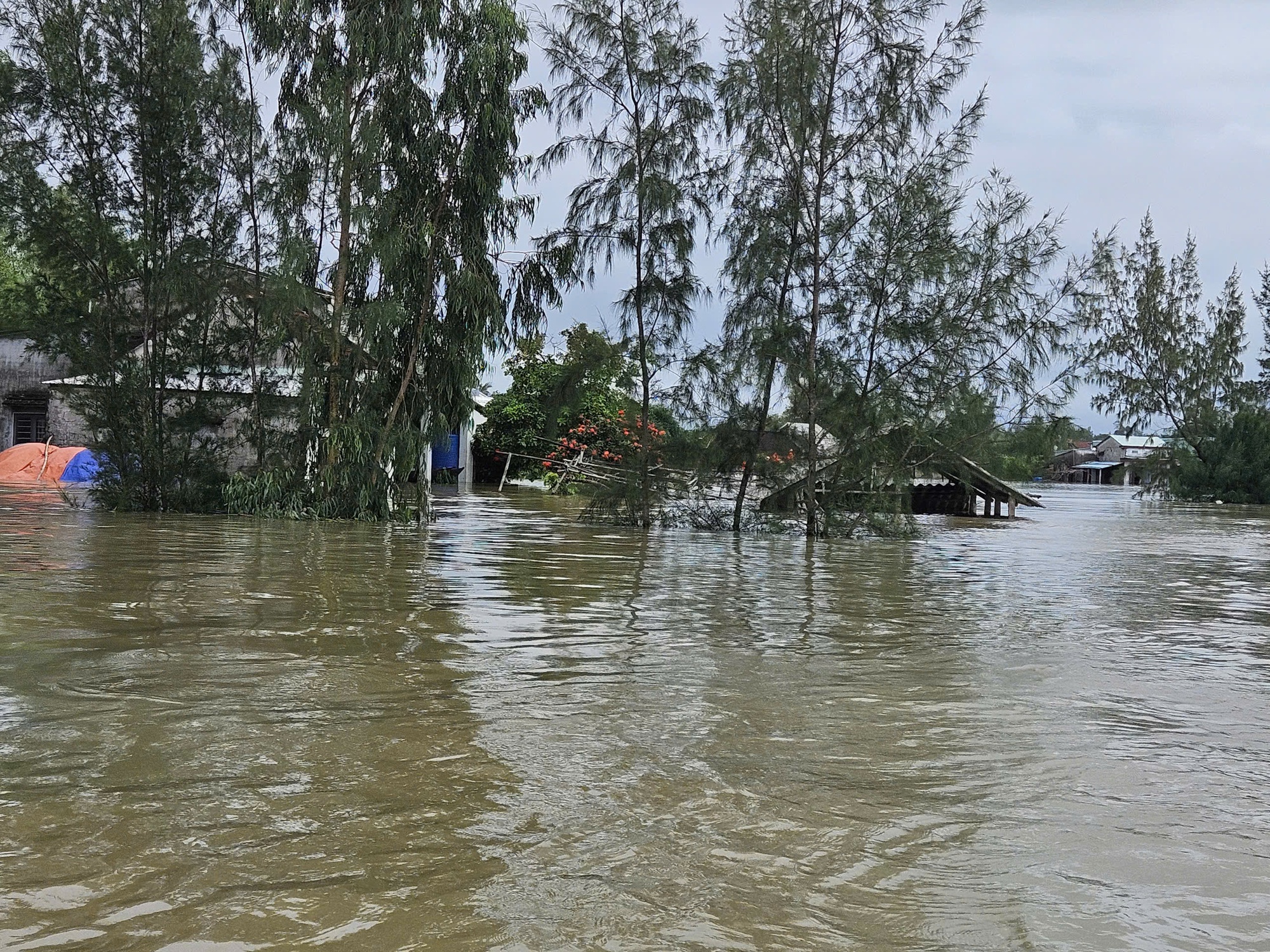
The rising flood of Thu Bon River is isolating many communes and wards in Da Nang.
PHOTO: MINH NGOC
In addition, 30 communes and wards are being heavily flooded, including: Hai Van, Hoa Xuan, Hoa Tien, Lien Chieu, Ngu Hanh Son, Hoa Vang, Ba Na, Thanh My, Phuoc Tra, Viet An, Son Cam Ha, Xuan Phu, Thang An, Thang Dien, Thang Binh, Thang Phu, Dong Duong, Quang Phu, Tay Ho, Phu Ninh, Dien Ban Tay, Duy Xuyen, Nam Phuoc, An Thang, Hoi An, Hoi An Tay, Hoi An Dong, Duy Nghia, Dien Ban, Dien Ban Bac.
According to the National Center for Hydro-Meteorological Forecasting, from October 27 to October 29, especially large floods occurred on the main rivers in Hue and Da Nang, with water levels on most rivers exceeding alert level 3.
Of which, 5/12 measuring stations exceeded historical flood levels, including:
Bo River (Hue) at Phu Oc station reached 5.27 m (7:00 p.m. on October 29), 0.03 m higher than the historical flood level in 2020 (5.24 m).
Vu Gia River (Da Nang) at Thanh My station reached 27.2 m (2:00 p.m. on October 29), 0.06 m higher than the historical flood level in 2007 (27.14 m); at Hoi Khach station reached 19.32 m (3:00 p.m. on October 29), 1.18 m higher than the historical flood level in 2009 (18.14 m).
Thu Bon River (Da Nang) at Nong Son station reached 18.68 m (7:00 p.m. October 29), 0.15 m higher than the historical level in 1998 (18.53 m); at Cau Lau station reached 5.62 m (at 2:00 a.m. October 30), 0.14 m higher than the historical flood level in 1964 (5.48 m).
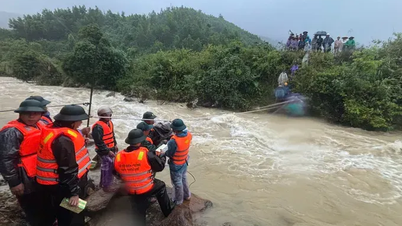
Carrying 3 landslide victims in Tra Tan 20km overnight to the emergency room
Thanhnien.vn
Source: https://thanhnien.vn/dai-hong-thuy-tren-song-thu-bon-vuot-lu-lich-su-nam-thin-1964-la-014-m-185251030115430198.htm
![[Photo] Prime Minister Pham Minh Chinh attends the 5th National Press Awards Ceremony on preventing and combating corruption, waste and negativity](https://vphoto.vietnam.vn/thumb/1200x675/vietnam/resource/IMAGE/2025/10/31/1761881588160_dsc-8359-jpg.webp)


![[Photo] Da Nang: Water gradually recedes, local authorities take advantage of the cleanup](https://vphoto.vietnam.vn/thumb/1200x675/vietnam/resource/IMAGE/2025/10/31/1761897188943_ndo_tr_2-jpg.webp)


Comment (0)