
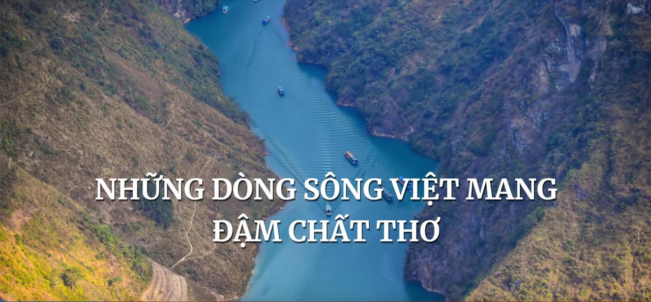
The Red River, Saigon River, Duong River, and Da River are four of many rivers that have entered poetry and left unforgettable memories in everyone's heart.
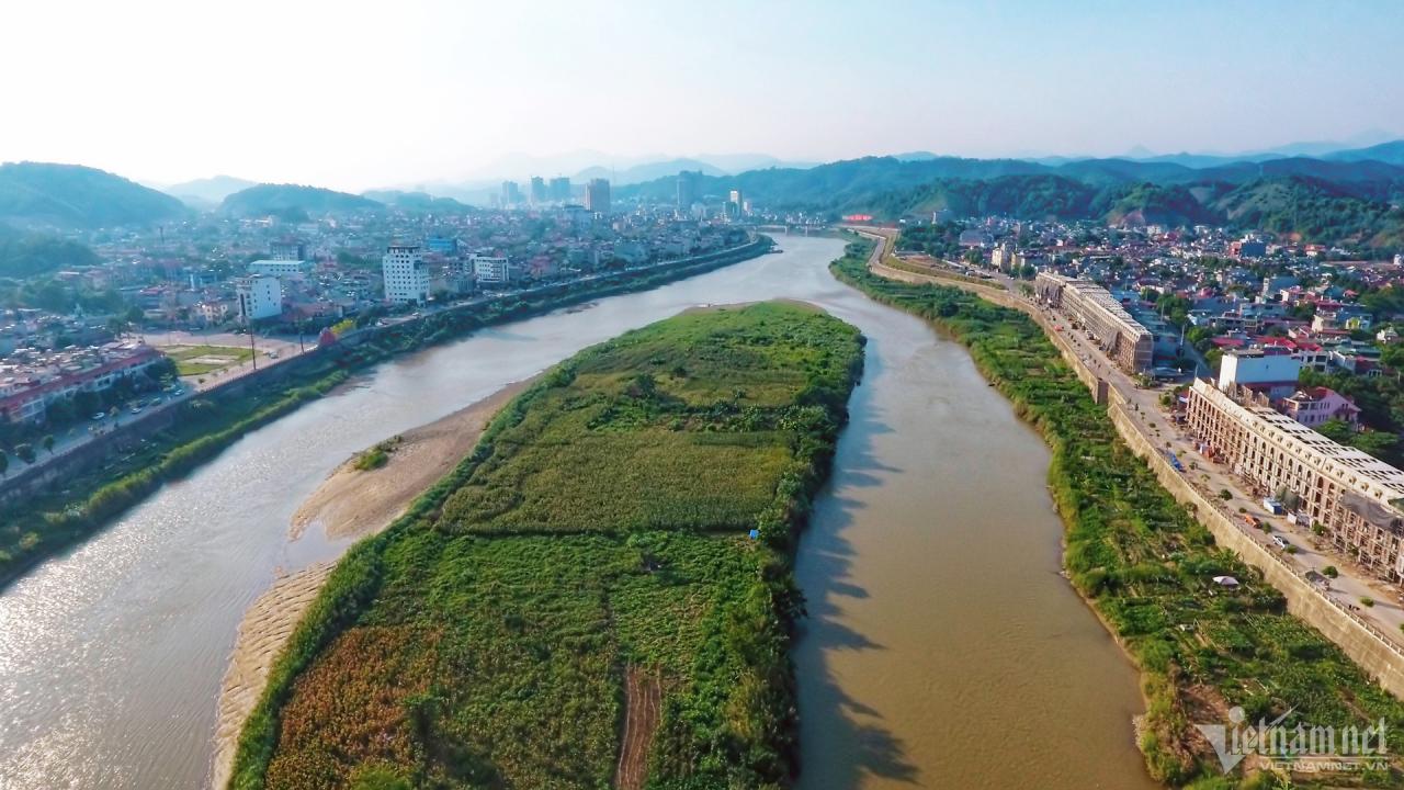
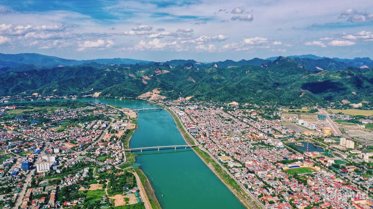
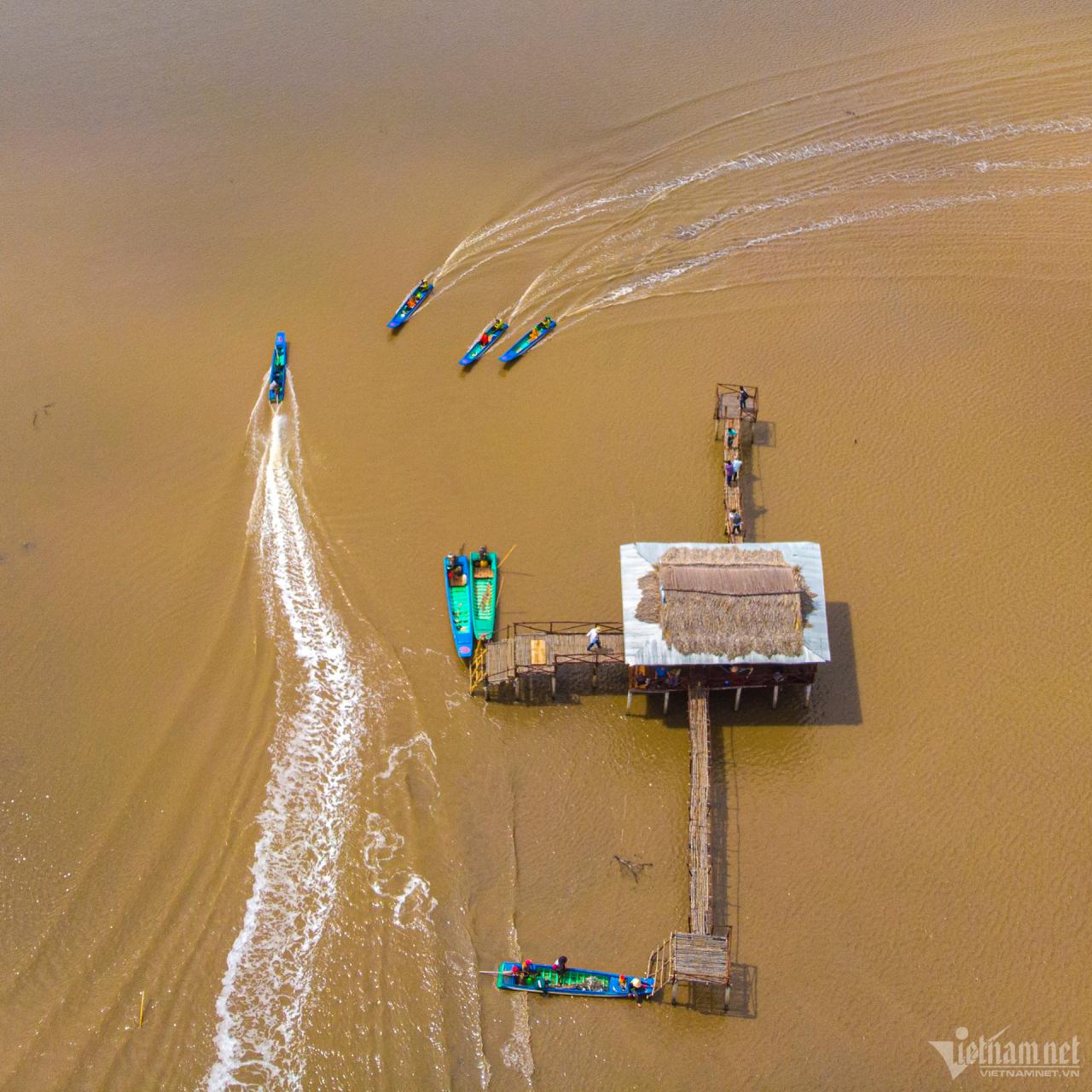
The Red River is a large river flowing over 500km in Vietnam. The starting point of the Red River is Bat Xat district (Lao Cai), the end point is Ba Lat estuary (located between Giao Thuy district, Nam Dinh province and Tien Hai district, Thai Binh province). The Red River system consists of 3 large branches (Da River, Thao River and Lo River) converging in Viet Tri and flowing into the sea at Ba Lat, Tra Ly, Lach Giang and Day estuaries. Image of the Red River in Lao Cai city.
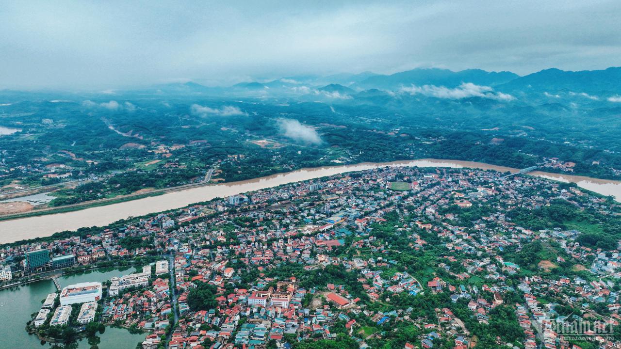
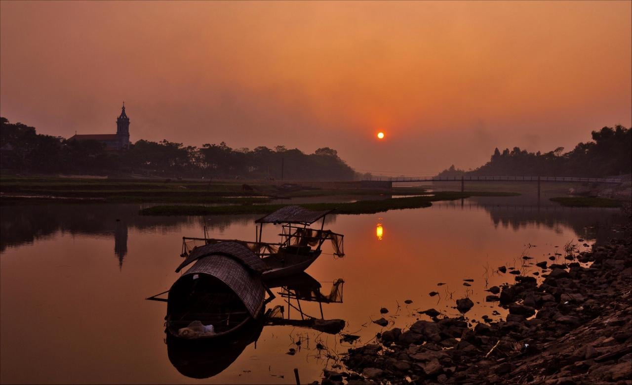
"Dear my love at the end of the Red River, seeing the river's waves turn red, I know I'm thinking of you...". Most people are familiar with this line from the song "Sending You at the End of the Red River" by musician Thuan Yen. The river has almost entered the cultural life, throughout the history of the country. Image of the Red River flowing through Yen Bai city (Yen Bai province).

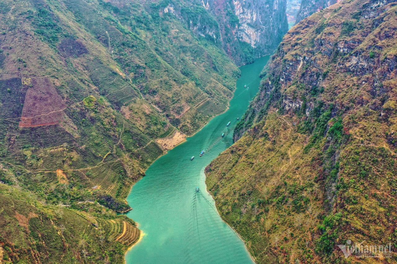
Nho Que River originates from Yunnan (China), flows into Vietnam at the northernmost point of Lung Cu commune, Dong Van district, Ha Giang province. The landscape here remains pure and wild. Somewhere on the mountainside there are still villages of ethnic people living, the river at dusk is full of magical mist. This river not only flows in Ha Giang province but also runs through Cao Bang. However, the head of the river flowing from Seo Lung village, Lung Cu commune, through Tu San Gom is considered the section with the most spectacular and captivating scenery. In 2009, the Ministry of Culture, Sports and Tourism classified this area as a scenic relic of Vietnam. Nho Que River is also honored as one of the unique Tectonic Valleys of our country. 
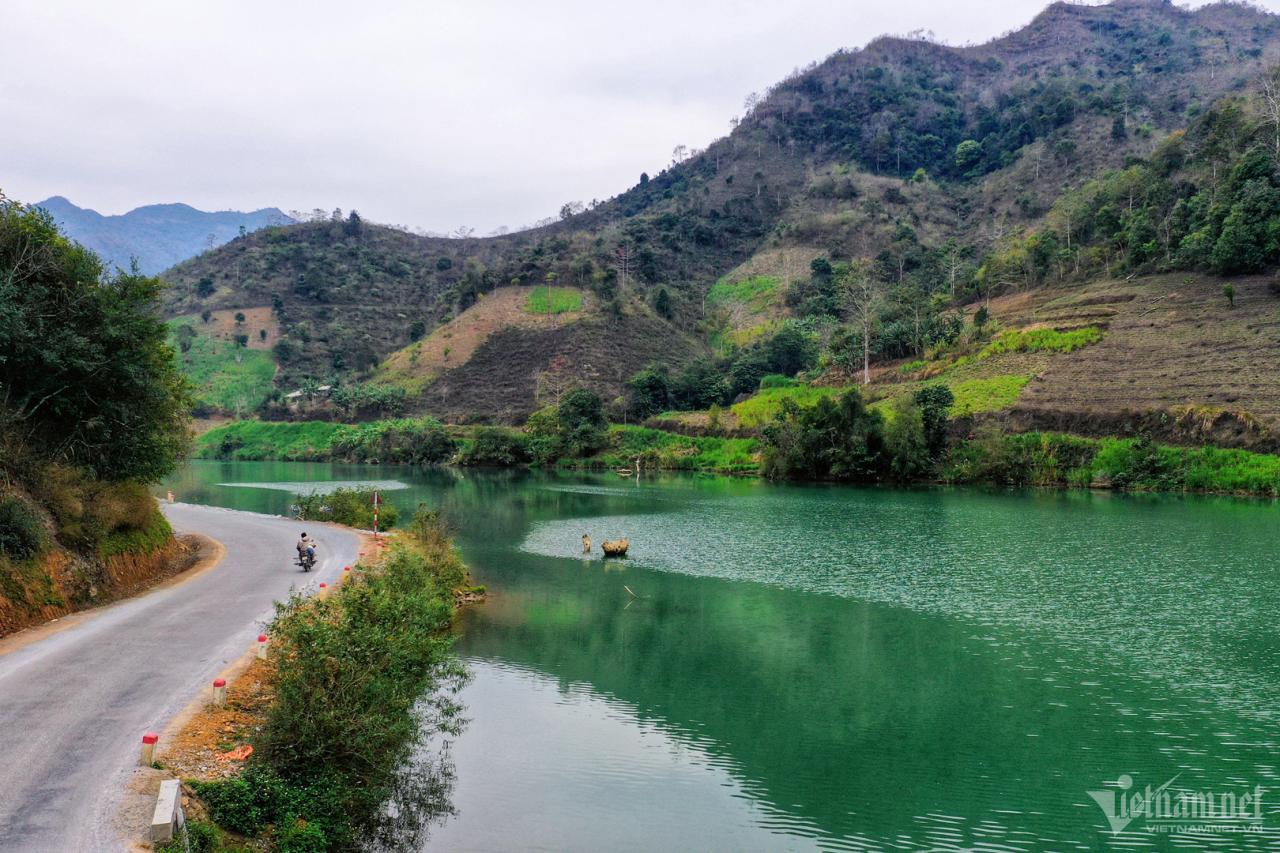
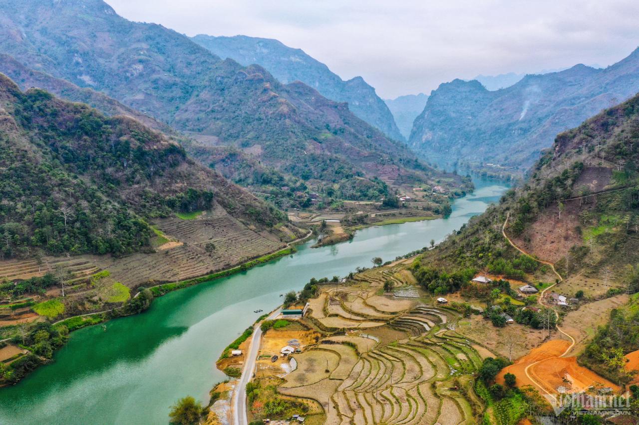
Like Nho Que River, Quay Son River (Cao Bang) has a winding emerald green color that stretches through many areas, some places embrace the foot of towering limestone mountains creating a picturesque landscape, some places nestle under lush green bamboo clumps, some bends like a soft silk strip across the ripe rice fields of Phong Nam, Ngoc Con... This is one of the few places with a very poetic landscape, captivating many visitors from afar. Quay Son River originates from Guangxi (China) with two branches flowing into Vietnam converging at Ngoc Khe commune (Trung Khanh district).
“Why are you sad, my dear? I will take you to the other side of the Duong River...”. Those are the two opening lines of the poem “On the other side of the Duong River” by poet Hoang Cam, making readers curious. What happened on the other side of the Duong River? The south of the river was formerly called the Dau region, and today is the Thuan Thanh, Gia Binh, and Luong Tai districts of Bac Ninh province. Although the Duong River belongs to Hanoi and Bac Ninh, the culture has no boundaries. In the Kinh Bac cultural region, now part of Hanoi, there are ancient villages located on the banks of the Duong River, such as Sui village, the residential area of ancient Vietnamese people during the Hung King period.
The Day River running through Thanh Oai District (Hanoi) is about 17km long, with 9 communes in the area. In the socio-economic development orientation of the district in the period of 2021-2025, it is determined to develop the area along the Day River into an eco -tourism space, form a waterway tourism route, and plan the entire alluvial area of the Day River as a mixed area of eco-tourism combined with agriculture, connecting the waterway tourism route with traditional craft village tourism along the river. Photo: Khuong Bino.
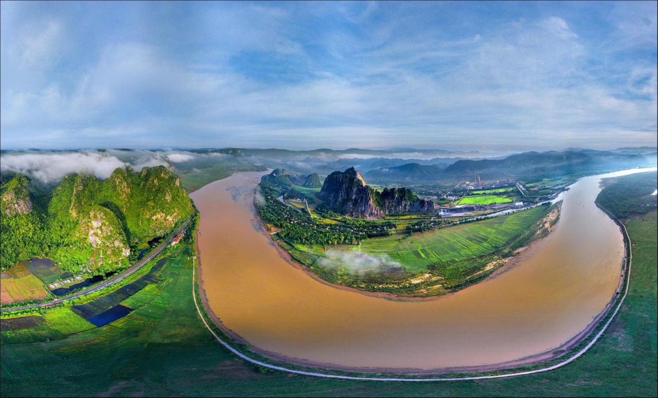
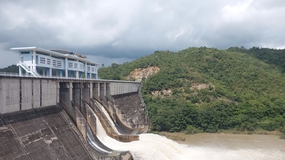
"There are waterfalls that require pulling the boat all the way to the shore, both during the wet season and the dry season... There are stretches where the boat is lifted ashore, tipped over and pulled for nearly a kilometer. There are places where the boat is pulled shallow and up the steep rocky banks. The majesty of the Da River is not only the waterfalls but also the scenes of the rocky river banks forming walls. There are places where the cliffs squeeze the Da River like a throat. Riding the waterfalls of the Da River, one must ride to the end like riding a tiger..." That is the "temperament" of some of the 73 notorious waterfalls that writer Nguyen Tuan clearly described in his work "The Ferryman of the Da River". The Da River, also known as the Bo River or the Black River, is the largest tributary of the Red River - the mother river of the Northern Delta. The Da River originates from Yunnan Province (China) with a total length of more than 910km, called Ly Tien Giang - the section of the Da River flowing into Vietnam is 543km long. The Da River is not only known as the largest energy river in Vietnam with a series of hydroelectric systems in Hoa Binh, Son La, Lai Chau... but also the mother river of dozens of ethnic groups in the Northwest region. 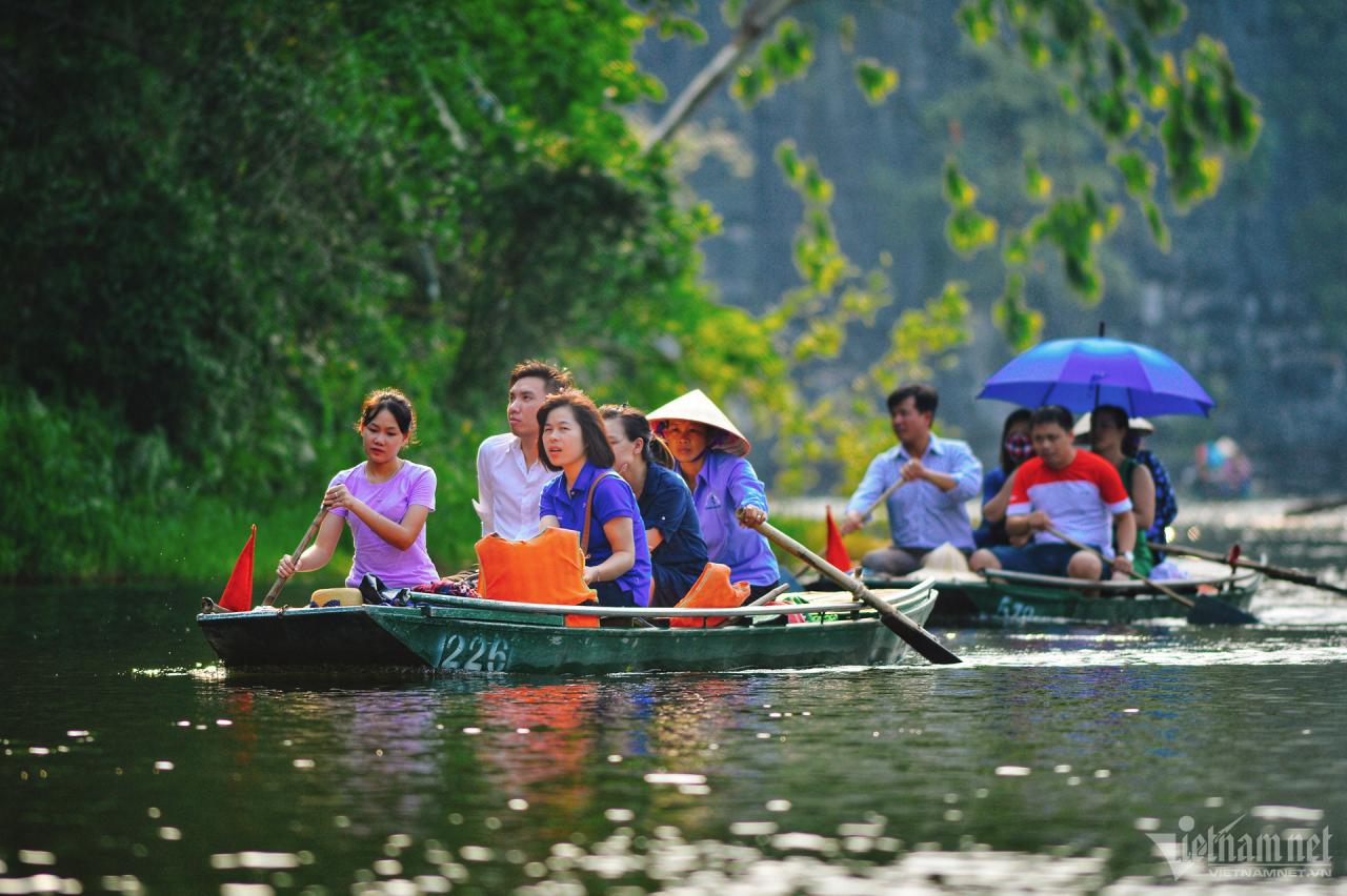
Boating on Sao Khe River (Ninh Binh) is truly an interesting experience. Water lilies bloom on both sides of the river as if inviting travelers to continue exploring. The boatman seems to row more evenly, the boat rhythmically splits the water, creating ripples, then the next boat follows. The feeling of the amazing nature is even more exciting, with the sound of the water gurgling really pleasant to the ears. According to history books, Sao Khe River has existed since the time of Dinh Bo Linh, connecting Hoang Long River and Day River. The name "Sao Khe" was given by King Ly Cong Uan in 1005. He used to travel on this river to Day River and then return to Dai La Citadel (Thang Long Citadel) in 1010.
Along with Ngang Pass, Gianh River is the geographical symbol of Quang Binh province. The river is 160km long, originating from the edge of Co Pi mountain, 2,017m high, in the Truong Son range. Gianh River flows through Minh Hoa, Tuyen Hoa, Quang Trach, Bo Trach districts and flows into the East Sea at Giang estuary. As one of the symbols of the nature of the Central region in general and Quang Binh in particular, Gianh River impresses with its basin area of 4,680km2 and average height of 360m. Photo: Tran An.
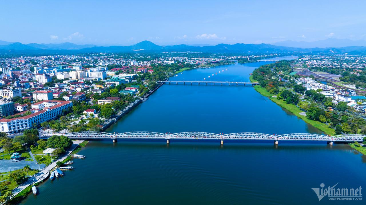
Coming to the ancient capital of Hue, tourists cannot help but visit the poetic and gentle Huong River flowing through the forests from Bang Lang junction deep into the heart of the city, then continuing to wind through the countryside downstream before reaching the sea. The river is also likened to a Hue girl smiling shyly under a conical hat. Photo: Le Huy Hoang Hai.
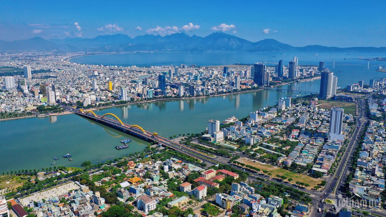
Han River - the river associated with countless memories of many people in Da Nang, is a part of the beloved homeland, an extremely precious natural gift of the Central region. Calling the Han River "the green silk strip in the heart of Da Nang city" is not without basis. The Han River is 7.8km long, about 400-700m wide (700m at its widest point, 300m at its narrowest), with an average depth of 7-10m.
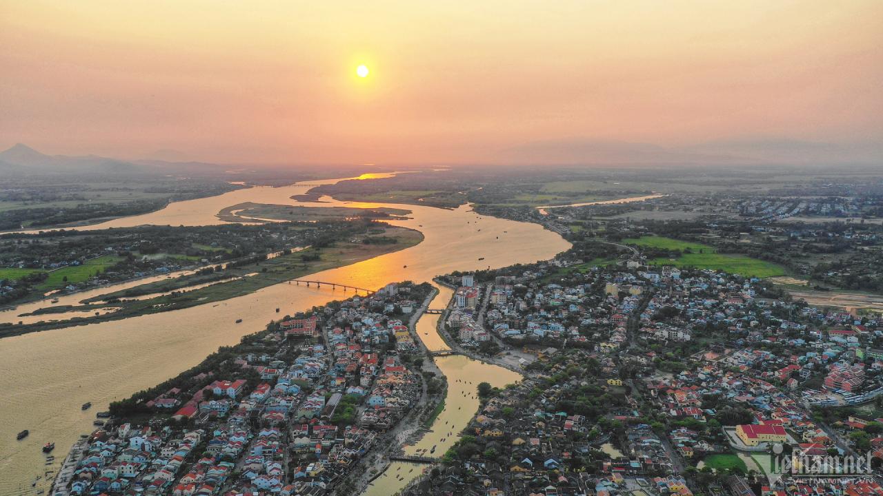
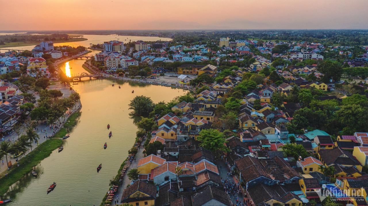
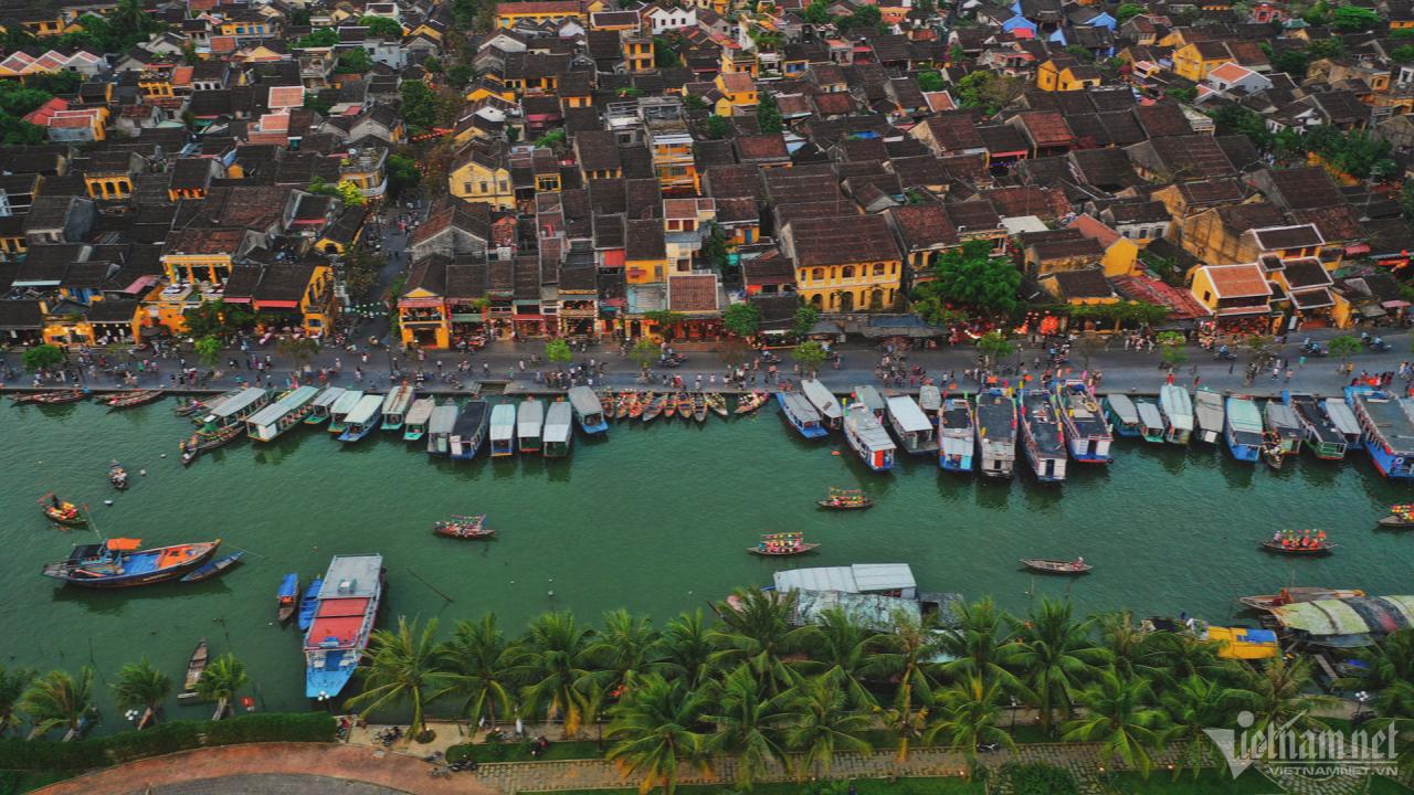
The Thu Bon River is the largest inland river in the country with a basin of 10,350 km², mainly concentrated in Quang Nam province and a small part of Kon Tum, Da Nang and Quang Ngai provinces. The upstream of the Thu Bon River from the Ngoc Linh mountain range (Kon Tum), stretches about 200 km to Cua Dai and then flows out to the East Sea. The section of the river flowing through Hoi An is vast, with rolling waves and endless wind. Every afternoon, the calm blue river surface reflects the shadows of trees and mountains, beautiful as a painting.
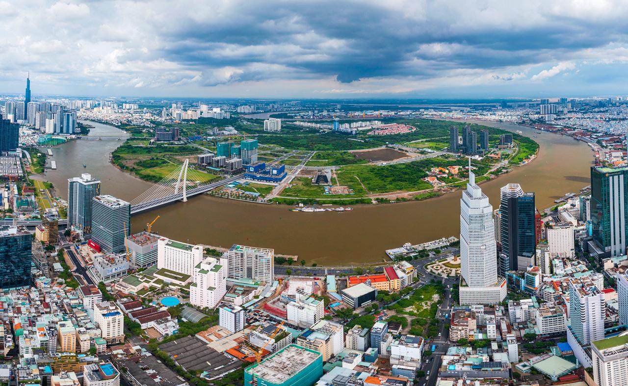
The Saigon River is 256km long, starting from Binh Phuoc then passing through Tay Ninh, Binh Duong and Ho Chi Minh City. The section of the river flowing through Ho Chi Minh City, about 80km long, is likened to a "soft silk strip" winding through the heart of the city, creating beautiful peninsulas such as Thanh Da or Thu Thiem. The winding dragon-shaped river running through the city is not only a symbol of the river city but also a witness to the 325-year process of formation and development of Saigon - Cho Lon - Gia Dinh - Ho Chi Minh City. Photo: Pham Doanh.
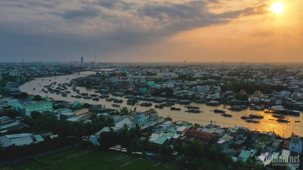
Along with the Tien River, the Hau River is one of the two distributaries of the Mekong River, a river system that forms the Mekong Delta of Vietnam. The Hau River is also known as the Ba Thac River, originating from the name Bassac in the Khmer language. This river flows through An Giang province and is the natural boundary between the provinces of Dong Thap and Can Tho, Vinh Long and Can Tho, Hau Giang and Vinh Long, Tra Vinh and Soc Trang. The river flows into the East Sea through the Tran De and Dinh An estuaries. The widest section of the Hau River lies between Cau Ke district (Tra Vinh) and Long Phu district (Soc Trang), nearly 4km long. Photo: Hoang Giam.
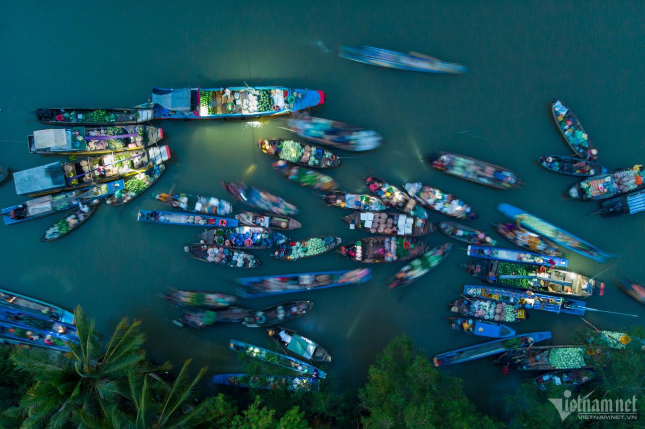
Can Tho River originates from the western inland area of Hau River, about 16km long, 280-350m wide, passing through O Mon district, Phong Dien district, Cai Rang district, Ninh Kieu district and flowing into Hau River at Ninh Kieu wharf. The highlight of Can Tho River is Cai Rang floating market tourist destination - National intangible cultural heritage in 2016. The market was formed in the early 20th century, mainly trading agricultural products, fruits, and specialties of the Mekong Delta.
Ca Mau has a dense and interwoven system of rivers and canals like a spider web with a total length of more than 7,000km, an average density of 1.34km/km², a total water surface area of 15,756ha, accounting for 3.02% of the province's natural area. There are many main rivers flowing into the West Sea (Gulf of Thailand) such as Bay Hap River, Ong Doc River, Trem Trem River, Cai Tau River, Bach Nguu River, Dong Cung River. Of which, Bay Hap River is more than 50km long. Bay Hap Gate also has other names such as Go Cong Gate, Rach Cheo Gate connecting to Ca Mau Cape (Ngoc Hien District). Photo: Hoang Giam.
![[Photo] General Secretary To Lam receives Vice President of Luxshare-ICT Group (China)](https://vphoto.vietnam.vn/thumb/1200x675/vietnam/resource/IMAGE/2025/11/15/1763211137119_a1-bnd-7809-8939-jpg.webp)
![[Photo] Prime Minister Pham Minh Chinh meets with representatives of outstanding teachers](https://vphoto.vietnam.vn/thumb/1200x675/vietnam/resource/IMAGE/2025/11/15/1763215934276_dsc-0578-jpg.webp)


Comment (0)