
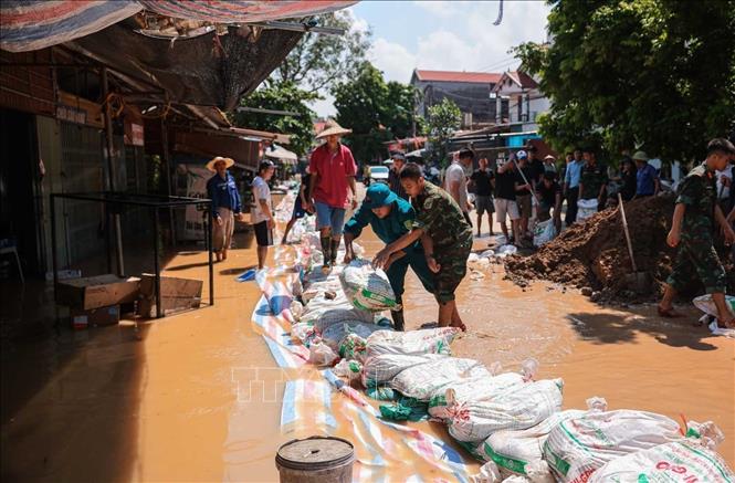
Trung Gia Commune People's Committee coordinated with functional forces and local people to participate in building and reinforcing the dike; supporting food, organizing the relocation and evacuation of hundreds of households to safety.
Specifically, at the end of the morning of October 9, the Cau River water level at Luong Phuc station was at 9.97m, 1.97m above alert level 3; Go Sanh station and level III dike were still safe (dike surface cos 10.5). The Commune People's Committee mobilized forces to patrol and guard the dike and forces to support people and dike protection in accordance with regulations.
The rising river water caused the roads passing through Trung Gia commune to be deeply flooded, making transportation difficult. On National Highway 3, the section from the Yamaha factory was flooded about 200m with a depth of 1.5m; the section from Viet Tin Factory - Xuan Son Cultural House was flooded about 500m, with a depth of 1.2m. Provincial Road 35, from Ny football field to Tu Tao bridge, was flooded about 300m, with a depth of 1-1.2m; the section from the gate of village 3 to the end of Phu Dien resettlement area was flooded about 300m, with a depth of 40cm.
Hong Ky - Bac Son Road, Lai Son Bridge section is flooded about 100m, about 1.5m deep. Provincial Road 296, from Binh An Cultural House to Vat Bridge is flooded about 600m, about 1m deep. Minh Tri - Bac Son Road to Do Tan, Trien Bridge section to Do Tan village is flooded about 500m, 1.5m deep... In addition, some roads in the villages are deeply flooded, vehicles cannot move.
According to the report of the Trung Gia Commune Civil Defense Command, the level III dykes are at high risk at Go Sanh station, the water level is about 15cm, the level IV dyke is overflowing (Vong Am dyke is overflowing 20m, Do Tan dyke is 7km). Currently, the water has flooded the households. The Trung Gia Commune Civil Defense Command has worked with other forces to continue to protect the dykes at Do Tan, Vong Am and the level III dyke at Go Sanh station, building a 20m embankment at Go Sanh culvert.
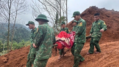
The high water level has isolated more than 2,400 households (with over 9,500 people) in Trung Gia commune; the most affected are the villages of Do Tan with 844 households (3,210 people), An Lac with 580 households (2,700 people), Lai Son with 350 households (1,400 people), Hoa Binh with 200 households (800 people)... The commune's civil defense command is working with the military, commune police and shock troops to mobilize and support people in isolated areas to move to safe locations.
At the same time, propaganda and warning signs were put up in flooded areas to ensure safety on traffic routes; ropes were put up, warning signs were placed, and propaganda was carried out to mobilize people to evacuate from areas at risk of landslides. The commune government also established working groups to continue implementing plans to move people in deeply flooded areas out of flooded areas and organize relief plans, support food and necessities for people.
In addition, the commune strictly organizes on-duty according to regulations, proactively handles arising incidents; ensures forces are ready to deploy response measures and overcome consequences for incidents caused by natural disasters; and announces the extremely high flood situation of Song Cau River. The functional forces continue to coordinate to inspect and review vulnerable, flooded, and landslide-prone areas in the commune, promptly respond to ensure safety for people and property.
Source: https://baotintuc.vn/kinh-te/nuoc-song-cau-cao-tren-bao-dong-3-hon-2400-ho-dan-o-xa-trung-gia-ha-noi-bi-co-lap-20251009140025883.htm


Comment (0)