
 |
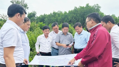
| According to the planning approved by the Provincial People's Committee, Provincial Road 489 through Hong Thuan commune will be the urban road of Dai Dong new urban area in the future. |
According to Decision No. 1117/QD-UBND of the Provincial People's Committee, Dai Dong new urban area has the following characteristics: it is an economic - cultural, trade and service center of the northeastern sub-region of Giao Thuy district; it is an eco-tourism resort center associated with high-tech agriculture covering the entire land area of the current administrative boundary of Hong Thuan commune with an area of about 1,455 hectares. Period up to 2030: Developing Dai Dong urban area (type V urban area) as one of the socio-economic, trade and service centers of the northeastern sub-region of Giao Thuy district; oriented to become a dynamic new economic urban area by 2045, an important service - trade, tourism, eco-resort and industrial center of Giao Thuy district. On the basis of terrain, natural landscape, traffic framework and research plan, Dai Dong new urban area is planned to develop into 3 functional areas including: Administrative - political center, trade, service, new cultural, sports and entertainment center of Dai Dong urban area with an area of 477.67 hectares, accounting for 32.83% of the total urban area; Western commercial and service urban area with functions of developing services, trade, public, entertainment along the Red River associated with residential development and is a spatial area connected with Giao Thuy town, with an area of 543.12 hectares, accounting for 37.33% of the total urban area; Eastern industrial and ecological agricultural urban area is the eastern gateway service, industrial and ecological urban area with an area of 434.17 hectares, accounting for 29.84% of the total urban area.
The new urban landscape architectural space of Dai Dong is divided into 4 main areas. The landscape area of the existing urban area will convert the rural model into an urban area with medium density to create positive links between existing areas and new development areas. The new urban landscape area expected to develop will form an urban area with low to medium construction density, with a large proportion of semi-detached houses and villas; the main urban axes and important traffic intersections will form functional complexes with large scale and high floors, creating highlights and spatial orientation; administrative, commercial and service center areas, large-scale construction works, high land use index. The agricultural production landscape area has low construction density and high floors, limiting the expansion of residential land scale; ecological garden housing works, combining residential functions with agricultural production functions. Natural landscape areas are areas of canals, lakes, and rivers that are maintained and protected, avoiding encroachment that affects the structure, morphology, continuity, and circulation; in this area, no permanent structures are built, only traffic works and infrastructure serving agricultural production are allowed.
To build and develop the new urban area of Dai Dong by 2045 to become a dynamic new economic urban area, an important center of services - trade, tourism services, ecological resorts and industry of Giao Thuy district, the general planning of Dai Dong urban area is planned with a synchronous and modern technical infrastructure system, especially the traffic system. Accordingly, external traffic will be upgraded and renovated to level I on the Red River to create favorable conditions for ships to pass through; by 2030, Hong Thuan port (combined with tourism) on the Red River will be added; the external traffic network will comply with the route and scale determined in the planning of Nam Dinh province for the period 2021-2030 with a vision to 2050 and upgrade provincial road 489 to meet urban road standards. Regarding internal traffic, the main road of the new urban area of Dai Dong includes 2 main axes: the main east-west axis with a cross-section of 59m wide; The main north-south axis road has a cross-section width of 34m (section passing through the urban center) and 24m (section passing outside the urban area). The inter-regional road includes 2 new planned routes connecting sub-areas and functional areas in the urban area, with a cross-section width of 28m. Regional roads are roads dividing into subdivisions; for newly opened routes, the width is planned to be 15.5m to 25m; for roads passing through existing residential areas, new roads are limited, mainly expanding existing routes, ensuring the road size of 2 lanes, prioritizing connections to urban functional areas. District roads connect the inner area with the outer area of the urban area, with a planned cross-section width of 11m and a road width of 9m. Upgrade and renovate the Red River dike road with a roadbed width of 8m and a road surface width of 6m. For existing residential routes, respecting the existing road structure, renovating and expanding when conditions permit, the main routes will have a road clearance of 7.5m-9m; the minimum cross-section of the road will be renovated, refurbished and newly planned through existing residential areas (implemented according to separate projects). Traffic hub works include parking lots (building 4 urban parking lots concentrated in subdivisions with a total scale of about 3.5 hectares); renovating and building new bridges over canals suitable for the planned road class. Public transport and static transport will improve service quality, building stops on the route to ensure the distance between points is from 500-700m, creating a complete public transport network, ensuring full service for people's travel needs.
According to the planning approved by the Provincial People's Committee in the coming time, the list of priority investment projects of the new urban area of Dai Dong includes: construction of urban public works (new town People's Committee, schools, markets, cultural centers, sports centers, central parks, etc.); Construction of main east-west and north-south traffic axes to create the main framework for Dai Dong urban area; Renovation of main urban traffic infrastructure; construction of new technical infrastructure works (urban clean water supply plant, central area water supply network, rainwater drainage network, wastewater treatment plant works, wastewater drainage network, etc.).
To manage and implement the planning, the Provincial People's Committee requests the Giao Thuy District People's Committee to strictly manage land funds and construction order according to the approved planning and other relevant legal provisions. Deploy the establishment of relevant construction plans in areas according to the requirements of urban development, management or construction investment needs. Establish annual and long-term priority investment programs and projects, develop plans to implement the planning in sync with investment in technical infrastructure systems, social infrastructure, etc. The Department of Construction shall inspect, supervise and manage construction work according to the approved planning and relevant legal provisions; the Department of Finance, the Department of Agriculture and Environment and relevant agencies and units according to their functions and tasks are responsible for updating sectoral planning to manage and organize the implementation of the planning according to regulations.
Article and photos: Thanh Trung
Source: https://baonamdinh.vn/kinh-te/202505/quy-huach-do-thi-moi-dai-dongtro-thanh-do-thi-kinh-te-nang-dong-vao-nam-2045-06b5eb2/


![[Photo] Prime Minister Pham Minh Chinh chairs the 16th meeting of the National Steering Committee on combating illegal fishing.](https://vphoto.vietnam.vn/thumb/1200x675/vietnam/resource/IMAGE/2025/10/07/1759848378556_dsc-9253-jpg.webp)


![[Photo] Super harvest moon shines brightly on Mid-Autumn Festival night around the world](https://vphoto.vietnam.vn/thumb/1200x675/vietnam/resource/IMAGE/2025/10/07/1759816565798_1759814567021-jpg.webp)


Comment (0)