
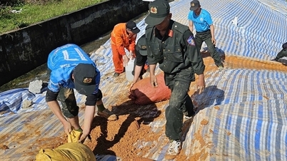
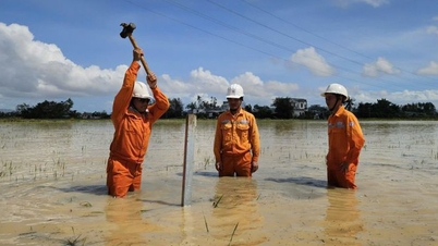
Throughout the night of November 7 and early morning of November 8, hundreds of people from many forces such as the Police, the Army, local forces and local people made efforts to reinforce the location of the landslide and crack on the left shoulder of the main dam of Kay An irrigation reservoir.
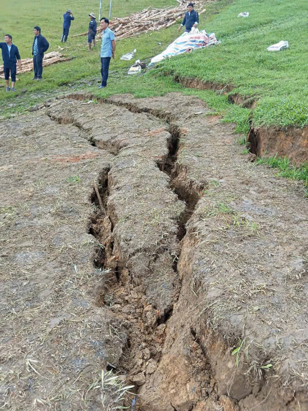
At this location, a series of slides and cracks appeared on the dam body. There were water leaks in some places, and the risk of the dam breaking was very high.
Kay An Lake contains about 1.7 million cubic meters of water, serving agricultural production for hundreds of hectares of local land. Downstream of this lake are Chan Rang Hao and Tou Neh villages with about 400 households living. When the dam breaks, it can directly affect nearly 100 households, hundreds of hectares of land, crops and people's property.

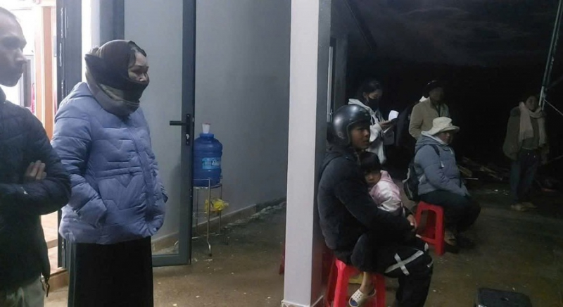
On the evening of November 7, when discovering that the cracks on the dam body were getting worse, the Chairman of the People's Committee of Ta Nang commune directed the urgent implementation of the work of evacuating people and property to a safe place, and at the same time asked for instructions from the leaders of Lam Dong province.
That very night, Deputy Secretary of the Provincial Party Committee, Chairman of the People's Committee of Lam Dong province Ho Van Muoi immediately traveled nearly 100km to the scene, directly commanding the functional forces, the police and the army, to urgently deploy response work.
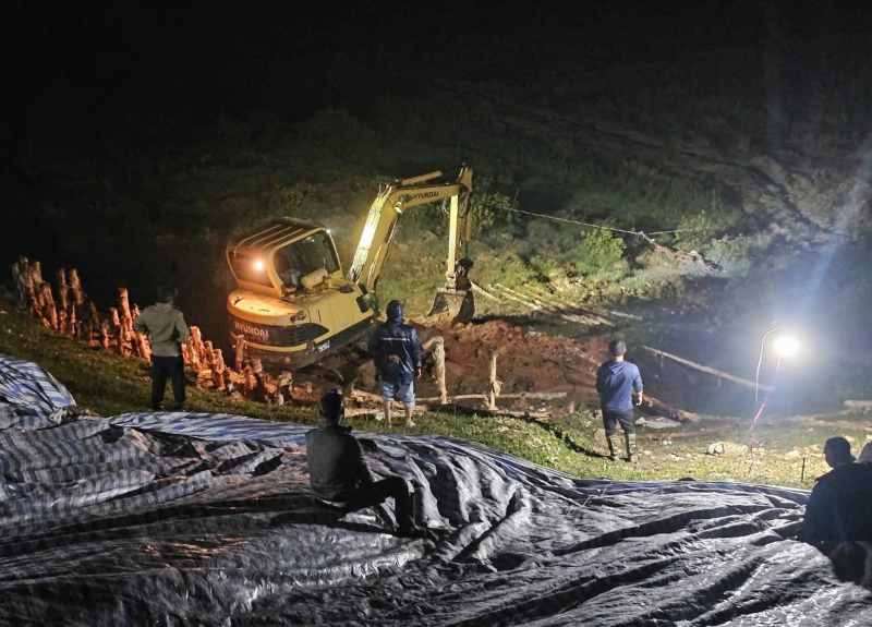
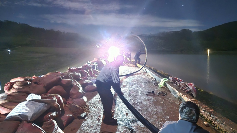
Along with piling, filling soil, reinforcing locations at risk of dam failure, opening the water discharge gates at full capacity, many pumps were mobilized to the scene, actively pumping to lower the water level on Kay An Lake, reducing pressure on the dam body.
After a night of synchronous efforts to deploy solutions, this morning the water level of Kay An Lake is decreasing. The location of the cracks and slides on the main dam body continues to be reinforced but is still very dangerous. Emergency response work to the risk of dam failure is being deployed. Local authorities prohibit unauthorized people and vehicles from entering the area.
Kay An Lake was put into use in 2007, with a capacity of about 1.7 million m3 of water. After storm No. 11, the left shoulder of the main dam of this lake appeared to have localized landslides with an area of 60 m2. This location formed a crack 8 m long, more than 1 m deep, more than 20 cm wide, with groundwater seeping through the foot of the dam. In addition, two other locations of the main dam also appeared to have water seepage and water leakage.
To deal with the landslides, the People's Committee of Ta Nang commune used tarpaulins to cover the entire affected area to prevent rainwater from flowing down and aggravating the cracks.
However, heavy rain has been continuing for the past few days, the lake water level has risen, the location of the incident has become increasingly worse, and the risk of the dam breaking is very high.
Source: https://cand.com.vn/Xa-hoi/trang-dem-cuu-ho-chua-1-7-trieu-m3-nuoc-truoc-nguy-co-bi-vo-dap-i787401/


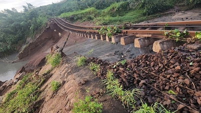
![[Photo] Cutting hills to make way for people to travel on route 14E that suffered landslides](https://vphoto.vietnam.vn/thumb/1200x675/vietnam/resource/IMAGE/2025/11/08/1762599969318_ndo_br_thiet-ke-chua-co-ten-2025-11-08t154639923-png.webp)


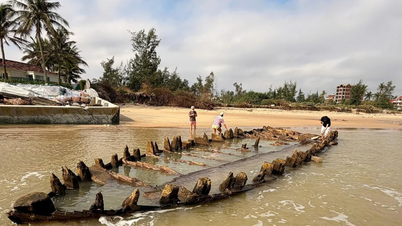


![[Photo] "Ship graveyard" on Xuan Dai Bay](https://vphoto.vietnam.vn/thumb/1200x675/vietnam/resource/IMAGE/2025/11/08/1762577162805_ndo_br_tb5-jpg.webp)


![[Video] Hue Monuments reopen to welcome visitors](https://vphoto.vietnam.vn/thumb/402x226/vietnam/resource/IMAGE/2025/11/05/1762301089171_dung01-05-43-09still013-jpg.webp)


Comment (0)