
.")
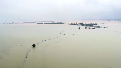
Specifically, in the Northern coast, the tide level is currently at a high level, the peak tide at Hon Dau marine station ( Hai Phong City) reached 4.09m at 4:50 a.m. on November 8. The National Center for Hydro-Meteorological Forecasting warned that in the next 24-72 hours, the tide level in the Northern coast will continue to increase slightly, the highest peak tide could reach 4.15m.
High tides will cause flooding in low-lying coastal areas, along rivers, and outside dykes. At the same time, strong currents during low tides pose a danger to maritime activities, seaports, and sea tourism in the morning.
Meanwhile, in the South, Vung Tau hydrographic station recorded a peak tide of 4.25m at 3:15 p.m. on November 7 and 4.16m at 1:45 a.m. on November 8.
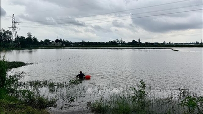
The National Center for Hydro-Meteorological Forecasting predicts that from tonight until November 9, the highest water level at Vung Tau station will fluctuate between 4.1 and 4.15 meters and will decrease slightly to 4.05 meters on November 10 and 11. This is a high tide period, directly affecting traffic, agricultural production, aquaculture, domestic water sources and livelihoods of coastal residents.
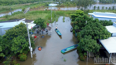
Although the tide is decreasing, it is still high, causing widespread flooding in the eastern coastal area of the South (from Ho Chi Minh City to Ca Mau).
According to meteorological experts, the cause of this rare phenomenon (high tides in both the North and the South) is the combination of high tides at the end of the year, strong northeast monsoon and the impact of storm Fung-wong currently active in the East Sea.
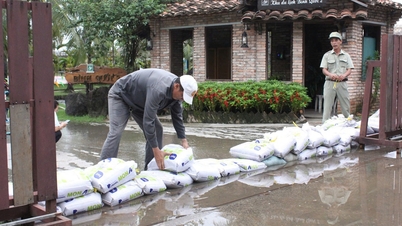
The meteorological agency recommends that people in coastal, low-lying areas, and areas outside the dike limit shore activities, closely monitor high tide developments, and prepare plans to prevent flooding.
Source: https://www.sggp.org.vn/trieu-cuong-xuat-hien-o-ca-bac-bo-va-nam-bo-post822505.html


![[Photo] Cutting hills to make way for people to travel on route 14E that suffered landslides](https://vphoto.vietnam.vn/thumb/1200x675/vietnam/resource/IMAGE/2025/11/08/1762599969318_ndo_br_thiet-ke-chua-co-ten-2025-11-08t154639923-png.webp)


![[Video] Hue Monuments reopen to welcome visitors](https://vphoto.vietnam.vn/thumb/402x226/vietnam/resource/IMAGE/2025/11/05/1762301089171_dung01-05-43-09still013-jpg.webp)


![Dong Nai OCOP transition: [Part 2] Opening new distribution channel](https://vphoto.vietnam.vn/thumb/402x226/vietnam/resource/IMAGE/2025/11/09/1762655780766_4613-anh-1_20240803100041-nongnghiep-154608.jpeg)


Comment (0)