
It is expected that after the downstream of the Hau River in Long Xuyen, An Giang reaches its peak tide in the evening of November 7, the water level on the Hau River in Long Xuyen is forecast to drop rapidly in the following days. Accordingly, the highest water level in 3 days on the Hau River at Long Xuyen station from 280 cm recorded on November 7, to November 8, it will decrease to 276 cm and the water level will continue to decrease to 270 cm on November 9.
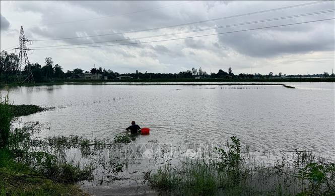
Forecasting that the downstream of Hau River in Long Xuyen will reach its peak tide on the evening of November 7, An Giang Province's Hydrometeorological Station warned of the possibility of localized flooding in Long Xuyen, Binh Duc, My Thoi wards and My Hoa Hung commune, An Giang province.
In particular, in Long Xuyen ward, the embankment area along the Hau river, Rach Gia Long Xuyen canal, Binh Long 1 and Binh Long 2 hamlets, and the streets of Bui Van Danh, Tran Hung Dao, Pham Cu Luong, and Ly Thai To in Long Xuyen ward were flooded. Binh Duc ward was flooded in Binh Khanh 5 and Binh Khanh 7 hamlets. My Thoi ward was flooded in the Hoi Dong canal area, Rach Goi Be, and Cai Sao-Bo Ho. My Hoa Hung commune was flooded in low-lying areas along the Hau river. The flooding time in the morning is from 5:00 to 8:00 and in the evening is from 18:30 to 22:00. The maximum flooding depth is from 5-50cm. The warning level of natural disaster risk due to flooding is level 2.
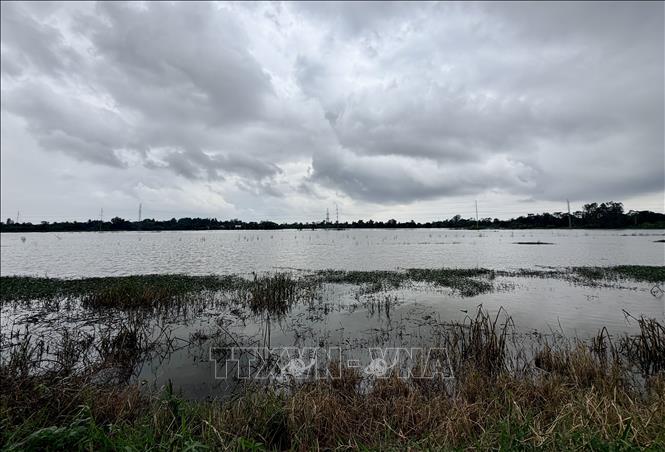
The An Giang Province Hydrometeorological Station also warned that on the Hau River in Long Xuyen, the river is wide, deep, has a strong flow rate and has a large, deep flooded area. When strong winds occur, they can create large waves that cause erosion and landslides on river banks, canals and streams. This will affect traffic activities, aquaculture, agricultural production, people's lives and economic and social activities. Therefore, localities need to be on guard against the possibility of landslides on embankments, weak dykes and traffic routes in flooded areas.
Over the past 24 hours, the water level in the upstream areas of the Tien and Hau rivers has risen slowly, but the downstream areas have risen rapidly following the tide. By the end of October 6, the highest water level on the Hau River in Long Xuyen was 277cm, 27cm above alert level 3.
According to the An Giang Province Hydrometeorological Station, the highest water level in the past 3 days at the upstream stations of Tien River, Hau River and the downstream areas of Tien River, Hau River rose rapidly; in which, the highest water level on November 6 at Tan Chau station on Tien River was 327 cm, 23 cm below alarm level 1; at Chau Doc station on Hau River was 311 cm, 11 cm above alarm level 1; at Long Xuyen station on Hau River was 277 cm, 27 cm above alarm level 3; at Can Tho station on Hau River was 235 cm, 35 cm above alarm level 3; at My Thuan station on Tien River was 224 cm, 44 cm above alarm level 3.
Source: https://baotintuc.vn/xa-hoi/dinh-trieu-vung-ha-luu-song-hau-du-bao-xuong-nhanh-trong-vai-ngay-toi-20251107181812420.htm


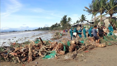
![[Photo] Da Nang: Hundreds of people join hands to clean up a vital tourist route after storm No. 13](https://vphoto.vietnam.vn/thumb/1200x675/vietnam/resource/IMAGE/2025/11/07/1762491638903_image-3-1353-jpg.webp)


Comment (0)