
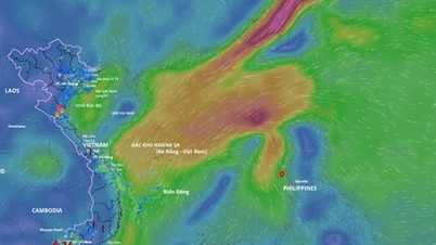
Updated position of storm No. 12 at 5:00 a.m. on October 21. Source: Vietnam Disaster Monitoring System
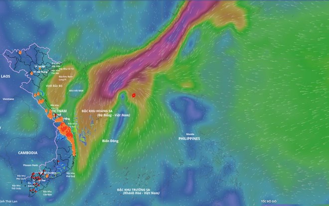
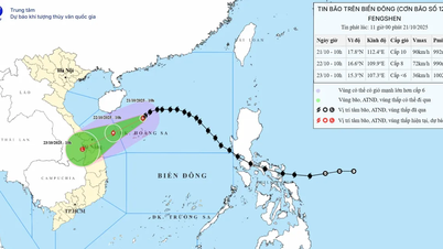
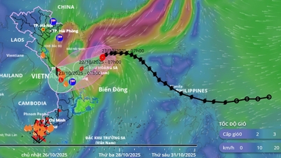
According to the National Center for Hydro-Meteorological Forecasting, at 4:00 a.m. on October 21, the center of storm No. 12 was at about 18.3 degrees north latitude - 113 degrees east longitude, about 200 km north-northeast of Hoang Sa special zone. The strongest wind near the center of the storm was level 9-10 (75-102 km/h), gusting to level 12. The storm moved westward at a speed of about 20 km/h.
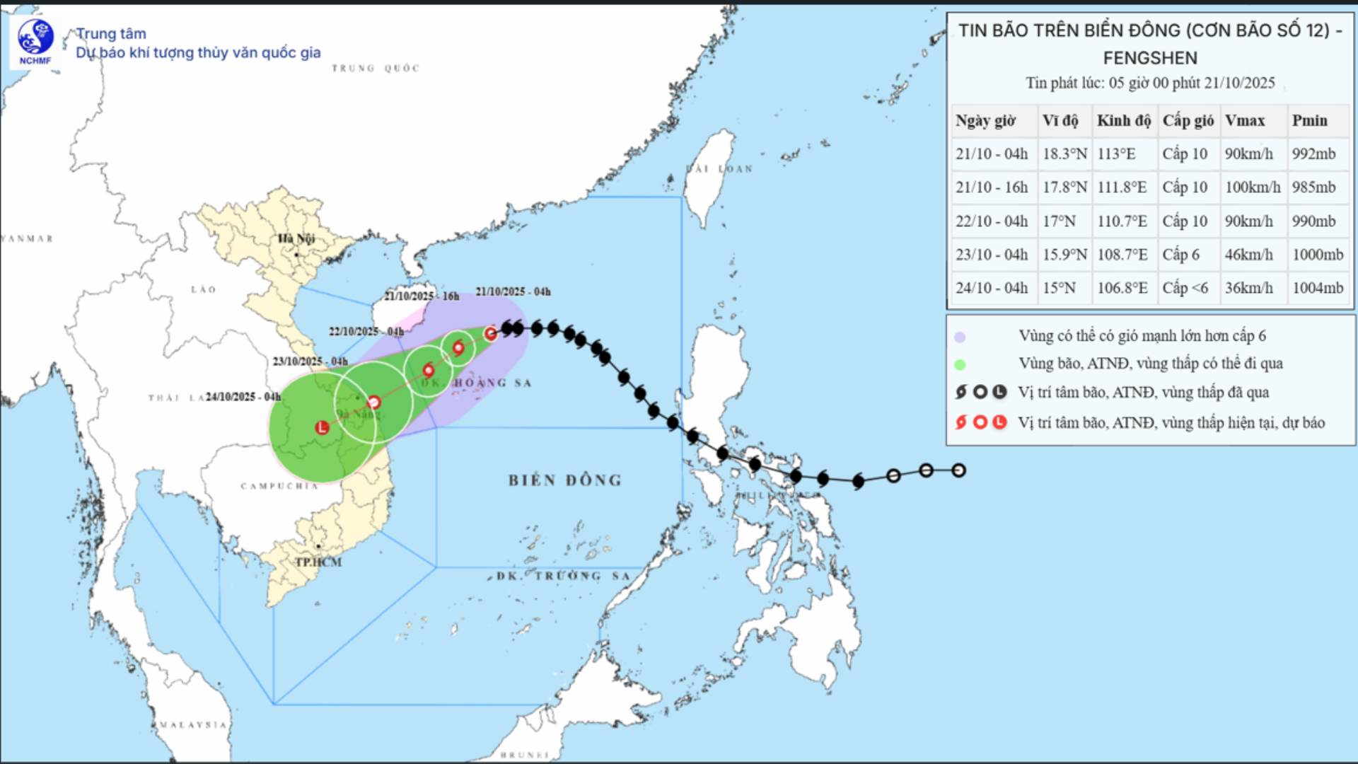
Updated position of storm No. 12 Fengshen at 5:00 a.m. on October 21. Source: National Center for Hydro-Meteorological Forecasting
Forecast in the next 24 hours , the storm will move west-southwest, speed 10-15 km/h. At 4:00 on October 22, the center of the storm will be at about 17.0 degrees north latitude - 110.7 degrees east longitude, in the sea northwest of Hoang Sa special zone. Strong winds level 9-10, gusting to level 12.
The dangerous area in the East Sea is from 15.5-20 degrees north latitude - 109.0-115 degrees east longitude. The natural disaster risk level is level 3 for the western sea area of the northern East Sea (including Hoang Sa special zone).
It is forecasted that in the next 48 hours, the storm will move southwest at a speed of about 10 km/h and may gradually weaken into a tropical depression. At 4:00 a.m. on October 23, the center of the tropical depression will be at about 15.9 degrees north latitude - 108.7 degrees east longitude, in the coastal waters of Hue City - Quang Ngai . Wind force is level 6, gusting to level 8.
The danger zone is from 14.5-19.0 degrees north latitude - 107.5-112.5 degrees east longitude. The natural disaster risk level is level 3 for the western sea area of the northern East Sea (including Hoang Sa special zone), the sea area from south of Quang Tri to Quang Ngai (including Ly Son special zone).
It is forecasted that in the next 72 hours, the tropical depression will continue to move southwest at a speed of about 10 km/h, entering the southern Laos region and gradually weakening into a low pressure area. At 4:00 a.m. on October 24, the center of the low pressure area will be at about 15.0 degrees north latitude - 106.8 degrees east longitude.
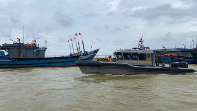
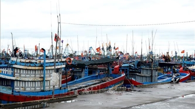
Regarding the impact of the storm at sea, the northern East Sea area (including Hoang Sa special zone) has strong winds of level 7-8, the area near the storm's eye has strong winds of level 9-10, gusting to level 12. Waves are 3-5 m high, the area near the storm's eye is 5-7 m high, the sea is very rough.
The sea area from southern Quang Tri to Quang Ngai (including Ly Son special zone) has strong winds of level 6, increasing to level 7 from the morning of October 22, the area near the storm center has strong winds of level 8, gusts of level 10, waves 3-5 m high, rough seas. All ships operating in the above-mentioned dangerous areas are likely to be affected by storms, whirlwinds, strong winds and big waves.
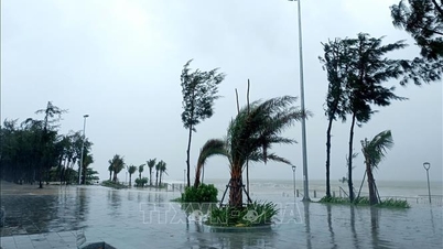
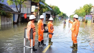
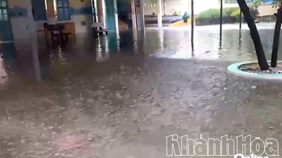
On land, due to the influence of storm circulation combined with cold air, easterly wind disturbances and topographic effects, from the night of October 22 to October 26, the area from Ha Tinh to Quang Ngai is likely to experience widespread heavy rain. Total rainfall from Ha Tinh to northern Quang Tri and Quang Ngai is about 200-400 mm, in some places over 500 mm; the area from southern Quang Tri to Da Nang City is commonly 500-700 mm, in some places over 900 mm.
Heavy rain in the Central region is likely to last until the end of October 2025.
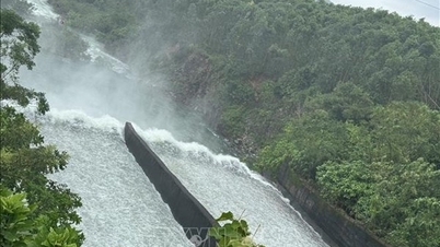
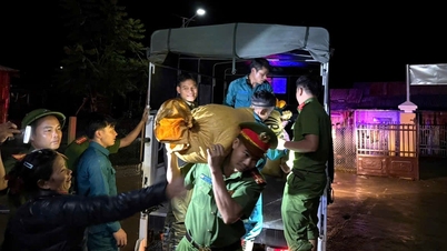
There is a high risk of flash floods and landslides in mountainous areas, and flooding in low-lying and urban areas. Localities need to pay attention to the safe operation of hydroelectric and irrigation reservoirs before, during and after the storm; and prepare response plans for flood scenarios on rivers from Quang Tri to Quang Ngai that may reach and exceed alert level 3. The forecast level of natural disaster risk due to floods and inundations is level 3.
Laodong.vn
Source: https://laodong.vn/moi-truong/tu-dem-2210-bao-so-12-gay-mua-to-truoc-khi-do-bo-du-bao-khu-vuc-trong-tam-mua-lon-1595224.ldo

![[Photo] Chairman of the Hungarian Parliament visits President Ho Chi Minh's Mausoleum](https://vphoto.vietnam.vn/thumb/1200x675/vietnam/resource/IMAGE/2025/10/20/1760941009023_ndo_br_hungary-jpg.webp)
![[Photo] National Assembly Chairman Tran Thanh Man holds talks with Hungarian National Assembly Chairman Kover Laszlo](https://vphoto.vietnam.vn/thumb/1200x675/vietnam/resource/IMAGE/2025/10/20/1760952711347_ndo_br_bnd-1603-jpg.webp)
![[Photo] Prime Minister Pham Minh Chinh meets with Speaker of the Hungarian National Assembly Kover Laszlo](https://vphoto.vietnam.vn/thumb/1200x675/vietnam/resource/IMAGE/2025/10/20/1760970413415_dsc-8111-jpg.webp)


Comment (0)