
5 sections and 2 bridges across the river mouth
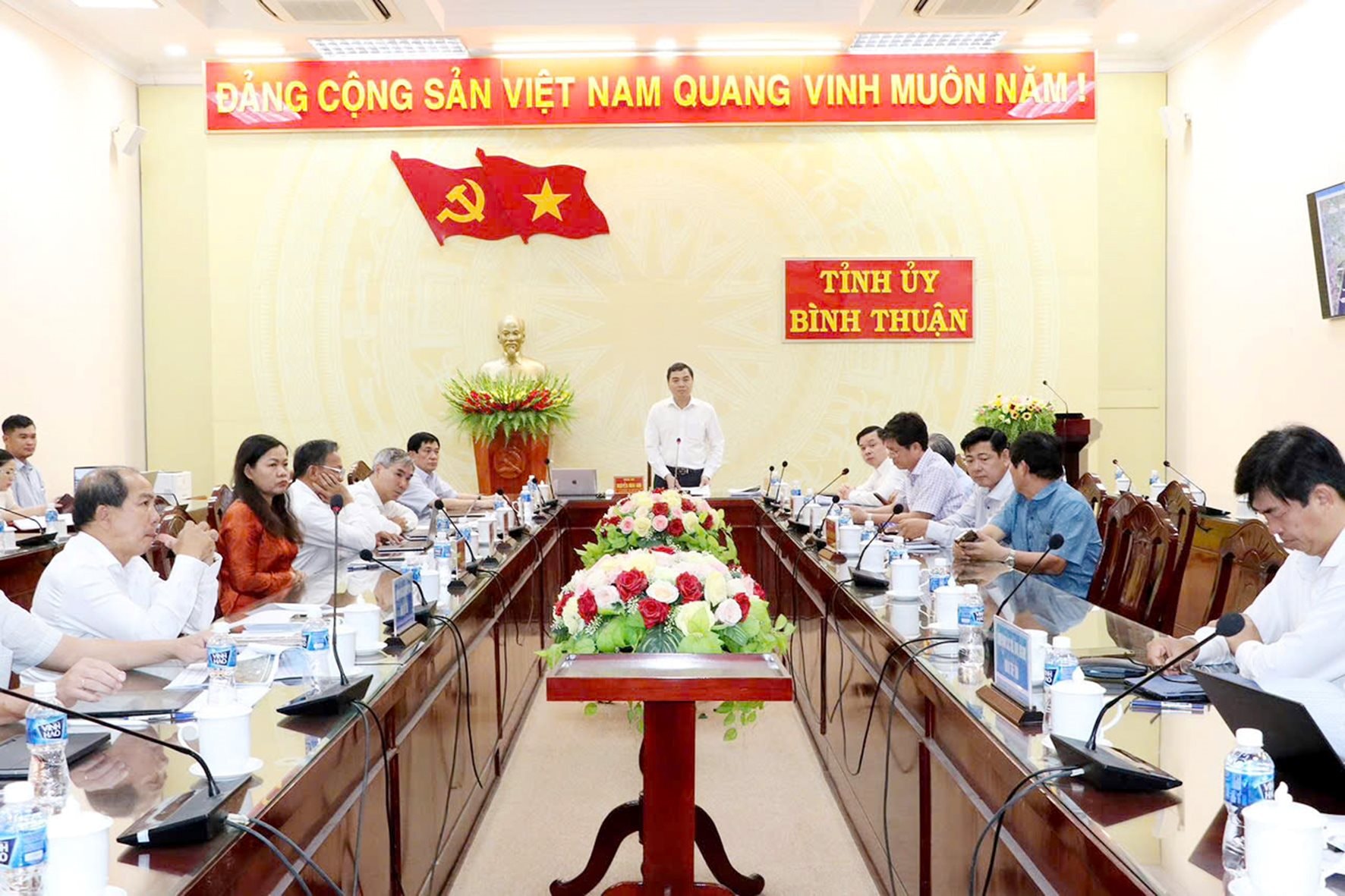
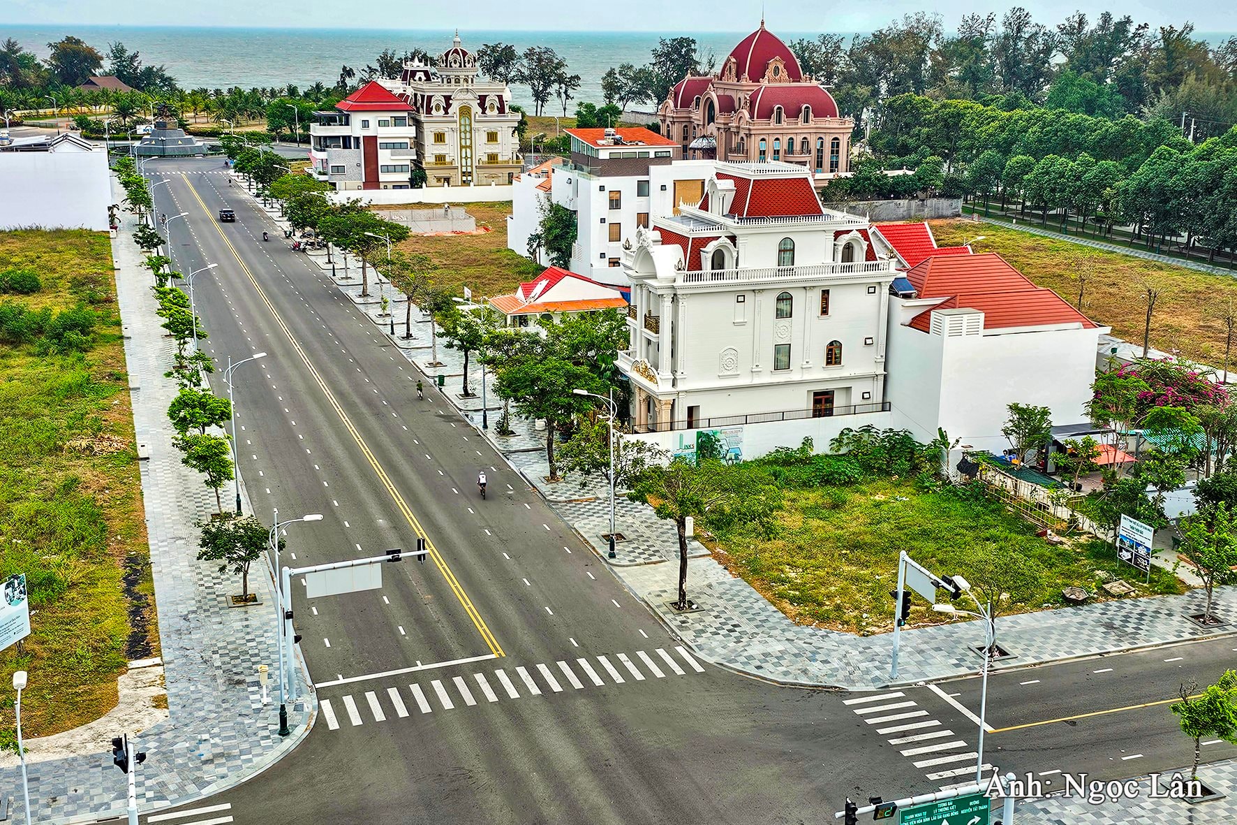
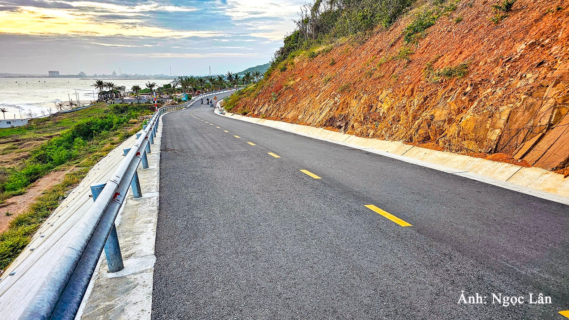
On May 19, 2025, commemorating the 135th anniversary of President Ho Chi Minh's birthday, the Ho Chi Minh Museum - Binh Thuan branch was bustling with visitors. Looking towards the sea from here, in 5 years if everything goes smoothly, the coastal road project through Phan Thiet City, connecting Phu Hai ward to Tien Thanh commune, which the Provincial Party Committee Standing Committee agreed on the same day, the Ca Ty River overpass will appear, right at the river mouth. This is the first overpass next to the second overpass at the Phu Hai river mouth, becoming a beautiful highlight, not only for the land with many rivers flowing through like Phan Thiet, but also for the 14.6 km long coastal road with the starting point at the roundabout at the beginning of DT.706B road, Phu Hai ward and the end point intersecting with DT.719 road at Cambodia slope, Tien Thanh commune. The entire route is divided into 5 sections and each section has a different investment and construction method, different difficulty levels, creating its own beautiful landscapes, but each section ensures 6 standard motor vehicle lanes, in which the road cross-section is 36.5 m.
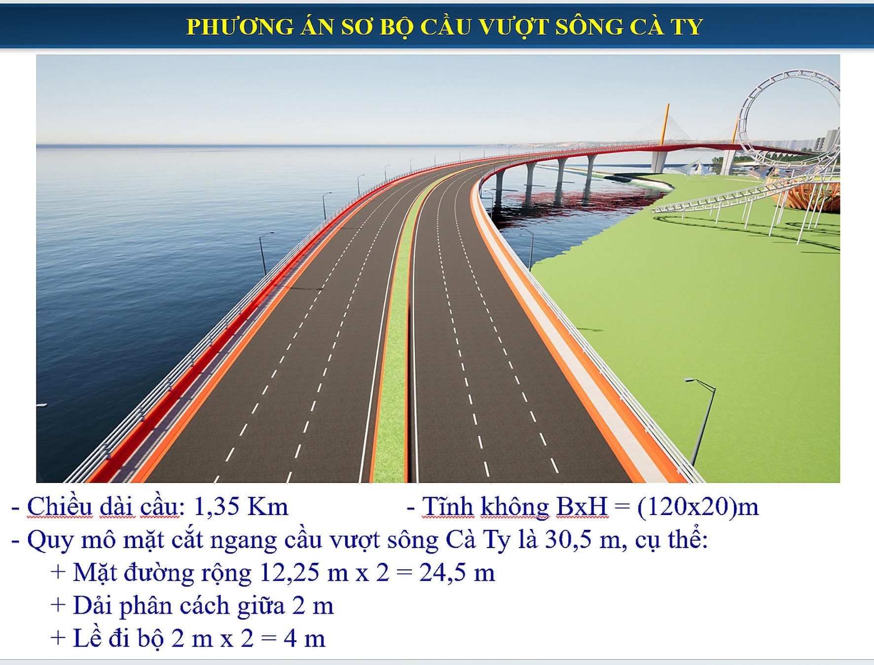
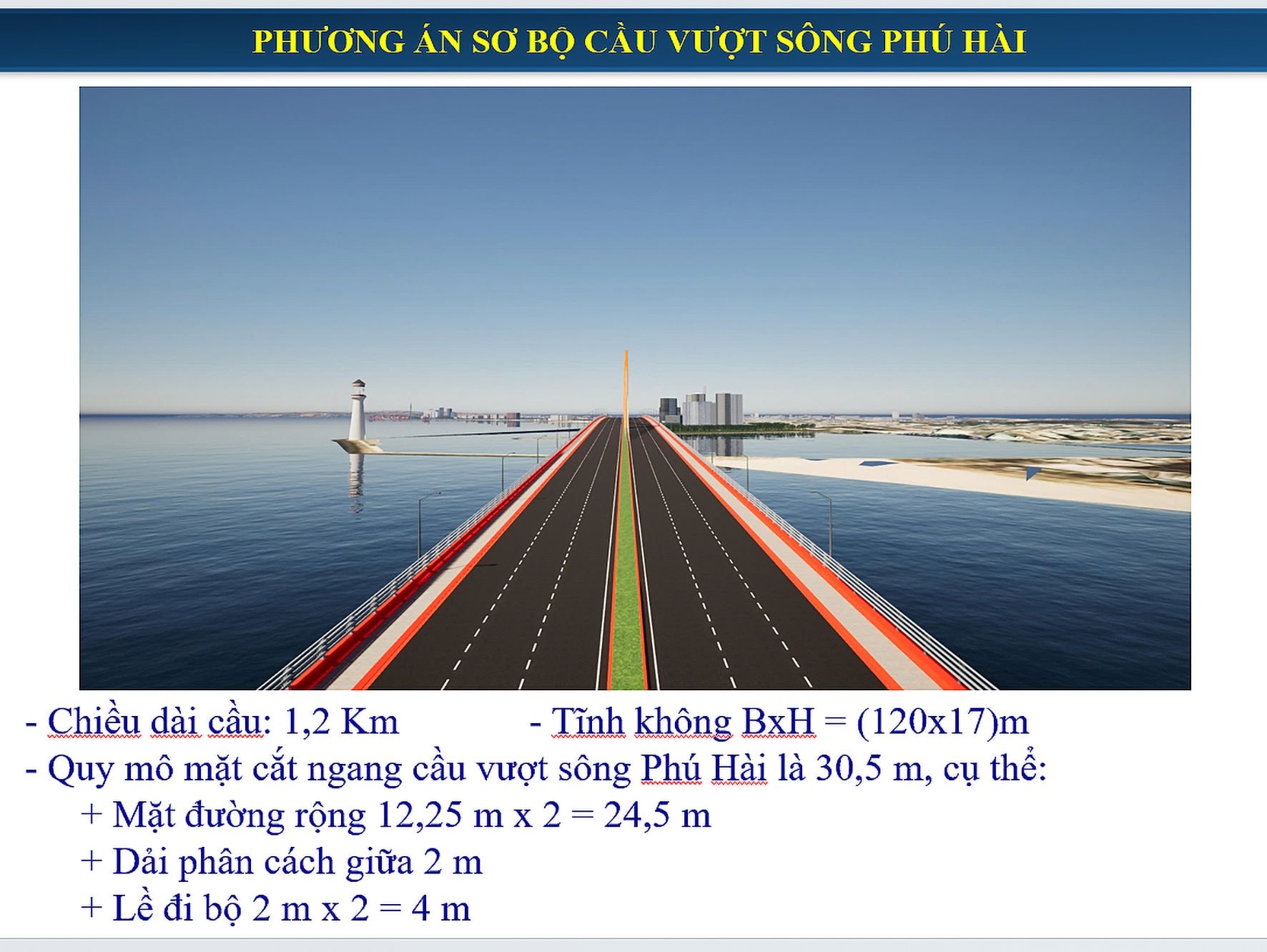
According to the investment plan report presented by the Provincial Party Committee at the meeting of the Provincial Party Standing Committee for comments, section 1, from the starting point of the project to Ton That Tung Street, is about 5.23 km long; including Phu Hai cable-stayed bridge, and at the same time, the sea encroachment along the Phu Hai estuary area is leveled with an area of about 44.1 hectares with an investment cost of about 3,484 billion VND. Section 2, about 0.98 km long, from Ton That Tung Street connecting to Phan Thiet coastal urban tourism area to Nguyen Tat Thanh Street. This is the section where 3 options are built for comparison, choosing the option that ensures the economic , technical and safety of Doi Duong beach area. Through the analysis of the meeting participants, the Provincial Party Committee Standing Committee decided to choose the option of utilizing the existing sidewalk and road surface of Le Loi Street in Phan Thiet coastal urban tourism area, 0.98 km long, expanding the road surface towards the sea, with a cost of about 950 billion VND. Continuing with section 3 connecting Nguyen Tat Thanh Street to Doi Duong Park, about 0.555 km long, the existing Le Loi Street will be expanded, keeping the sidewalk on the left side of the road intact, expanding to the right side of the road to retain the trees on the sidewalk of Doi Duong Park, with a cost of about 92 billion VND.
.jpg)
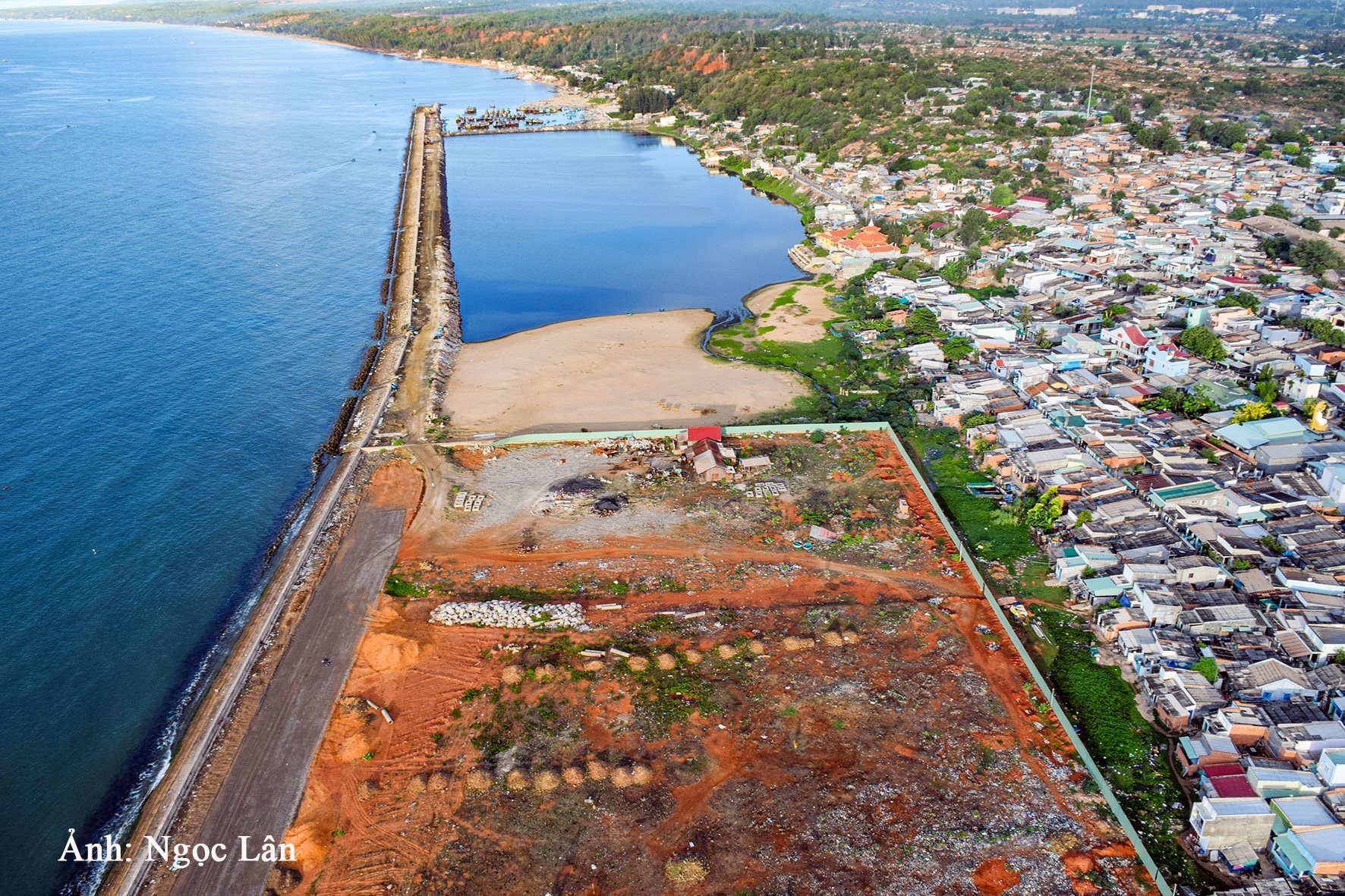
To section 4, about 4.855 km long (including Ca Ty bridge), from the end of Doi Duong park, close to Thuong Chanh sea embankment to connect to the current coastal road in the residential area of the South fishing port. Accordingly, investment will be made in building a sea encroachment road and a cable-stayed Ca Ty bridge, building a 3.3 km long embankment on the southern bank of Ca Ty bridge. In parallel, reclaiming the sea along the South fishing port area with an area of about 40.7 hectares; building a 250 m long breakwater (west wing) of the Ca Ty river mouth to prevent silting of the river mouth... with a fairly high cost, about 4,586 billion VND.
Finally, section 5 is about 2,980 km long, from the coastal road through the project of sea encroachment, residential rearrangement and urban beautification of Duc Long ward, Phan Thiet city to the intersection of coastal road DT.719 (Cambodia slope). This section belongs to the project of Improving the urban environment of type 2 cities - Binh Thuan province component (ADB capital); currently, Phan Thiet city People's Committee is implementing the project investment policy step, so the cost of about 336 billion VND for phase 2 is added to complete the project scale.
| Expanding space towards the sea |
If the two overpasses at the two mouths of the Ca Ty and Phu Hai rivers, when built, will create architectural and landscape highlights, becoming symbols to attract tourists, then the filling and reclaiming of about 84.8 hectares of land when the project is implemented will make Phan Thiet urban area outstandingly different. Because in addition to planning the reclaimed areas, it is also exploiting newly emerged land funds, which the Standing Committee of the Provincial Party Committee emphasized must meet the criteria to contribute to making this land a livable place. Specifically, those new places must be invested in the nature of a modern urban area, in harmony with nature by organizing coastal green tree lines, central parks of the area, creating beautiful landscapes and the highlight of each area is the combination of commercial service blocks, high-rise apartments connected to the central park. High-rise apartment blocks are arranged with the core being green areas combined with sports facilities, increasing the value of life for people in the urban area, ensuring both convenient access and a sustainable green environment...
From here, the 4 planned areas for sea encroachment are designed with the mission of contributing to overcoming the limitations of the current Phan Thiet tourist city. The weakest point is that in some coastal areas, people build houses, mainly level 4 houses, temporary houses, small areas, close together, while the narrow traffic roads do not ensure traffic circulation, traffic safety, fire prevention and fighting, greatly affecting people's lives, causing loss of urban beauty.
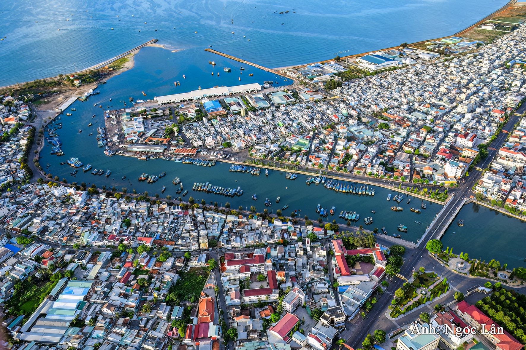
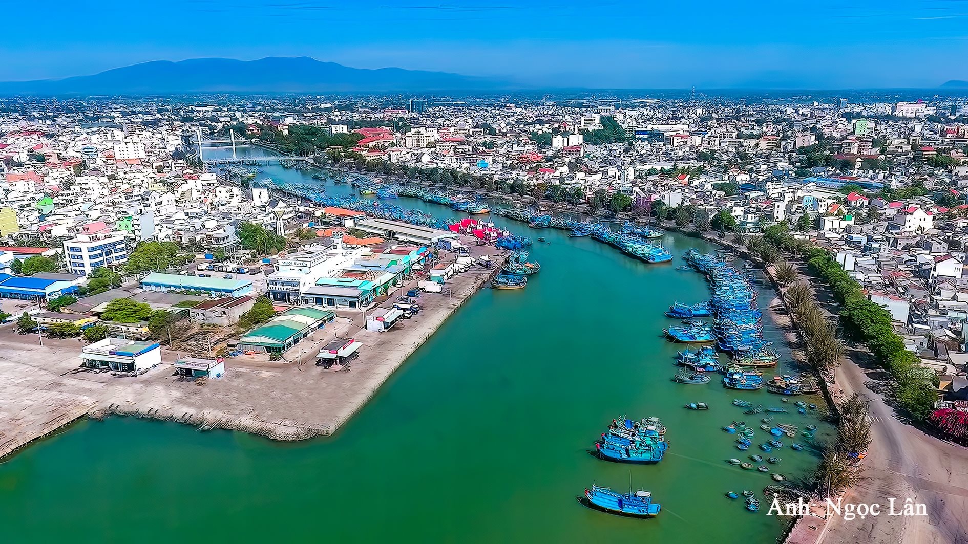
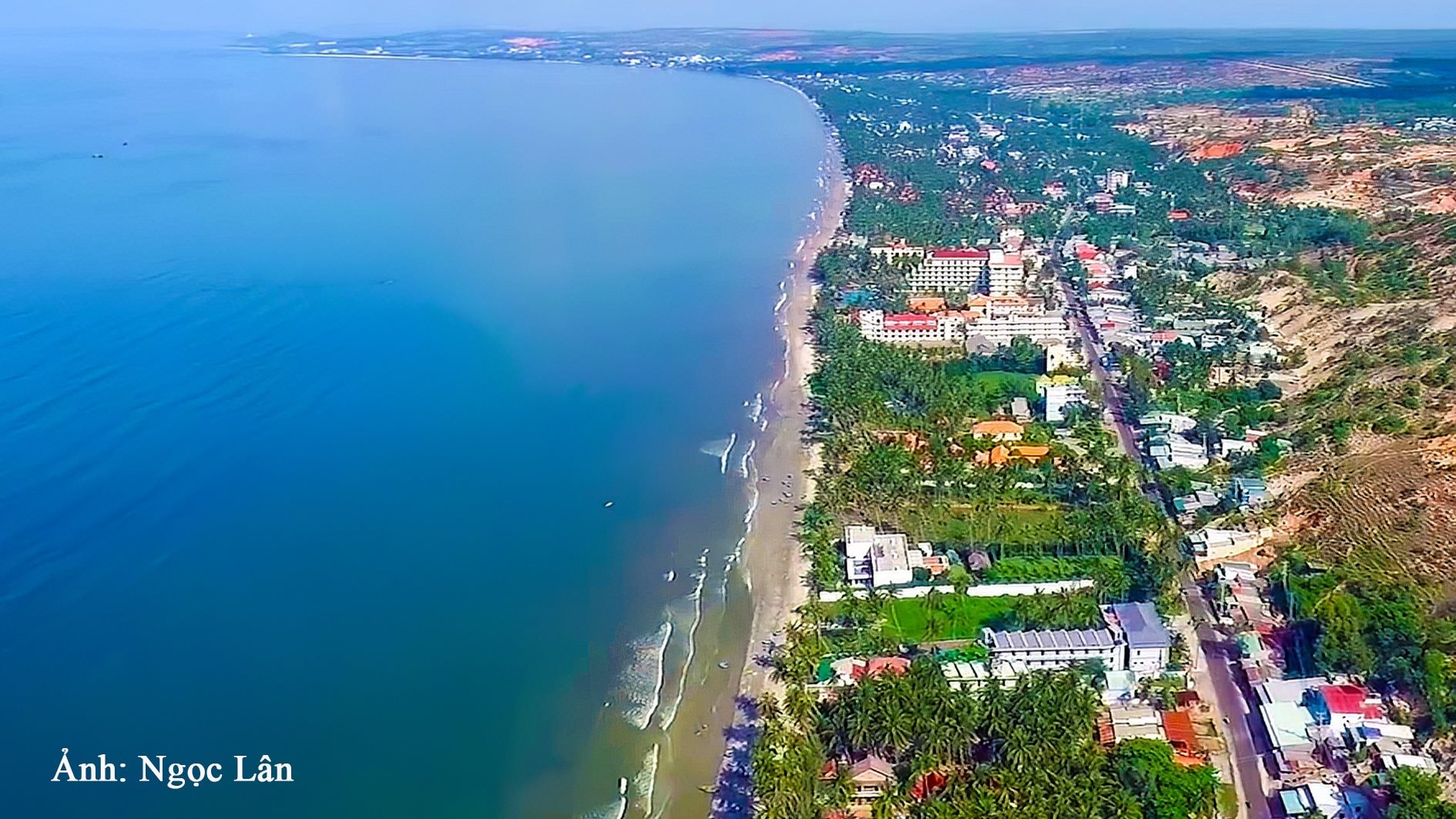
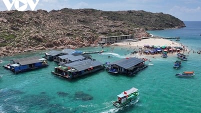
Not only that, there are several other limitations that, previously, in Conclusion No. 703-KL/TU, dated March 15, 2023, the Standing Committee of the Provincial Party Committee assessed, that is, the coastal axis of Phan Thiet is currently divided by river mouths, existing residential areas, tourism and urban projects. The construction planning, landscape and environment of the coastal area are not beautiful, many locations have been licensed to build tourist works close to the sea, some places have been licensed to build high-rise buildings, obstructing the view; there are not many public beach areas serving people and tourists in the city. Therefore, Phan Thiet city needs to plan a continuous coastal route from the North ( bordering Hong Phong commune, Bac Binh district ) to the South ( bordering Thuan Quy commune, Ham Thuan Nam district). In particular, priority is given to building roads and overpasses through the estuaries of Phu Hai, Thanh Hai, Phu Thuy, Hung Long, Duc Thang, Lac Dao, Duc Long and Tien Thanh commune.
Therefore, the agreement to invest in the coastal route through Phan Thiet city and the Ca Ty and Phu Hai river overpasses on the route by the Provincial Party Standing Committee at the meeting on May 19, 2025 is a continuation of the above orientation.
4 planning areas for land reclamation:
Zone 1 has a total reclaimed area of about 29.8 hectares in Phu Hai ward, of which the Department of Construction plans to plan land use functions of 13.72 hectares, including residential land (apartment buildings) of 7.07 hectares; commercial service land of 2.05 hectares; green park land of 1.92 hectares... Zones 2 and 3 are both located in Phu Hai port area on the North bank with 7.98 hectares, on the South bank with 14.3 hectares, also planned with similar land use functions. Zone 4 has a total reclaimed area of about 40.7 hectares in Phan Thiet fishing port area, the project of reclaiming the sea, rearranging residents and urban embellishment of Duc Long ward, the area that the Department of Construction plans to propose to plan land exploitation is about 34.71 hectares, of which residential land (apartment buildings) is 9.95 hectares; mixed land (expected to arrange high-rise residential buildings combined with commercial services, commercial service buildings, etc.) about 3.34 hectares; green park land 7.53 hectares...
Lesson 2: Continuing the mission of community access to the sea
Source: https://baobinhthuan.com.vn/tuyen-duong-ven-bien-qua-tp-phan-thiet-quyet-dinh-do-thi-bien-dang-song-bai-1-tren-ca-tiem-nang-khac-biet-130411.html
![[Photo] Prime Minister Pham Minh Chinh attends the groundbreaking ceremony of Trump International Hung Yen Project](https://vphoto.vietnam.vn/thumb/1200x675/vietnam/resource/IMAGE/2025/5/21/ca84b87a74da4cddb2992a86966284cf)

![[Photo] Prime Minister Pham Minh Chinh chairs the Government's special meeting on law-making in May](https://vphoto.vietnam.vn/thumb/1200x675/vietnam/resource/IMAGE/2025/5/22/1c880aae96fd4e0894abc47a46fe19ba)


Comment (0)