
After entering the East Sea, storm Kalmaegi is forecast to continuously increase in strength. By the evening of November 6, the storm could reach level 14, gusting to level 17, and could directly affect the area from Da Nang to Khanh Hoa.
According to the National Center for Hydro-Meteorological Forecasting, at 7:00 p.m. on November 3, the center of storm Kalmaegi was located on the eastern coastal area of the central Philippines. The strongest wind near the center of the storm was level 12-13 (118-149 km/h), gusting to level 16.
In the next 24 hours, the storm will move in the West Southwest direction at a fast speed of about 25km/h.
By the evening of November 4, storm Kalmaegi in the central region of the Philippines had a level 13 intensity, gusts of level 16 and was likely to strengthen, moving mainly westward at a speed of about 25km/h and entering the East Sea.
It is forecasted that on November 5, the storm will enter the East Sea, becoming the 13th storm of the year with a level 12 intensity, gusting to level 15. After entering the East Sea, the storm will mainly move in the West-Northwest direction at a fast speed of 20-25km/h.
At 7:00 p.m. on November 5, storm Kalmaegi was in the middle of the East Sea, about 800km east-southeast of the coast of Gia Lai province, with a level 13 intensity, gusting to level 16, and likely to strengthen.
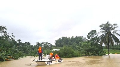
 |
| The movement of storm Kalmaegi (Photo: NCHMF). |
By the evening of November 6, the storm in the Quang Ngai sea area reached Dak Lak , about 200km east-southeast of the Gia Lai province coast, with a level 14 intensity, gusting to level 17 and likely to strengthen, moving mainly in the West-Northwest direction at a speed of about 25km/h.
Thus, after entering the East Sea for 2 days, storm Kalmaegi continuously increased in level (from level 12 to level 14) and mainly moved in the West Northwest direction.
From the next 72 to 108 hours, the storm will move mainly in the West Northwest direction, 20-25km per hour, gradually weakening.
The Japan Meteorological Agency said that at 8:30 p.m. on November 5, Typhoon Kalmaegi had a wind speed of about 130 km/h. When entering the East Sea, Typhoon Kalmaegi could reach 148 km/h on the evening of November 5; by the evening of November 7, it would decrease to 64 km/h.
Hong Kong Radio forecasts that when in the middle of the East Sea, storm Kalmaegi will be strong at 165km/h, approaching Gia Lai mainland and can reach 175km/h.
According to the Department of Hydrometeorology, Ministry of Agriculture and Environment, storm Kalmaegi may reach intensity of level 13-14 in Truong Sa special zone and in the sea area of Da Nang - Khanh Hoa.
From the night of November 6, the storm is likely to directly affect the area from Da Nang to Khanh Hoa.
The strongest wind in coastal areas (including Ly Son special zone) is likely to reach level 12-13, gusting over level 15. Inland coastal areas are likely to reach level 10-12, gusting to level 14-15.
The Hydrometeorological Agency assessed that this is a strong storm, with thunderstorms and tornadoes possible before the storm, causing widespread heavy rain from the night of November 6 to November 9, in the area from Quang Tri to Dak Lak. There is a risk of new flooding on rivers from Quang Tri to Khanh Hoa provinces.
According to dantri.com.vn
Source: https://baovinhlong.com.vn/thoi-su/202511/bao-kalmaegi-lien-tuc-tang-cap-du-bao-cac-dia-phuong-bi-anh-huong-fd737ef/


![[Photo] Prime Minister Pham Minh Chinh receives the Chairman of the Japan-Vietnam Friendship Association in the Kansai region](https://vphoto.vietnam.vn/thumb/1200x675/vietnam/resource/IMAGE/2025/11/03/1762176259003_ndo_br_dsc-9224-jpg.webp)


![[Photo] Fall Fair 2025 and impressive records](https://vphoto.vietnam.vn/thumb/1200x675/vietnam/resource/IMAGE/2025/11/03/1762180761230_ndo_br_tk-hcmt-15-jpg.webp)


Comment (0)