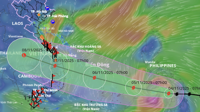
According to the meteorological bulletin, at 7:00 a.m. on November 3, the center of the storm was located at about 10.7 degrees North latitude; 129.0 degrees East longitude, in the sea east of the central Philippines. The strongest wind near the center of the storm was level 11 (89-102 km/h), gusting to level 15, moving in the West Southwest direction at a speed of about 25 km/h. It is forecasted that in the next 72-120 hours, the storm will likely enter the East Sea and become Storm No. 13 of 2025.
From the afternoon of November 4, the sea area in the East Sea will have winds gradually increasing to level 6-7, then increasing to level 8-9; the area near the storm center will have strong winds of level 10-12, gusts of level 14-15, waves 5-7 m high, and rough seas. On November 5-6, the area in the East Sea (including Truong Sa archipelago) and the offshore sea area from Da Nang to Khanh Hoa may be affected by strong winds of level 12-14, gusts above level 17, waves 8-10 m high.
Faced with the above situation, the Provincial Civil Defense Command requests:
- Closely monitor storm developments, update and promptly notify people, especially ship owners, captains, and offshore cargo keepers, to proactively prevent.
- The Border Guard coordinates with relevant sectors to strengthen inspection and control of vessels entering and leaving seaports and operating at sea.
- Functional forces are on duty 24/7, ready with rescue vehicles and personnel when situations arise.
- Localities promptly report all developments to the Provincial Civil Defense Command Office (Irrigation Sub-Department) for timely handling.
The Provincial Civil Defense Command requested units and localities to proactively coordinate, not to be negligent or subjective, in order to minimize damage caused by natural disasters.
Source: https://www.camau.gov.vn/thoi-su-chinh-tri/chu-dong-ung-pho-voi-con-bao-kalmaegi-co-kha-nang-vao-bien-dong-tro-thanh-bao-so-13-290432


![[Photo] Ca Mau "struggling" to cope with the highest tide of the year, forecast to exceed alert level 3](https://vphoto.vietnam.vn/thumb/1200x675/vietnam/resource/IMAGE/2025/11/04/1762235371445_ndo_br_trieu-cuong-2-6486-jpg.webp)

![[Photo] Panorama of the Patriotic Emulation Congress of Nhan Dan Newspaper for the period 2025-2030](https://vphoto.vietnam.vn/thumb/1200x675/vietnam/resource/IMAGE/2025/11/04/1762252775462_ndo_br_dhthiduayeuncbaond-6125-jpg.webp)
![[Photo] Ho Chi Minh City Youth Take Action for a Cleaner Environment](https://vphoto.vietnam.vn/thumb/1200x675/vietnam/resource/IMAGE/2025/11/04/1762233574890_550816358-1108586934787014-6430522970717297480-n-1-jpg.webp)

![[Photo] The road connecting Dong Nai with Ho Chi Minh City is still unfinished after 5 years of construction.](https://vphoto.vietnam.vn/thumb/1200x675/vietnam/resource/IMAGE/2025/11/04/1762241675985_ndo_br_dji-20251104104418-0635-d-resize-1295-jpg.webp)




























Comment (0)