
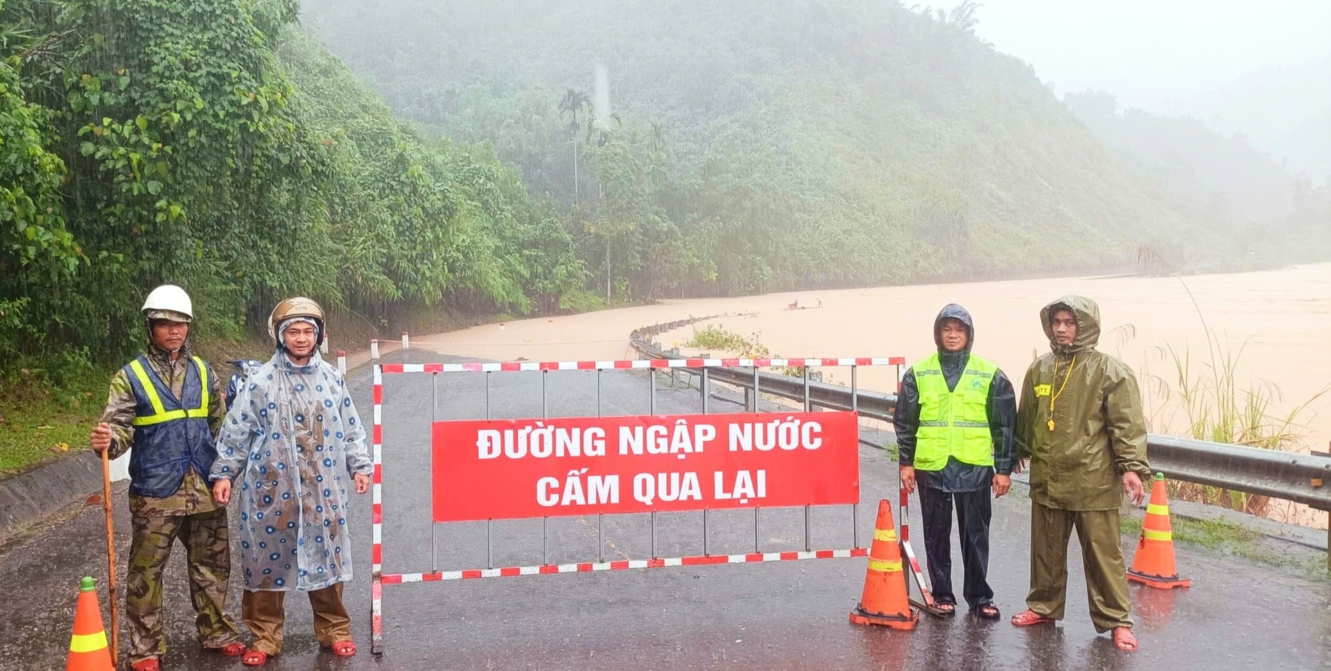
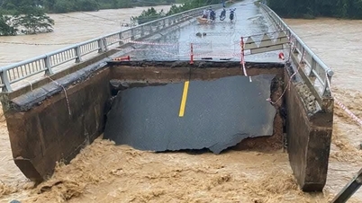
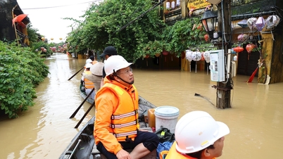
Mr. Briu Quan, Chairman of the People's Committee of Avuong Commune, said that from early morning on October 28, the locality recorded the water level of Avuong River in Cr'toonh village rising unexpectedly, the flood overflowed Ho Chi Minh Highway, section Km438+700 - Km439+150.
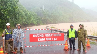
Faced with the above situation, Road Management Area 3 (the unit managing the Ho Chi Minh Highway - West branch) closed the road, preventing traffic from entering the dangerous area, starting from 7:30 a.m. the same day.
.jpg)
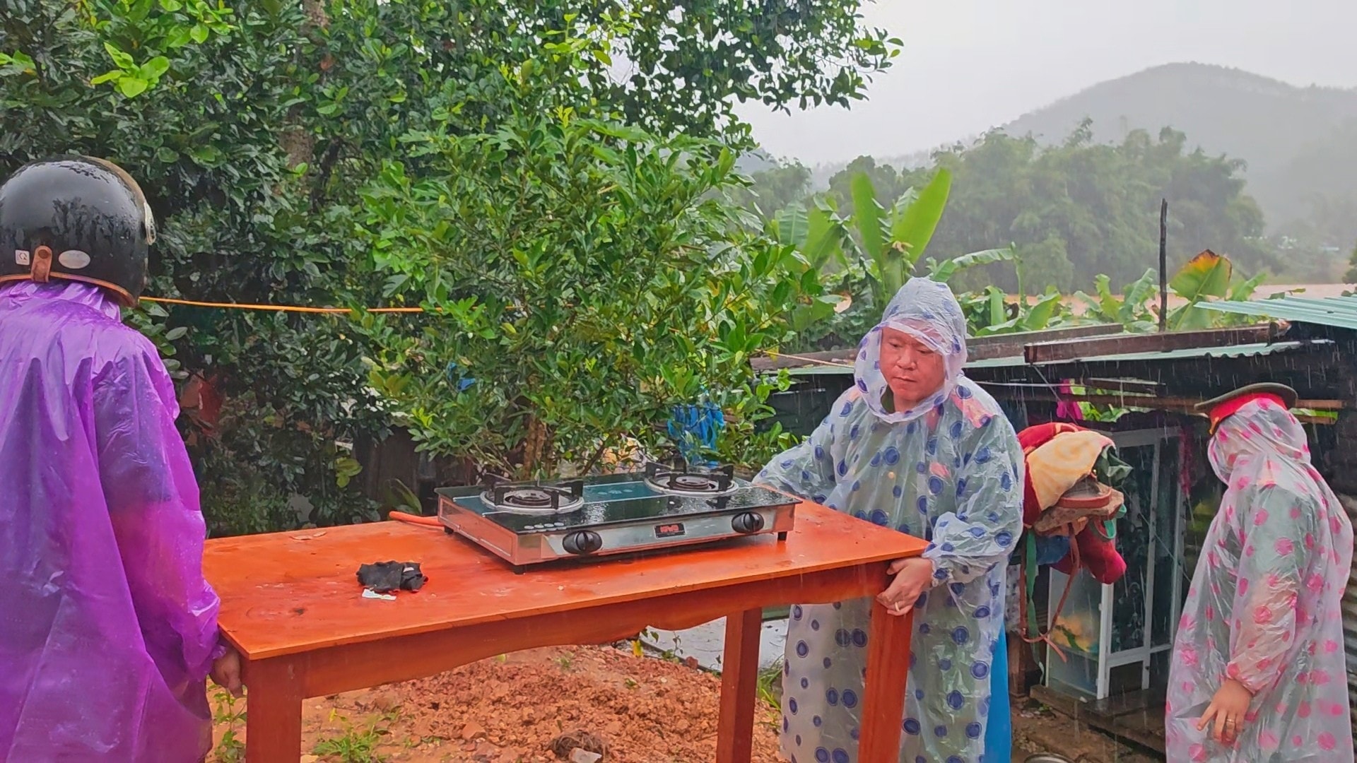
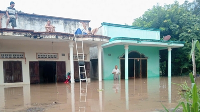
The Chairman of the People's Committee of Avuong Commune said that currently, in Azut village (center of Avuong Commune), 10 houses are flooded more than 0.5m deep due to the rising water level of Cha Lang River. Some households in Ateep village have had their houses damaged due to the impact of landslides on the positive slope.
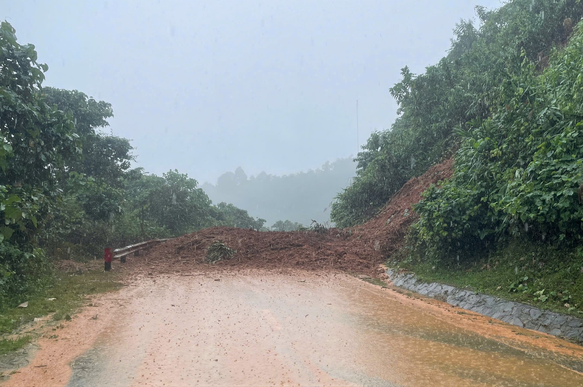
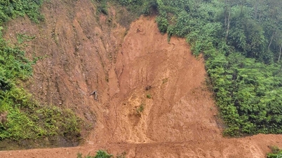
On the Ho Chi Minh road through the commune (28.3km long), there are many landslides on the slopes. Among them, there is a large one in Xa'oi village that completely cut off the area.
.jpg)
In addition, the DT606 route (7.2km long) had a negative slope landslide at Km5+830; the DH3 route (from Ateep to Axoo village) and the DH5 route (from the beginning of Avuong bridge - Ra'bhup village) had many large and small landslides. DH5 alone had 7 points, of which 1 point had a large landslide that prevented all vehicles from passing.
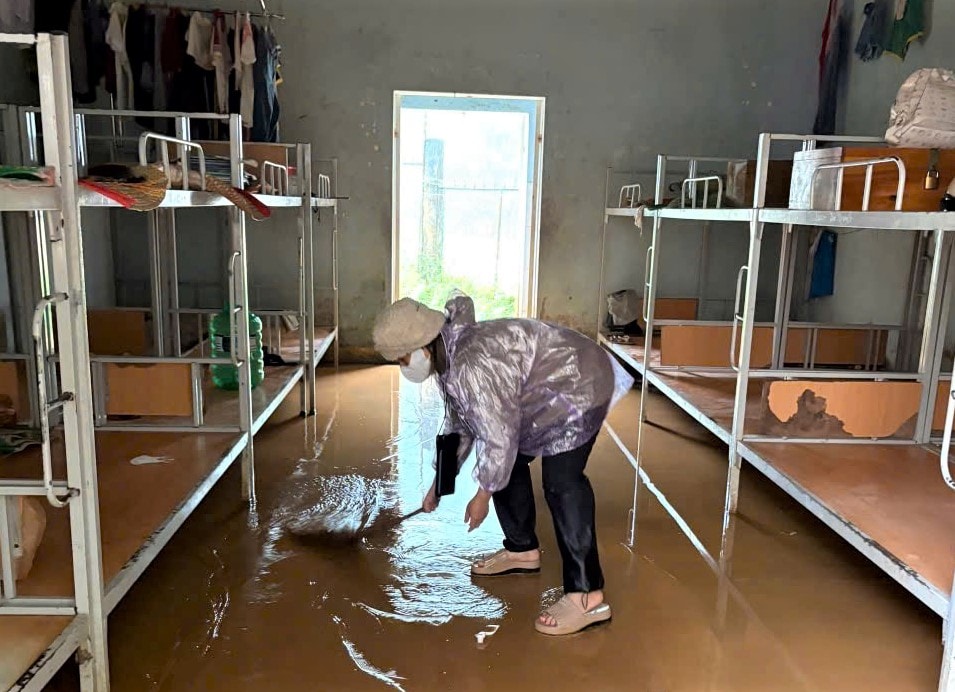
Heavy rains have affected public works. The ground floor of Nguyen Ba Ngoc Secondary School for Ethnic Minorities is flooded more than 0.2m deep; Avuong Kindergarten is at risk of landslides.
The medium voltage line passing through R'cung village (near Ho Chi Minh road) was broken, causing a power outage since 7am on October 28. Power crews are urgently fixing the problem.
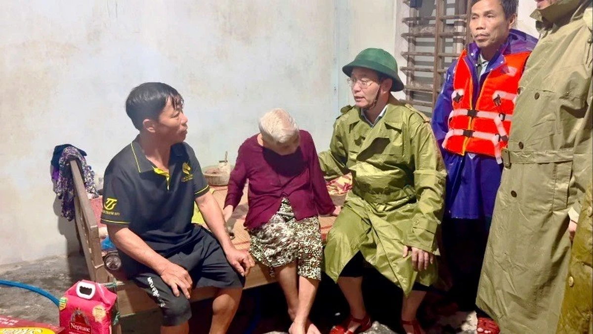
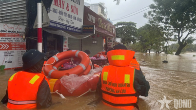
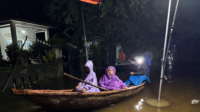
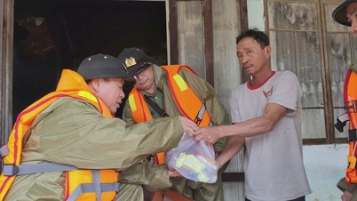
At this time, Avuong commune organized the evacuation of 11 households with 45 people to a safe place.
.jpg)
Source: https://baodanang.vn/cam-luu-thong-tren-duong-ho-chi-minh-doan-qua-xa-avuong-do-lu-3308518.html
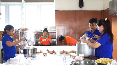
![[Photo] Hue: Inside the kitchen that donates thousands of meals a day to people in flooded areas](https://vphoto.vietnam.vn/thumb/1200x675/vietnam/resource/IMAGE/2025/10/29/1761738508516_bepcomhue-jpg.webp)
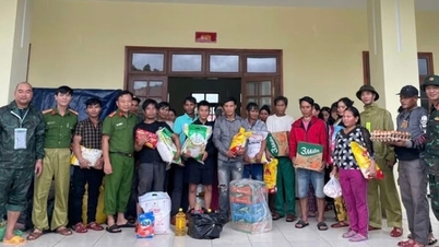
![[Photo] Human love in the flood in Hue](https://vphoto.vietnam.vn/thumb/1200x675/vietnam/resource/IMAGE/2025/10/29/1761740905727_4125427122470875256-2-jpg.webp)
![[Photo] Prime Minister Pham Minh Chinh chaired a meeting to discuss solutions to overcome the consequences of floods in the central provinces.](https://vphoto.vietnam.vn/thumb/1200x675/vietnam/resource/IMAGE/2025/10/29/1761716305524_dsc-7735-jpg.webp)

![[Photo] Prime Minister Pham Minh Chinh chaired a meeting to evaluate the operation of the two-level local government model.](https://vphoto.vietnam.vn/thumb/1200x675/vietnam/resource/IMAGE/2025/10/29/1761751710674_dsc-7999-jpg.webp)


![[Live] Concert Ha Long 2025: "Heritage Spirit - Brightening the Future"](https://vphoto.vietnam.vn/thumb/402x226/vietnam/resource/IMAGE/2025/10/29/1761743605124_g-anh-sang-am-thanh-hoanh-trang-cua-chuong-trinh-mang-den-trai-nghiem-dang-nho-cho-du-khach-22450328-17617424836781829598445-93-0-733-1024-crop-1761742492749383512980.jpeg)


Comment (0)