
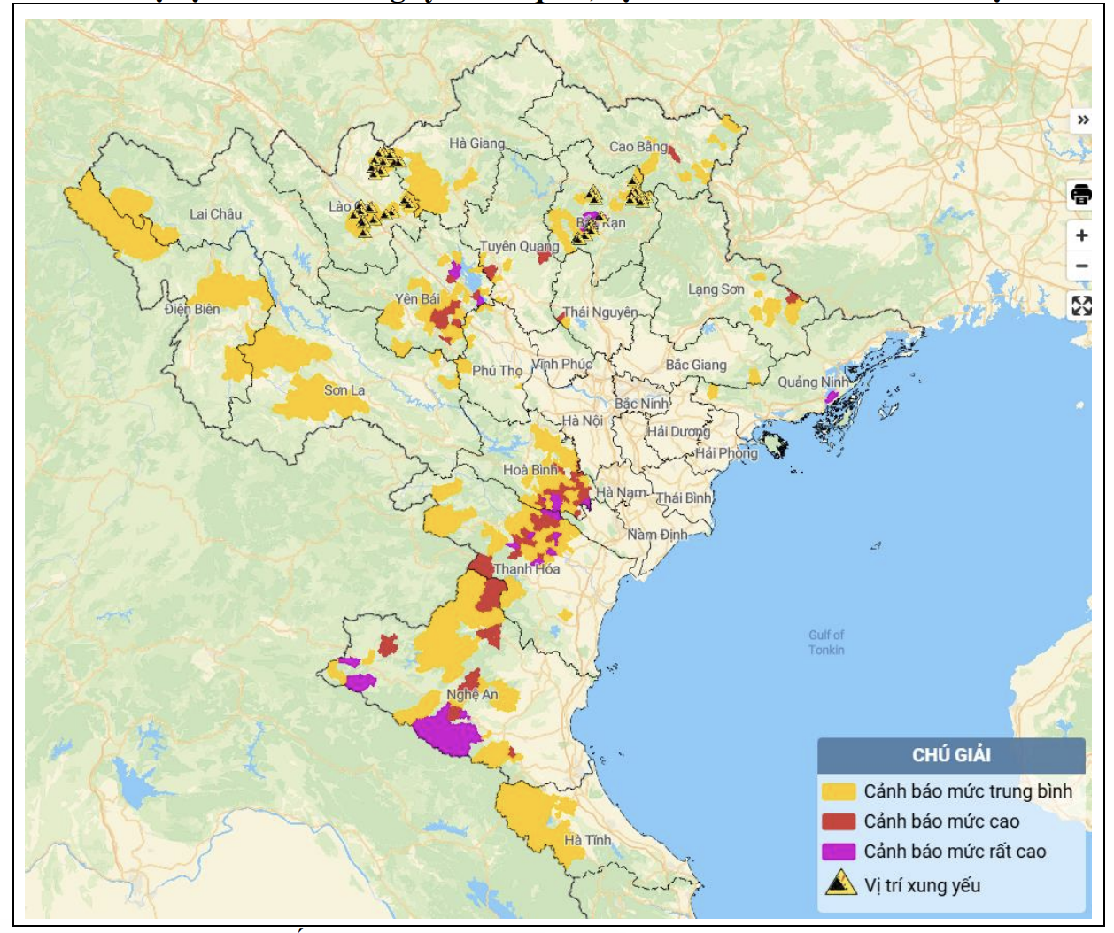
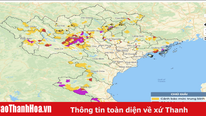
Map of flash flood and landslide risk in the areas.
From 1:00 p.m. on May 23 to 1:00 p.m. on May 24, the Northern and North Central provinces had moderate to heavy rain, and some places had very heavy rain such as: Thinh Hung 118.8mm (Yen Bai); Luc Binh 109.6mm ( Bac Kan ); Hoang Nong 97.6mm (Thai Nguyen); Linh Phu 91mm (Tuyen Quang); Khe Mai 135mm (Quang Ninh); Ngoc Lac 80.2mm (Thanh Hoa); Na Ngoi 246mm (Nghe An); Son Hong 162mm (Ha Tinh)...
Soil moisture models show that some areas in the above provinces are close to saturation (over 85%) or have reached saturation.
Warning, in the next 3-6 hours, the Northern and North Central provinces will continue to have rain with common rainfall from 20-40mm, some places over 70mm.
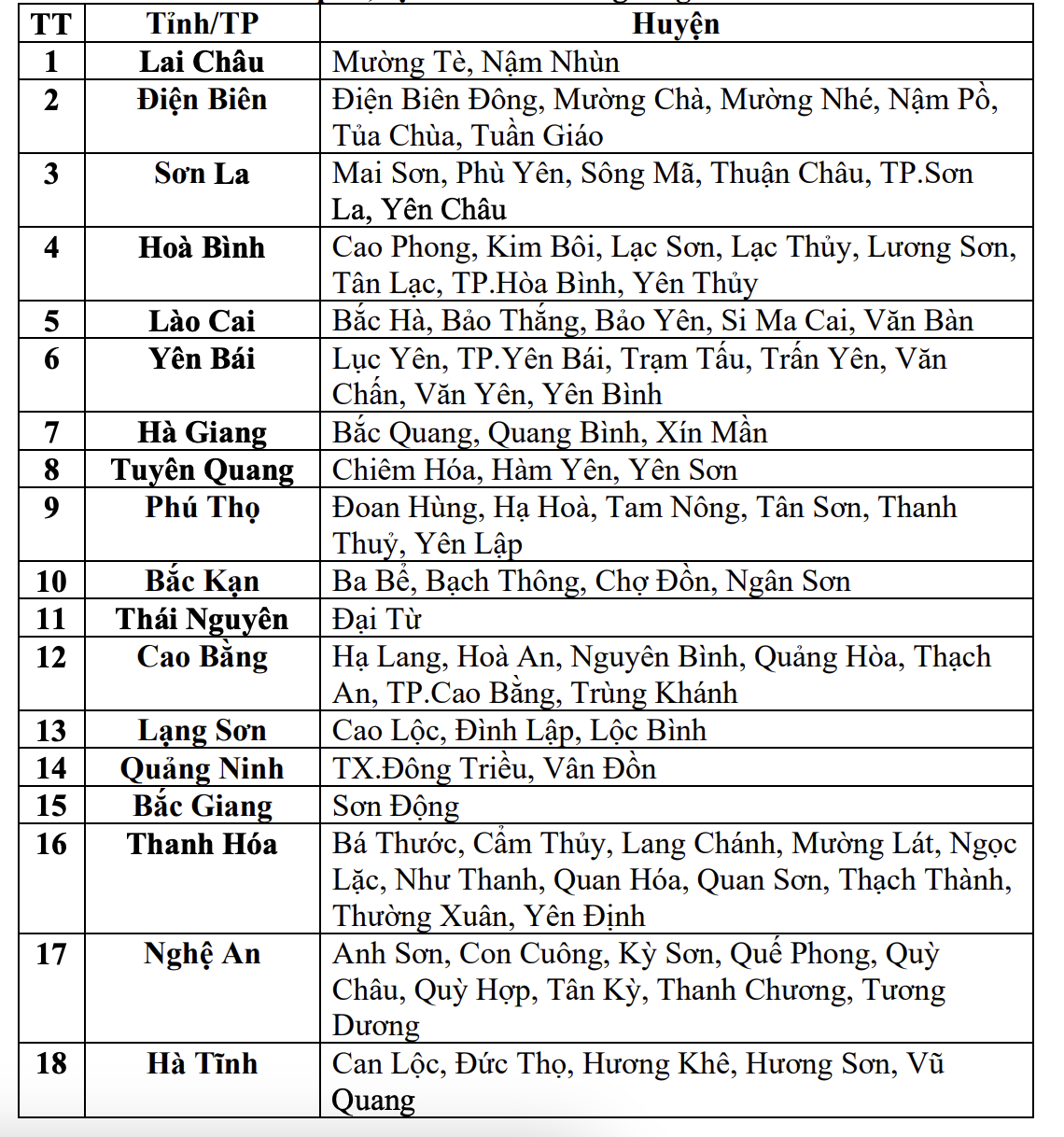
List of areas at risk of flash floods and landslides in the next 6 hours
In the next 6 hours, there is a risk of flash floods on small rivers and streams, landslides on steep slopes in many districts of the following provinces: Lai Chau, Dien Bien, Son La, Hoa Binh, Lao Cai, Yen Bai, Ha Giang, Tuyen Quang, Phu Tho, Bac Kan, Thai Nguyen, Cao Bang, Lang Son, Quang Ninh, Bac Giang , Thanh Hoa, Nghe An, Ha Tinh.
In Thanh Hoa province, the districts of Ba Thuoc, Cam Thuy, Lang Chanh, Muong Lat, Ngoc Lac, Nhu Thanh, Quan Hoa, Quan Son, Thach Thanh, Thuong Xuan, and Yen Dinh are forecasted to be at risk of flash floods on small rivers and streams, and landslides on steep slopes in the next 6 hours.
Warning level of natural disaster risk due to flash floods, landslides, land subsidence due to rain, floods or water flow: Level 1.
TS
Source: https://baothanhhoa.vn/canh-bao-lu-quet-sat-lo-tai-11-huyen-mien-nui-thanh-hoa-249814.htm


![[Photo] Ho Chi Minh City holds funeral for former President Tran Duc Luong](https://vphoto.vietnam.vn/thumb/1200x675/vietnam/resource/IMAGE/2025/5/24/9c1858ebd3d04170b6cef2e6bcb2019e)
![[Photo] Party and State leaders visit former President Tran Duc Luong](https://vphoto.vietnam.vn/thumb/1200x675/vietnam/resource/IMAGE/2025/5/24/960db9b19102400e8df68d5a6caadcf6)


![[E-Magazine] - Sparkling lotus love](https://vphoto.vietnam.vn/thumb/402x226/vietnam/resource/IMAGE/2025/5/23/a88277aeff0f4dfb9047554fb1139760)


Comment (0)