
1. Quang Ngai people have long heard the saying: Oh Quang Ngai! Do you still remember the glorious old days. The flags spread from An Tan to Sa Huynh in the wind. (Quang Ngai, the indomitable motherland - Truong Quang Luc).
At that time, the administrative boundary of Quang Ngai province from North to South was calculated from Doc Soi (Binh Son) to Sa Huynh (Duc Pho). But when writing “Quang Ngai, the stubborn motherland” - the song considered the most typical of the province, musician Truong wrote: From An Tan to Sa Huynh, the wind is strong.
I remember the year I wrote the article Nui Thanh - Sea Culture (later included in the collection Wind from a Thousand Far Away), I quoted two lines that Mr. Hoa read in a moment of inspiration: The people of the nation will forever know this grace/ The foundation was established in Ban Tan.
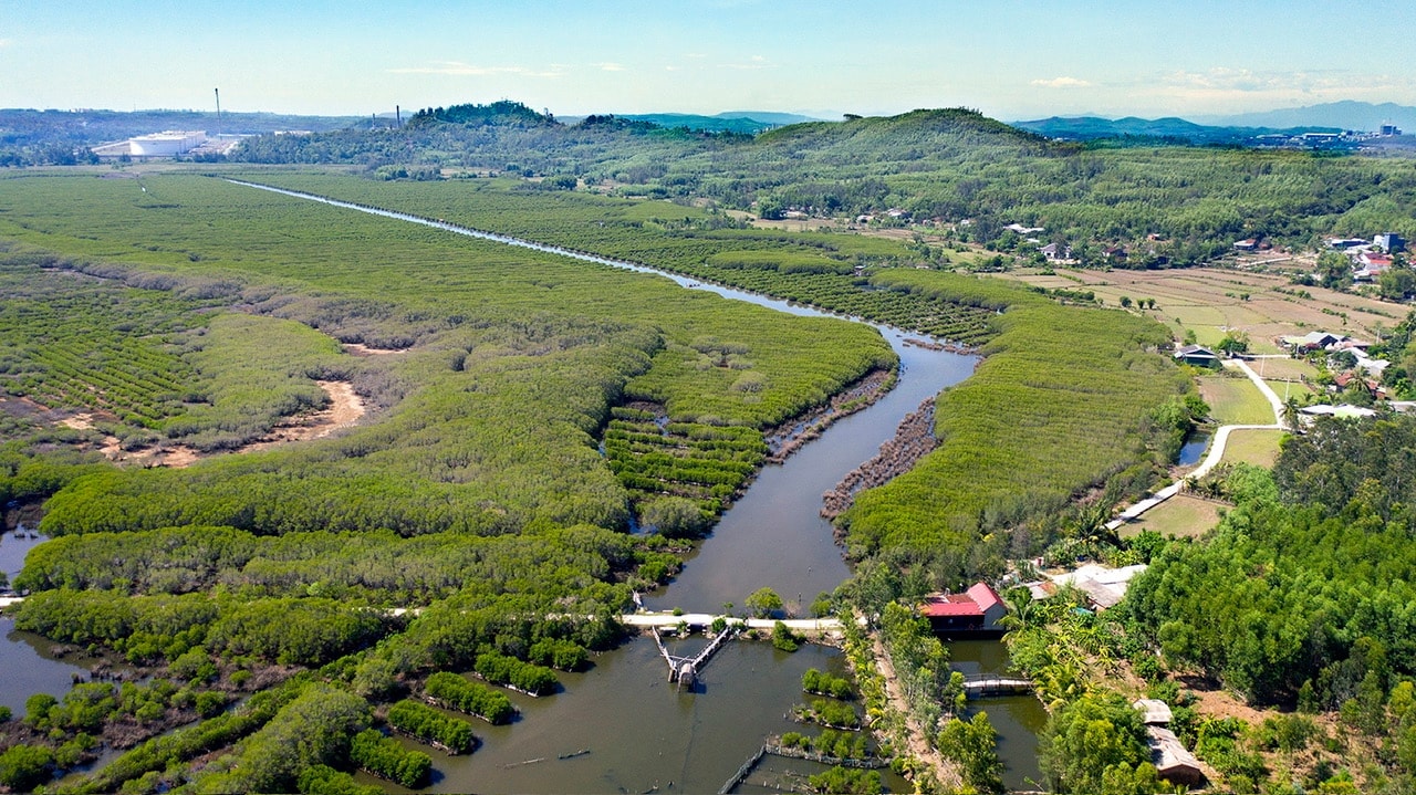
Ban Tan River is the old name; later it had other names such as: Ben Van River, An Tan River. An Tan River consists of two small branches, one flowing down from Tam Tra, one from Binh Son crossing Tam Nghia commune, merging and meeting at Tam My, flowing a bit further and pouring into An Thai lagoon, then connecting to the sea, through Ky Ha port.
The book “Dai Nam Nhat Thong Chi” recorded: “Tan Ban Tan, 52 miles south of Ha Dong district, headquarters in An Tan hamlet, with officers and soldiers guarding and interrogating passersby…”.
And the place name Ban Tan is also associated with many important historical events. In 1775, after the defeat at Cam Sa, Nguyen Nhac's army retreated and withdrew all troops to Ban Tan to prevent General Hoang Ngu Phuc's army from advancing. Thus, Ban Tan was a very important stronghold.
The book “Hoang Le Nhat Thong Chi” recorded: “Tran Van Ky was from Thuan Hoa, had a literary background, was a famous scholar in Nam Ha… In 1786, Bac Binh Vuong attacked and captured Phu Xuan citadel, sent someone to find Ky to ask about the affairs of the North and the South. Ky answered very quickly and very well, so Bac Binh Vuong respected him very much, let him stay in the “curtain”, discussed everything with Ky, was always close to Ky, rarely left”…
Thus: "The country and people will forever be grateful thanks to the decisive success in Ban Tan" is thanks to the strategic talent of Tran Van Ky when he stood up to mediate between the Nguyen Tay Son brothers to avoid internal division and escape the situation of bloodshed.
By taking Ban Tan as the boundary: from Quang Ngai to the South was ruled by Nguyen Nhac; from Thang Dien to the North was ruled by Nguyen Hue. Perhaps because of this historical story, musician Truong Quang Luc boldly wrote: From An Tan to Sa Huynh, the wind was strong… right?
2. Another story, Mr. Vo Van Thang - former Director of the Da Nang Cham Museum one day asked me, in Tam Ky, do people still use the words chu, ni, mi, mo, te, rang, rua...?
I replied yes. It seemed he was still skeptical… because he had been to the deep areas like Quang Ngai, Binh Dinh… many times and had not seen those words appear. And perhaps he also “guessed” that Tam Ky must be like those areas in the deep.
I quickly replied to him that the people of Nui Thanh (Quang Nam) use the exact same words and accent as the people of Binh Son (Quang Ngai).
I have a suggestion for you: the words and accent in a region often affect the same way an army is stationed for a long time in that region or country. For example, the Central Army of Emperor Nguyen Nhac was stationed on the South bank of Ban Tan River, and the army of Bac Binh Vuong Nguyen Hue was stationed on the North bank of Ban Tan River. Over time, the climate and climate of which side will affect the accent of the people on each side (?).
The late Professor Tran Quoc Vuong once said that the North is characterized by cave culture or valley culture. Binh Tri Thien is the ultimate space of those cave cultures. But the Central region and Binh Tri Thien are characterized by the culture of sand dunes (scallop sand dunes located on the ancient coast, above are freshwater lakes, from Cau Giat - Quynh Luu of Nghe An through Bau Khe, Bau Tro to Bau Du of Quang Nam).
The Central Southern region of Quang (Quang Nam, Quang Ngai) is the true homeland of the Sa Huynh culture. Moreover, the Central region is associated with hills, bearing the characteristics of the midlands, it also echoes the richness of the humid tropical rainforest, with trees growing in a haphazard, irregular rows.
When reading the book “500 years like that”, Professor Tran Quoc Vuong “agrees” with author Ho Trung Tu about the Quang Nam accent and said: “The accent of Cham mothers speaking Vietnamese, that accent has been passed down to their children to become today’s Quang accent”.
And many readers "agreed" with the author that for 500 long years (from 1306 to 1802 when Gia Long ascended the throne), the Cham people - the former owners of this land - lived together, got married, had children, and mixed bloodlines in the Vietnamese bloodline.
Whether that is correct or not, we should try to use a basic methodology or logical analysis to boldly propose three main time points: 1306, 1402, 1471 - these are the times when there was a "very steady", unceasing flow of people moving to the South.
In 1306, Che Man offered the two Chau O and Chau Ri as a dowry to marry Princess Huyen Tran, which meant there was a large migration from the land south of Deo Ngang to the north bank of Thu Bon River (Quang Nam).
In 1402, Champa offered the two lands of Chiem Dong and Co Luy to Dai Viet. From here, Ho Quy Ly established sovereignty over the new land.
In 1471, when King Le Thanh Tong issued the Binh Chiem Edict, the Quang Nam land belonged to Dai Viet forever and the migration continued following King Le Thanh Tong's army deep into Cu Mong Pass (Binh Dinh).
The period from 1602 to 1631 was the period of the strongest migration, also the time when Lord Nguyen attacked Phu Yen and built Truong Duc rampart. From 1631 to 1671, the migration phenomenon ended because during this period, Trinh Nguyen fought over Gianh River as the boundary...
The fact that Vietnamese people speak the same language, live together with Cham people, have neighborly relationships, and are husband and wife... is true. All of these things are extremely necessary because we will understand more clearly how the so-called identity, personality, and language of Quang people began. Quang land will not be the same as other places because of the cultural assimilation and influence of the region...
Source: https://baoquangnam.vn/cau-chuyen-ranh-gioi-tho-ngoi-vung-mien-3157192.html


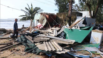
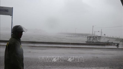
![[Photo] Da Nang: Hundreds of people join hands to clean up a vital tourist route after storm No. 13](https://vphoto.vietnam.vn/thumb/1200x675/vietnam/resource/IMAGE/2025/11/07/1762491638903_image-3-1353-jpg.webp)


Comment (0)