

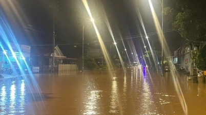
Floods on rivers tend to rise again.
Accordingly, from the night of October 31 to November 1, in the area from Ha Tinh to Da Nang city and the east of Quang Ngai province, there will be moderate rain, heavy rain, and locally very heavy rain and thunderstorms.
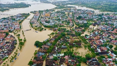
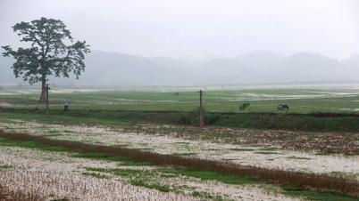
Floods on rivers from Quang Tri to Quang Ngai tend to rise again. Currently, the water level on Gianh River (Quang Tri) is above alert level 1; on Bo River and Huong River (Hue City) is above alert level 2; on Vu Gia and Thu Bon River (Da Nang City) is fluctuating at alert level 1-2; on Tra Khuc River (Quang Ngai) is at alert level 2.
During the period from November 1 to 3, due to the continuous strengthening of cold air combined with the tropical convergence zone with its axis passing through the South Central region (connected to the low pressure area in the southern East Sea) being strongly active and the easterly wind zone in the upper atmosphere continuing to be strongly active, it is forecasted that from now (November 1) to November 4, the area from Ha Tinh to Da Nang city and the east of Quang Ngai province will have heavy to very heavy rain.
Total rainfall in Hue city, Da Nang city and eastern Quang Ngai province is generally 300-600mm, locally over 800mm.
Rainfall in Ha Tinh and Quang Tri areas is generally 200-350mm, locally over 500mm; in the south of Nghe An province and the west of Quang Ngai there is moderate to heavy rain with common rainfall of 70-150mm, locally over 250mm.
It is forecasted that from November 5 to 6, rain in the Central region will tend to decrease.
Due to the impact of heavy rain, from November 2 to 5, floods will appear on rivers from Ha Tinh to Quang Ngai and Dak Lak, with the flood peak on the Ngan Sau and Ngan Pho rivers in Ha Tinh likely to reach level BĐ2-BĐ3.
In Quang Tri province, flood on Gianh river reached level 2-3; Kien Giang river, Thach Han river reached level 2-3 and above level 3.
In Hue city, flood on Bo river and Huong river reached level BĐ3 and above BĐ3.
Flood on Vu Gia and Thu Bon rivers of Da Nang city reached level 2-3 and above level 3.
Floods on Ve and Tra Khuc rivers in Quang Ngai province have risen to levels 2-3 and above 3; Se San river has risen to levels 1-2.
Small rivers and upstream rivers in Gia Lai, Dak Lak, Khanh Hoa reach level 1-2 and above level 2.
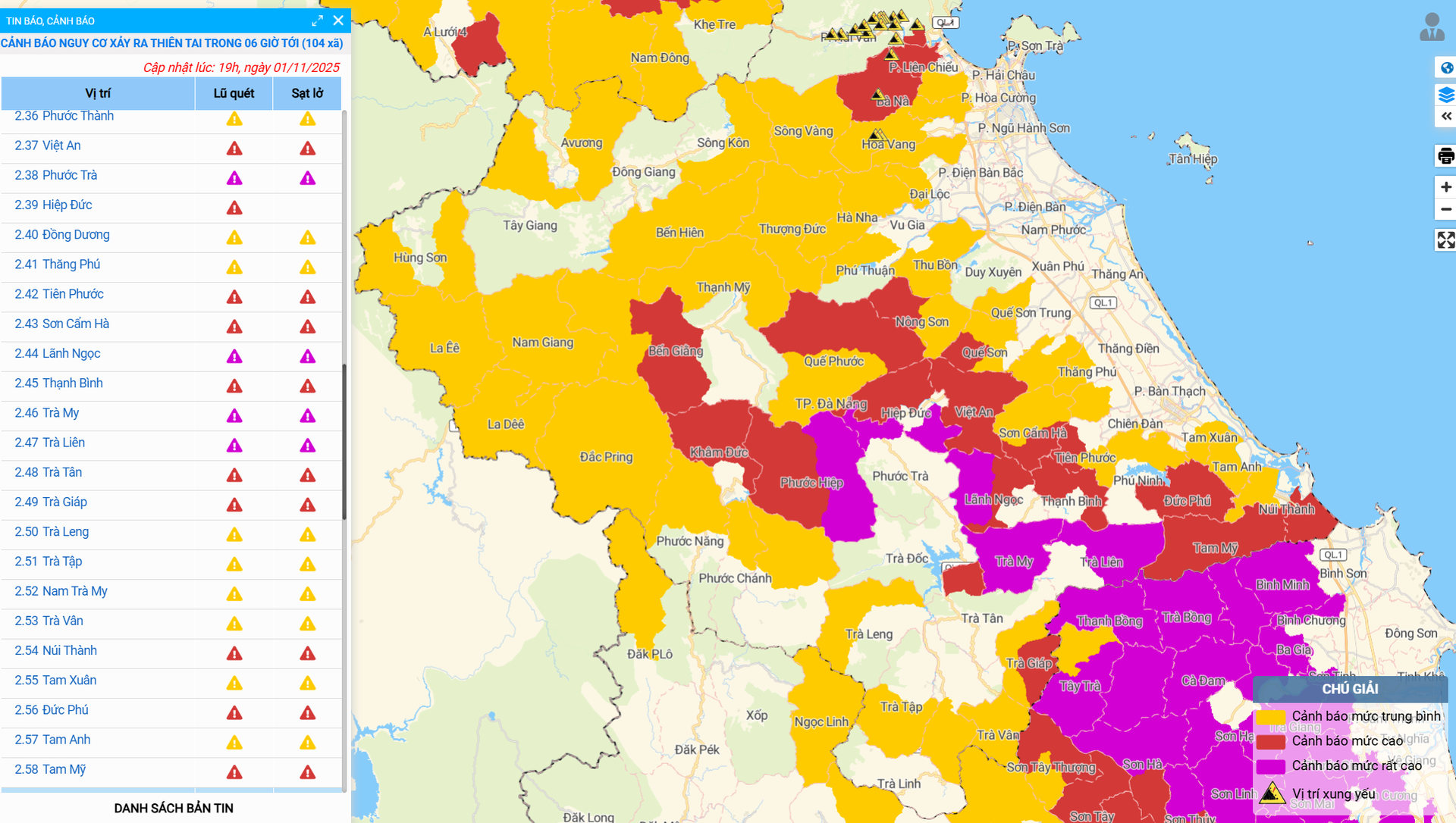
There is a high risk of flash floods on small rivers and streams, landslides on steep slopes in mountainous areas from Ha Tinh to Gia Lai provinces, especially in the following provinces/cities: Ha Tinh, Quang Tri, Hue, Da Nang and Quang Ngai.
There is a very high risk of flash floods and landslides in Ha Tinh province with 47 communes and wards; Quang Tri with 30 communes and wards; Hue city with 19 communes and wards; Da Nang city with 62 communes and wards; Quang Ngai with 52 communes and wards; Gia Lai with 36 communes and wards.
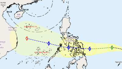
On November 5, the storm moved into the East Sea.
Currently (November 1) in the eastern part of the Philippines, there is a tropical depression (TLD). According to current forecast data, tonight to tomorrow morning (November 2), the TLD has the potential to strengthen into a storm.
Around November 5 (Wednesday), the storm will enter the East Sea and become storm number 13. This is forecast to be a strong storm in the East Sea, strongest in the Truong Sa special zone with wind intensity possibly over level 12.
Around November 7, the storm is likely to move into our country. The focus area that needs to be noted that is likely to be directly affected by the storm is from Da Nang city to Khanh Hoa province.
The storm may cause strong winds and heavy rain in provinces and cities in the Central Central, South Central, and Central Highlands regions from the night of November 6 to November 9, 2025.
The Department of Hydrometeorology reminds localities and units that the storm has not yet formed and is still affected by many large-scale factors in the coming days as well as the impact of terrain when it makes landfall in the Philippines, so scenarios on the intensity, direction of movement as well as areas directly affected by storm No. 13 need to be monitored and updated with new observation and forecast data.
Source: https://baodanang.vn/cuc-khi-tuong-thuy-van-thong-tin-du-bao-ve-mua-lu-va-bao-nhung-ngay-toi-3308928.html


![[Photo] Prime Minister Pham Minh Chinh chairs the second meeting of the Steering Committee on private economic development.](https://vphoto.vietnam.vn/thumb/1200x675/vietnam/resource/IMAGE/2025/11/01/1762006716873_dsc-9145-jpg.webp)


Comment (0)