
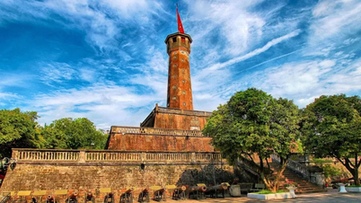
From 2:00 p.m. to 11:00 p.m. on May 11 and 13, Hai Phong City Police banned all vehicles and pedestrians on That Khe Street, Hoang Van Thu Street and Hoang Van Thu Bridge, Do Muoi Street (from Hoang Van Thu - Nguyen Tri Phuong intersection to the intersection with East-West 1A Road); East-West Road; Tran Kien Street; Bac-Nam Road, East-West 1A Road and branch roads adjacent to the Administrative Center area in Thuy Nguyen City (where the event was held).
The routes that are completely prohibited for all vehicles are Cau Binh street (from the intersection of Nam Cau Binh to Cau Binh); Cau Binh; Provincial Road 359 (from Cau Binh to the intersection with Road 9C - VSIP Industrial Park); Mang Road - Thuy Nguyen City (from the intersection with Provincial Road 359 to the intersection with Road 9C - VSIP Industrial Park); Adjacent branch roads directly connecting to the above-mentioned road sections and routes.
 |
Hai Phong police recommend that people and vehicles participating in traffic proactively follow the routes and instructions of traffic control forces. |
Trucks and passenger cars are prohibited from traveling on National Highway 10 (from Quan Toan intersection to Da Bac bridge). During the ban, trucks and passenger cars traveling between Hai Phong and Quang Ninh will follow the following routes: From Hai Phong to Quang Ninh, take the route Quy Cao intersection - Provincial Road 391 - Provincial Road 39B - National Highway 5 - National Highway 37 - National Highway 18 or National Highway 10 - Hanoi - Hai Phong - Quang Ninh Expressway; Quang Thanh Bridge - Provincial Road 390 - National Highway 37 - National Highway 18; Dinh Bridge - Thanh Nien Street - Tran Hung Dao Street - National Highway 17B - National Highway 18; Quan Toan intersection - National Highway 5 - Tien Trung intersection - National Highway 37 - National Highway 18.
Direction from Quang Ninh to Hai Phong: Vehicles traveling from National Highway 18 are prohibited from trucks and passenger cars traveling towards Da Bac Bridge and Ben Rung Bridge.
The city also restricts vehicles on inner-city routes and adjacent routes leading to the administrative center of Thuy Nguyen City. During the ban, people and vehicles from Hai Phong city through Kien Bridge (National Highway 10) to Thuy Nguyen City are restricted.
Vehicles with delegate badges, vehicles escorted by traffic police and other vehicles on duty are allowed to enter prohibited routes under the control and guidance of traffic control forces. The ban time may change depending on the actual situation.
 |
Movement diagram of the blocks reviewing the formation and mass parade. |
In addition, Hai Phong City also announced temporary traffic diversion to serve the training sessions, rehearsals, and the program of reviewing the troops and mass parades on the occasion of the 70th anniversary of Hai Phong Liberation Day and the 2025 Red Flamboyant Festival.
According to the announcement, people and vehicles (except delegates and invited guests) are prohibited from moving into the central streets, the theater area and the city's central flower garden from 7:00 a.m. to 11:30 a.m. on May 9 and 10 and from 5:30 a.m. to 11:30 a.m. on May 11.
 |
The city organizes free parking locations for military parades and mass parades. |
The streets include: Tran Hung Dao, Tran Phu, Quang Trung, Nguyen Duc Canh, Hoang Van Thu, Dinh Tien Hoang, Le Dai Hanh, Minh Khai, Tran Quang Khai, Ly Tu Trong, Dien Bien Phu, Cau Dat, Me Linh, Nguyen Khuyen, Pham Ngu Lao, Tran Binh Trong.
Hai Phong also arranges free parking spots for the review of the team and parade: Tran Phu Secondary School; Ngo Quyen Secondary School; Hai Phong Continuing Education Center; Old Hong Bang District People's Committee Yard; Old Hong Bang District Party Committee Yard; 26 Luong Khanh Thien; Port Gate No. 4.
Source: https://baophapluat.vn/phan-luong-giao-thong-tam-thoi-phuc-vu-ky-niem-70-nam-ngay-giai-phong-hai-phong-va-le-hoi-hoa-phuong-do-post547803.html


![[Photo] National Assembly Chairman Tran Thanh Man visits Vietnamese Heroic Mother Ta Thi Tran](https://vphoto.vietnam.vn/thumb/1200x675/vietnam/resource/IMAGE/2025/7/20/765c0bd057dd44ad83ab89fe0255b783)


Comment (0)