
The Thuong dike is a level II dike running through Bac Giang city with a length of 21.9 km. Through management and inspection, the authorities discovered that the riverbanks in the areas of K6+750 - K6+800; K8-K8+250 and K9+850- K10+155 in Tho Xuong and Tran Phu wards had many landslides on the riverbanks and riverbanks. The most dangerous landslide was 11m downstream from Phu Lang Thuong Hydrological Station.
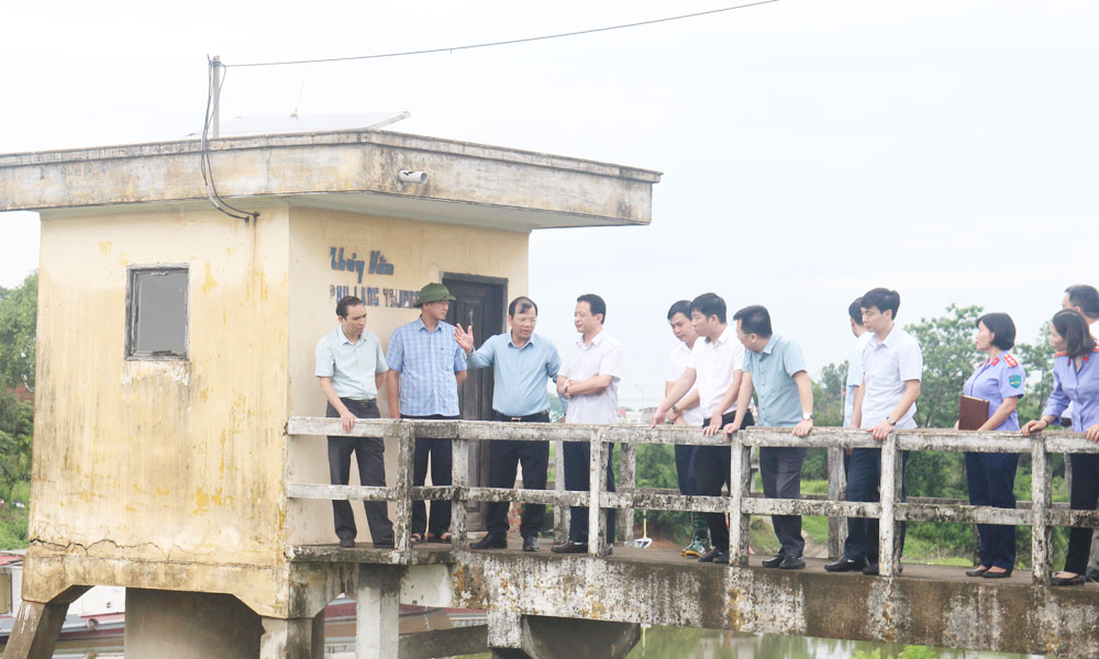 |
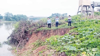
Comrade Phan The Tuan inspected and directed the work of overcoming landslide incidents on the left dike of Thuong. |
According to the assessment of the Department of Agriculture and Environment, this is a dangerous incident that needs to be handled promptly to protect the safety of the dike line and prevent floods. Faced with the above situation, Bac Giang city has developed additional dike protection plans for points from K6+750, K8+00-K8+250 and K9+850-K10+155; the Department of Agriculture and Environment has sent a document to the Department of Dike Management and Disaster Prevention and Control ( Ministry of Agriculture and Environment ) to propose and request direction for remedial measures.
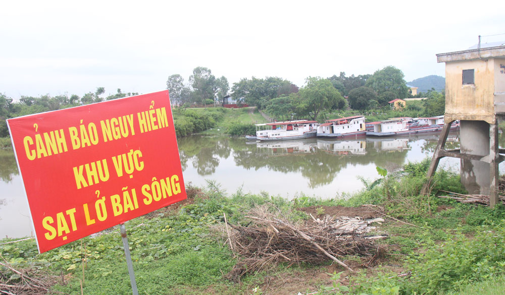 |
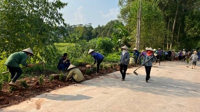
Bac Giang city authorities put up warning signs for landslide areas on the left Thuong dike. |
Inspection at the left dike of Cau Ba Tong showed that some sections had subsidence and cracks on the dike surface that needed to be maintained and repaired, such as: From K3+500 - K7+100; K7+800 - K8+300. On the right dike of Thuong Ba Tong, the section from K11+400 - K11+500 was also degraded; the dike body and dike foundation had weak geology. When floods above alert level 3 occurred, in this area there were seepage, seepage, extrusion, and seepage through the dike body.
For the T6 drainage canal, when heavy rain occurs, the drainage of the canal basin to the main canal of Cong Bun Pumping Station is slow, causing stagnation and local flooding. As an important drainage canal for urban areas and industrial parks in Viet Yen town, in recent times, despite the attention of authorities and enterprises to dredging and renovating the T6 canal, it is often silted up, the narrow canal bed affects the drainage capacity when heavy rain occurs.
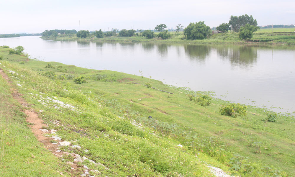 |
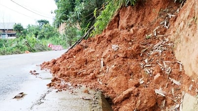
The stone embankment on the right dike of Thuong Ba Tong is degraded. |
To overcome the above problems, the Provincial Management Board of Investment and Construction of Traffic and Agricultural Works has proposed a number of plans to renovate and upgrade the right dike of Thuong Ba Tong and the left dike of Cau Ba Tong such as: Building a retaining wall towards the river or constructing a reinforced concrete beam frame with a yin-yang roof, straightening the dike towards the river... Proposing to build a new T6 canal to ensure drainage capacity, prevent flooding for urban areas and industrial zones during the rainy season.
After checking and grasping the situation, comrade Phan The Tuan basically agreed with the plans proposed by the professional agency. He noted that in the work of natural disaster prevention and control, sectors and localities need to promote the spirit of early and remote initiative; improve forecasting capabilities; carefully calculate plans with the goal of ensuring safety for the people first and foremost; minimizing damage to people and property, and maintaining stability. He directed the Department of Agriculture and Environment, the Provincial Management Board of Investment and Construction Projects for Traffic and Agricultural Works to continue to accurately assess the current status of the dikes. From there, develop optimal technical plans to ensure safety, efficiency, and suitability to the geology of each area; clearly identify the roadmap, total investment cost of the projects, and the works and items that need to be prioritized. The Department of Finance is interested in timely arranging funds to serve the renovation and upgrading of dike and irrigation works.
Source: https://baobacgiang.vn/pho-chu-tich-ubnd-tinh-bac-giang-phan-the-tuan-kiem-tra-mot-so-cong-trinh-de-dieu-thuy-loi-postid419498.bbg


Comment (0)