
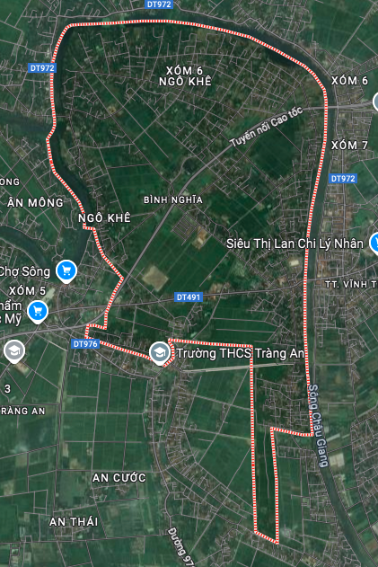
The traffic infrastructure of Binh Nghia commune, Binh Luc district, Ha Nam province is oriented to develop and expand with many new routes according to the adjusted land use planning map until 2030. This plan promises to significantly improve the local connectivity, creating momentum for socio-economic development.
Overview of location and existing infrastructure
Binh Nghia commune has an area of 8.09 km², located at the northernmost position of Binh Luc district. The administrative boundaries of the commune are determined as follows:
- Southwest borders Trang An commune
- South borders Dong Du commune
- The West borders Duy Tien town
- North and East border Ly Nhan district
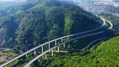
Most of the commune's border is surrounded by the Chau Giang River. Regarding transportation, Binh Nghia commune currently has important routes such as Provincial Road 491 and the Expressway. In addition, the commune's location is also close to major traffic routes in the area such as Provincial Road 972, Provincial Road 976 and National Highway 37B.
Routes expected to open according to planning
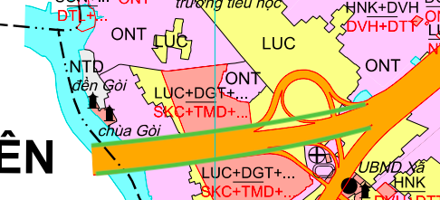
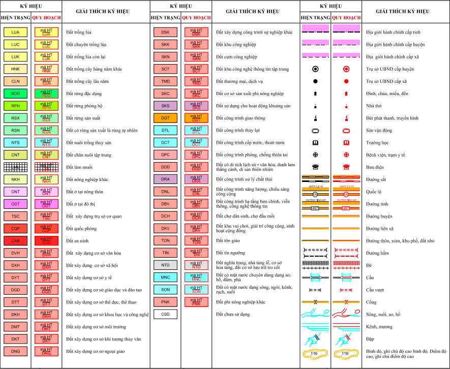
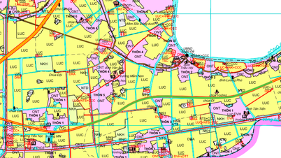
According to the land use planning adjustment map to 2030 of Binh Luc district, a number of new routes will be deployed in Binh Nghia commune. These routes are clearly shown on the planning map, helping to shape the future traffic network.
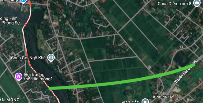
One of the notable routes is the one that runs through the western part of the commune. This route starts at Goi Pagoda and ends at the existing Expressway. The construction of this route is expected to shorten travel time and enhance internal connectivity within the commune.
Meaning and development potential
Investing in and expanding the transport network plays a key role in promoting the development of Binh Nghia commune. New routes not only serve the travel needs of the people but also open up trade opportunities, attract investment and can have a positive impact on the real estate market in the area.
When the infrastructure system is completed, the connectivity from Binh Nghia commune to neighboring economic centers and national arterial roads will be significantly improved, creating a solid foundation for long-term development.
Important Note
Information on the routes to be opened is stated in the article based on the adjusted land use planning map to 2030 of Binh Luc district and is for reference only. The planning may change during the actual implementation process according to the decision of the competent state agency. People and investors should contact the local authorities directly to get the most accurate and updated information.
Source: https://baolamdong.vn/quy-hoach-giao-thong-xa-binh-nghia-ha-nam-den-nam-2030-398220.html


![[Photo] The 5th Patriotic Emulation Congress of the Central Inspection Commission](https://vphoto.vietnam.vn/thumb/1200x675/vietnam/resource/IMAGE/2025/10/27/1761566862838_ndo_br_1-1858-jpg.webp)


![[Photo] Party Committees of Central Party agencies summarize the implementation of Resolution No. 18-NQ/TW and the direction of the Party Congress](https://vphoto.vietnam.vn/thumb/1200x675/vietnam/resource/IMAGE/2025/10/27/1761545645968_ndo_br_1-jpg.webp)
![[Photo] National Assembly Chairman Tran Thanh Man receives Chairman of the House of Representatives of Uzbekistan Nuriddin Ismoilov](https://vphoto.vietnam.vn/thumb/1200x675/vietnam/resource/IMAGE/2025/10/27/1761542647910_bnd-2610-jpg.webp)
![[Photo] Prime Minister attends the 28th ASEAN-China Summit](https://vphoto.vietnam.vn/thumb/1200x675/vietnam/resource/IMAGE/2025/10/28/1761623580521_vna-potal-thu-tuong-du-hoi-nghi-cap-cao-asean-trung-quoc-lan-thu-28-8368557-3355-jpg.webp)


Comment (0)