
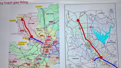
Overview of the inter-regional road project
The project to connect the three provinces of Son La, Lai Chau , and Lao Cai with the Noi Bai - Lao Cai expressway has had its details published in the Environmental Impact Assessment Report. The project is managed by the Investment and Construction Project Management Board No. 1 of Lao Cai province, with a total length of approximately 69 km and an estimated total investment of 2,030 billion VND.
The main objective of the project is to create a vital transportation artery connecting the localities of Muong La (Son La), Than Uyen, Tan Uyen (Lai Chau), and Mu Cang Chai, Van Chan, Van Yen ( Yen Bai ) with the IC15 interchange of the Noi Bai - Lao Cai expressway. Upon completion, the road is expected to promote community tourism development, serve national defense and security purposes, and support search and rescue operations in the region.

Technical specifications and detailed plans
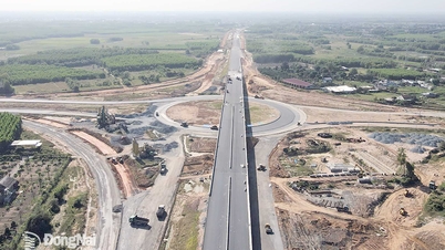
The road is designed according to the standards of a Class IV mountain road, allowing a design speed of 40 km/h. The roadbed width is 7.5 m, of which the carriageway width is 5.5 m.
Specific route
The project starts at the intersection with National Highway 32 (Km299) in Mu Cang Chai district, Yen Bai province, and ends at the intersection with Gia Hoi - Dong An road (Km15+375) in Van Yen district, Yen Bai province. The route is divided into 4 main sections:
- Section 1 (Km0 - Km15+700): Starting from National Highway 32, the route follows the northeast direction along the stream, then climbs to the top of the watershed and continues along the mountain slope.
- Section 2 (Km15+700 - Km26+660): The route crosses the Lung Cung pass at an altitude of 2,000 m, passes through the Ta Cu Y valley and gradually descends to the Nam Co stream area.
- Section 3 (Km26+660 - Km41+700): Crossing the Nam Co stream via a reinforced concrete bridge, the route runs horizontally and gently ascends to the Lang Giang village area.
- Section 4 (Km41+700 - Km68+950): The route continues to gradually decrease in elevation, crossing the Ngoi Hut stream and connecting to the Gia Hoi - Dong An road at the end point.
Along the entire route, two main bridges will be constructed crossing the Nam Co stream and the Ngoi Hut stream, along with four at-grade interchanges to connect with existing roads.

Funding sources and implementation schedule
The project's total investment of VND 2,030 billion is structured from two main sources:
- Central government budget funds: 1,485 billion VND.
- Local government budget and other legal sources: 545 billion VND.
The project is expected to be implemented within 6 years from the date of funding allocation. The estimated construction time for the entire route is 72 months.
Impact of the project
Socio-economic impact
The construction of the new route will significantly shorten travel time and enhance connectivity between the northern mountainous provinces and the Red River Delta. This will not only facilitate trade but also act as a catalyst for the tourism industry, especially ecotourism and community-based tourism in localities such as Mu Cang Chai.
Environmental impact
According to the report, the project will utilize approximately 417.22 hectares of land, of which 187.8 hectares are forested land, accounting for 45% of the total area. Notably, a portion of this area is part of the upstream watershed protection forest. Construction through this area requires rigorous technical and environmental solutions to minimize negative impacts on the ecosystem, limit erosion, and protect water resources.
Source: https://baolamdong.vn/du-an-2030-ty-dong-lam-duong-noi-3-tinh-tay-bac-voi-cao-toc-398025.html
![[Photo] Closing Ceremony of the 10th Session of the 15th National Assembly](/_next/image?url=https%3A%2F%2Fvphoto.vietnam.vn%2Fthumb%2F1200x675%2Fvietnam%2Fresource%2FIMAGE%2F2025%2F12%2F11%2F1765448959967_image-1437-jpg.webp&w=3840&q=75)


![[OFFICIAL] MISA GROUP ANNOUNCES ITS PIONEERING BRAND POSITIONING IN BUILDING AGENTIC AI FOR BUSINESSES, HOUSEHOLDS, AND THE GOVERNMENT](https://vphoto.vietnam.vn/thumb/402x226/vietnam/resource/IMAGE/2025/12/11/1765444754256_agentic-ai_postfb-scaled.png)


Comment (0)