
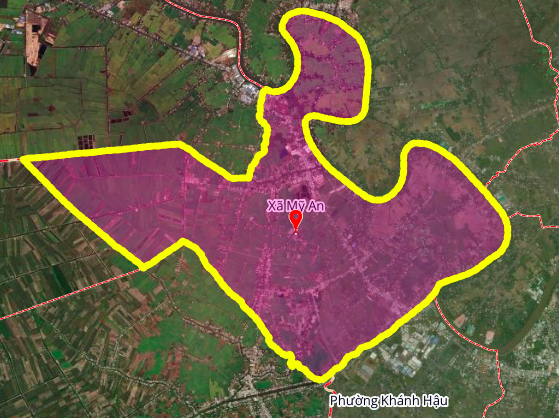
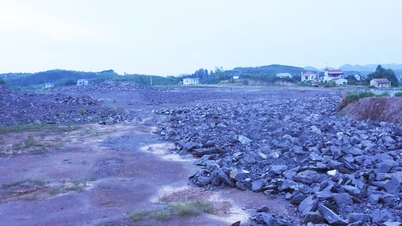
According to the land use planning adjustment map for the period 2021 - 2030 of Thu Thua district, Long An province, My An commune is oriented to develop traffic infrastructure with a number of new routes. These routes are expected to improve connectivity in the area and promote socio-economic development.
Details of two planned routes in My An commune
Below are details of two notable routes that will be opened in My An commune according to approved planning documents.
1. Route near My An Primary School
This route is about 3 km long, located west of Highway 62. The starting point of the route intersects with Highway 62 at the intersection with HL28 Street, near My An Primary School. When completed, this route will help to divert traffic and facilitate travel for local people.
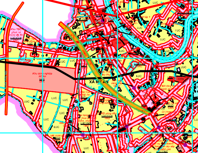
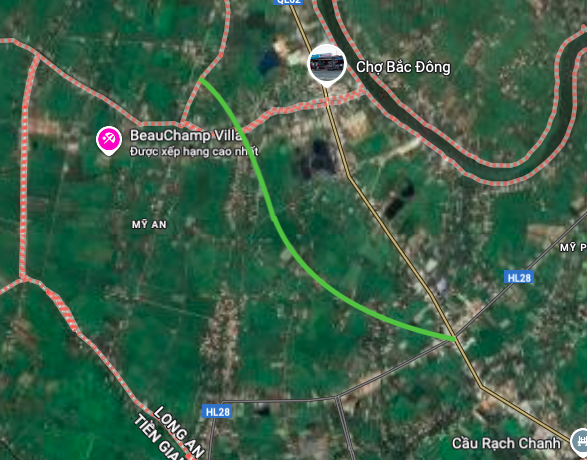
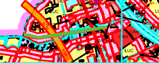
2. Route perpendicular to Highway 62
Another route is planned to run perpendicular to Highway 62, with a length of about 1.4 km. The starting point of the route is on Highway 62, near the Bac Dong culvert. This route plays a role in connecting residential and production areas with the main traffic axis of the district.
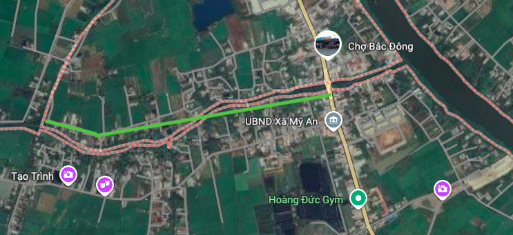
Note on planning information
The information on the above route is referenced from the "Map of land use planning adjustment for the period 2021 - 2030 of Thu Thua district, Long An province". The actual implementation process may have adjustments and changes depending on the decision of the competent authorities. People and investors need to follow the official announcements to get the most accurate information.
Source: https://baolamdong.vn/quy-huach-giao-thong-xa-my-an-long-an-hai-tuyen-duong-moi-399776.html


![[Photo] Government holds a special meeting on 8 decrees related to the International Financial Center in Vietnam](https://vphoto.vietnam.vn/thumb/1200x675/vietnam/resource/IMAGE/2025/11/04/1762229370189_dsc-9764-jpg.webp)


![[Infographic] How will Dong Nai's economic indicators grow in the first 10 months of 2025?](https://vphoto.vietnam.vn/thumb/402x226/vietnam/resource/IMAGE/2025/11/04/1762224574377_anh_thumbnail_chi_tieu_kt_xh_10-2025_20251103215336.jpeg)


Comment (0)