
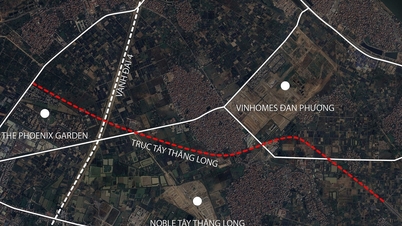
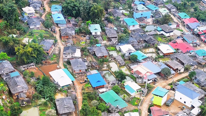
Overview of traffic planning of Tru Van Tho commune
According to the land use planning map until 2030 of Bau Bang district, Binh Duong province, approved by the Provincial People's Committee in early 2022, Tru Van Tho commune will be invested in building many new traffic routes. This plan aims to complete the infrastructure network, enhance connectivity and promote local socio-economic development.
Tru Van Tho commune is strategically located in the north of Bau Bang district, about 22 km from the district administrative center and about 46 km from the center of Binh Duong province.
Existing transport infrastructure
Currently, the traffic network through Tru Van Tho commune has important roads, acting as the backbone for the movement and transportation of goods, including:
- National Highway 13: This is a vital route along the North-South axis, connecting Ho Chi Minh City with Binh Duong and Binh Phuoc provinces and to Hoa Lu border gate (Vietnam-Cambodia border).
- Ho Chi Minh Trail: Part of the trans-Vietnam route, facilitating inter-regional connectivity.
- Provincial Road DT750: An important route connecting the district and neighboring areas.
Analysis of some new routes according to planning
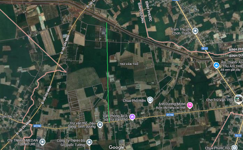
Among the newly planned routes, there are some notable projects that will help reshape the traffic landscape of the commune. A typical example is the approximately 3 km long route, shown by the blue line on the planning map.
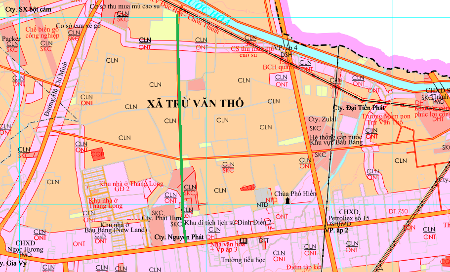
This route has the following characteristics:
- Location: Runs through the eastern area of the Song Be Franciscan Monastery.
- Route direction: Almost perpendicular to DT750 road.
- Connection point: There is an end point that connects directly to the DT750 road, helping to relieve traffic and create a new direction of travel.
Impact and development potential
The implementation of new planned routes is expected to bring many positive impacts. Synchronous traffic infrastructure will be a lever to attract investment in industrial parks and industrial clusters in Bau Bang district. At the same time, people's travel will become more convenient, contributing to improving the quality of life and creating momentum for the development of the real estate market in the area.
Note for investors and residents
Planning information is indicative and may be adjusted during implementation. People and interested investors should regularly update information from competent state agencies and carefully check the legal status of the property before making a transaction.
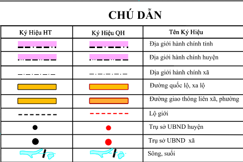
Note: The diagrams and maps in the article are for relative reference only.
Source: https://baolamdong.vn/quy-hoach-giao-thong-xa-tru-van-tho-bau-bang-den-nam-2030-397998.html


Comment (0)