
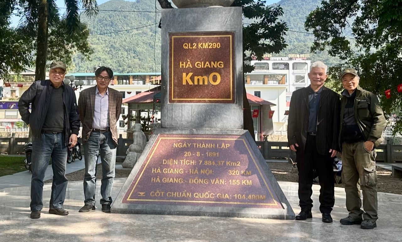
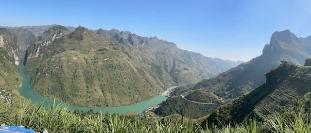
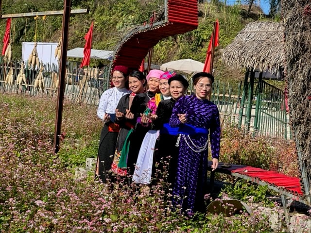
This route loops through high rocky mountain regions such as Quan Ba, Yen Minh, Dong Van, Meo Vac, and returns to the starting point. The rocky plateau is in the buckwheat flower season. The pink and purple blossoms, both near and far, adorn the rugged, treacherous landscape, creating unique natural beauty.
From Ha Giang, we followed National Highway 4C for about 10 km, then turned right onto a rural road through Thuan Hoa, Thai An, and Duong Thuong to reach Du Gia. This road is quite treacherous. Journalist Ngo Ha Thai, who was driving, chose this route, following the itinerary of the Ha Giang Loop. This choice was somewhat risky because the rural road is quite bad, with some landslides. But in return, the natural scenery is breathtaking.
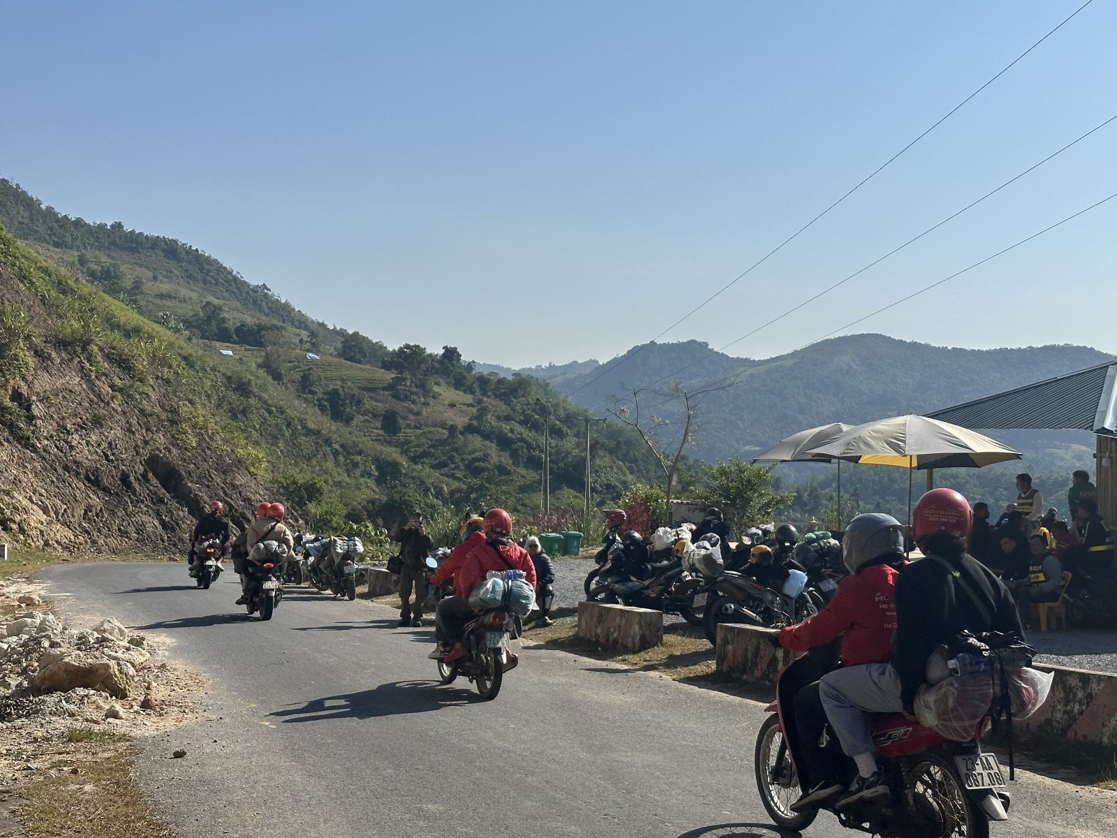
What surprised us was the large number of tourists, mostly foreigners. Groups of tourists followed one another, mostly on motorbikes, with occasional cyclists. There were very few cars. The viewpoints were crowded. Tourists rented motorbikes from Ha Giang and traveled in groups, either with guides or independently. They took photos, recorded videos, admired the scenery, and enjoyed the local food.
At a stop in Thuan Hoa, I spoke with a tourist. Her name was Linda, a student from Switzerland, traveling with a group of friends. They learned about the Ha Giang Loop through online information and decided to spend one week of their four-week stay in Vietnam here. Linda shared that she and her friends were very impressed with the stunning scenery and friendly people and hoped to return.
I've been to Ha Giang many times, but this was my first time visiting Du Gia, a "hot" destination with its pristine beauty nestled in the rocky mountains of the Dong Van Plateau. Du Gia comprises 14 villages, home to ethnic groups such as the Mong, Dao, Tay, Xuong, and Cao Lan, with nearly 10,000 inhabitants. The people here mainly cultivate corn and rice and raise livestock for their livelihood. The development of tourism is opening up opportunities for the development of this region.
The scenery in Du Gia is peaceful. Villages are surrounded by terraced rice fields and ancient forests. When we arrived, the main village of Du Gia was very crowded with tourists. Many trekking groups chose it as a stopover. The small town was bustling with people of all skin colors and languages. Although there are nearly 40 homestays here, their small size means it's difficult to find a room without making a reservation beforehand.
Homestay Panorama Du Già is located on a high hill. The owners are a Tay couple – Nguyen Van Khuy, 30, and Nguyen Thi Ngoc, 27. Mr. Khuy said their homestay has 8 houses and bungalows, with 40 accommodations. They received a loan from the bank to start their business. Many other establishments in Du Già also receive similar loans. This homestay has an average monthly revenue of about 50 million VND. After covering expenses and paying bank interest, they reinvest to expand their operations. The number of visitors to Du Già is increasing. Young people here are learning English, using the internet, and connecting to develop their service businesses.
In the cool highland air, we enjoyed a warm dinner of grilled chicken, sticky rice, and a glass of rice wine brewed in the unique style of the Du Gia people. In the morning, from our stilt house on the hilltop, we had the opportunity to admire the sunrise amidst the undulating mountains and swirling clouds—unforgettable sights.
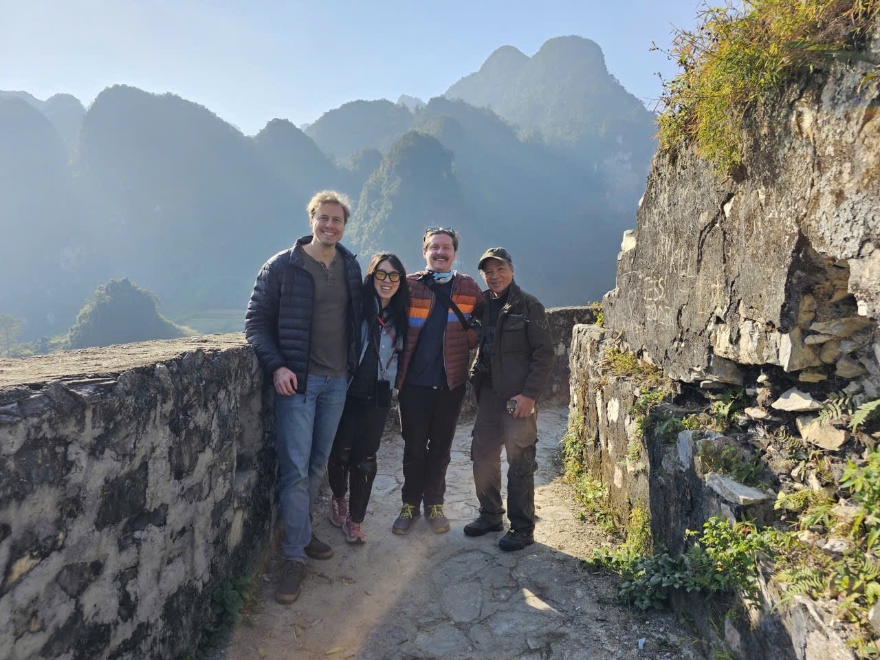
From Du Gia, we traveled to Mau Due and then to Meo Vac. The roads above the clouds here are amazing, even though many sections are narrow. The feeling of traveling alongside rivers of clouds is truly special. This route is less crowded with tourists in the morning. We passed several tourist sites under construction. Some historical sites along the way have been upgraded. One of our stops was the architectural remains of a French military outpost from the mid-20th century. Here, we met a group of American tourists – Terry, Waldland, and Alice. They are engineers from California. Like other tourists, they traveled to Ha Giang by car and rented motorbikes to get around. In their conversation, they said that the most impressive things about the place were: the majestic and pristine mountain scenery, the friendly people, the affordable services, and the good security. These things make up the allure of the "Ha Giang Loop".
We returned to Meo Vac with our own memories. In 1984, when the border war was still raging, I came here as a reporter for Vietnam Photo News - VNA. The impression of that trip remains vivid. Working in Ha Giang town under the cover of Chinese artillery, always ready to take shelter. The newly opened Quyet Thang road had many jagged sections, winding along deep ravines, climbing mountains and piercing through clouds to reach the summit. Our group of reporters from Photo News was taken to various places in Meo Vac district by the district chairman, Mua Mi Cho, from Sung Tra to Ma Pi Leng, across the Nho Que River to Thuong Phung and Xin Cai.
In 2021, together with journalist Ngo Ha Thai, I returned to Meo Vac and had a long-awaited meeting with Chairman Mua Mi Cho. That year, he was 87 years old, his health declining, but his mind was still very sharp. He embraced me like a close relative after so many years of separation. I understood that those years were still vivid in his memory. Chairman Mua Mi Cho's son, Major Mua Mi Cay, who was then the political officer of the Xin Cai border guard post, took us to his home in Meo Vac town to visit his parents. Our conversation with Chairman Mua Mi Cho and his son Mua Mi Cay brought back memories of the glorious years gone by and about life in Meo Vac today. Sadly, a year after that meeting, Chairman Mua Mi Cho passed away.
Ma Pi Leng Pass and the Nho Que River have always been symbols of the grandeur and majesty of this land. The scenery of Ma Pi Leng Pass has changed considerably. The road is wider, so the steepness is no longer as great as before. It is now a very popular tourist destination. In my poem "Beside the Nho Que River," written about the heroic years of the border defense war, I shared:
The river is like a divine sword bestowed upon the mountain.
Hold onto your homeland at the border.
The undulating gray rocks carry the soul of the water.
The river flows deep into the heart of the rock.
From Ma Pi Leng Pass, we ascended to Lung Cu, the northernmost point of Vietnam. Each time I come here, gazing at the national flagpole rising high amidst the rugged mountains that form this northern border, I have a very special impression. The first flagpoles were erected here using cypress wood during the Ly Dynasty. Through countless changes and upheavals, the Lung Cu flagpole remains a historical landmark, affirming Vietnamese sovereignty and symbolizing the aspiration of our ancestors: "The mountains and rivers of the South belong to the Southern Emperor."
From the flagpole, we followed the border patrol road through Xeo Lung village to the last promontory. This is where the border marker, sovereignty monument, and northernmost observation tower are located. The northernmost point is at coordinates 23°22'59" North latitude; 105°19'21" East longitude. We met a group of Danish tourists here. I had a conversation with Ms. Vang Thi Sinh, a Hmong woman from Then Pa village, right at the foot of the flagpole. Ms. Vang Thi Sinh sells souvenirs here. She said that the number of tourists visiting the northernmost point is increasing. The scenery of this borderland attracts tourists from many different parts of the world . The products Ms. Vang Thi Sinh sells, such as peppermint honey, chrysanthemum tea, and buckwheat sticky rice cakes, are quite popular with tourists.
We revisited Lo Lo Chai village right at the foot of the Lung Cu flagpole. The narrow roads, the houses with yin-yang tiled roofs and earthen walls reflect the unique lifestyle of the Lo Lo people. In recent years, with the help of the government, the villagers have learned about tourism and expanded their services. To date, dozens of families in Lo Lo Chai village run homestays to welcome guests. The village also has a performing arts group with performances showcasing the unique Lo Lo culture. The lives of the villagers have improved significantly. And here's some good news: the village has just been recognized by the United Nations Tourism Organization (UN Tourism) as one of the "Best Tourist Villages in the World 2025".
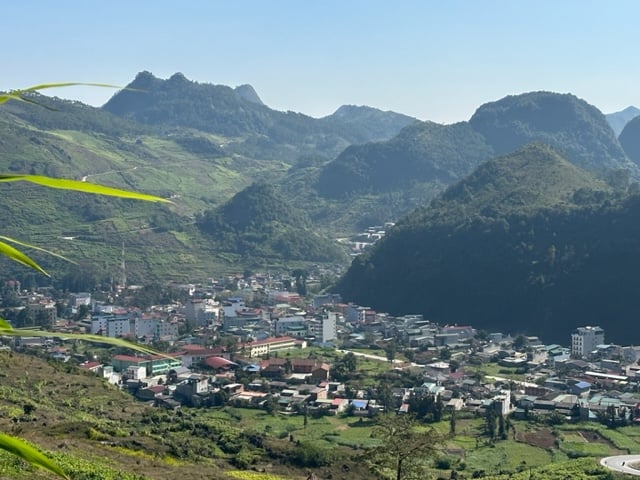
We returned to Dong Van, a town nestled in the heart of the plateau. In recent years, Dong Van has undergone many changes. The streets are wider and more modern. Many new buildings have been constructed. It was a weekend. The whole town was preparing for the buckwheat flower festival. A memorable night in the rather chilly weather, amidst the bustling old market filled with music and crowds of tourists from all over.
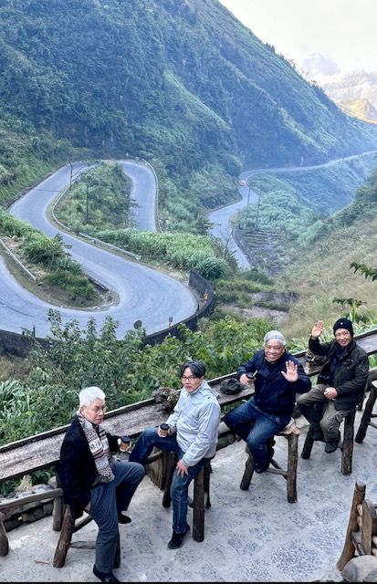
We traveled down National Highway 4C back to Ha Giang. The road passed through landmarks that have made this region famous: Quan Ba Heaven's Gate at an altitude of 1,500 meters, the starting point of the Happiness Road; a viewpoint offering panoramic views of the entire region, including the Twin Mountains and many other scenic spots. Tham Ma Pass, a winding road that snakes across the mountainside, creates spectacular curves. Many tourists stop at the top of the pass to take unique photos. Mong girls with their baskets of yellow mustard flowers have a very distinctive beauty, harmonizing with the natural scenery. We had the opportunity to enjoy a hot cup of coffee at the top of Tham Ma Pass, admiring the winding road between the two sides of rocky mountains. Yen Minh town with its buckwheat flower fields in bloom was also an attractive stop along the way… In the opposite direction, groups of tourists were still coming from Ha Giang city. Parking lots were packed. A very lively atmosphere prevailed on the roads of the "Ha Giang Loop".
According to the latest figures, by November 2025, the number of tourists visiting Tuyen Quang province (including Ha Giang) will reach nearly 3.7 million, of which nearly half a million will be international tourists. Total tourist spending in the province will be nearly 10 trillion VND, with international tourists spending nearly 2 trillion VND. These figures have exceeded the province's 2025 annual plan targets. On December 6th, at the awards ceremony in Bahrain, the World Travel Awards organizers honored the Dong Van Karst Plateau Global Geopark as the "World's Leading Cultural Destination 2025". This title further enhances the reputation of this region, making tourism an increasingly powerful driving force for development in the new era.
Source: https://baotintuc.vn/du-lich/tren-nhung-cung-duong-ha-giang-loop-20251209210626183.htm

![[Photo] General Secretary and President To Lam presides over a meeting on preparations for the review of one year of operation of the three-tiered government system.](https://vphoto.vietnam.vn/thumb/1200x675/vietnam/resource/IMAGE/2026/06/02/1780391821195_a1-bnd-4595-9717-jpg.webp)


Comment (0)