
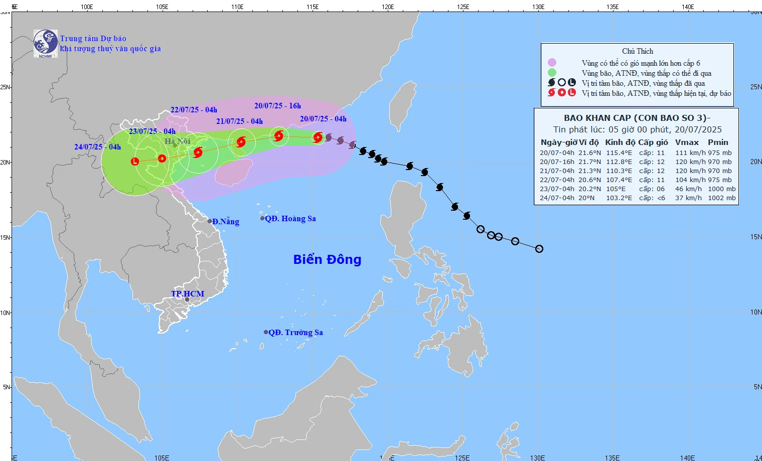
Forecast path of storm No. 3 at 5:00 a.m. on July 20, 2025.
According to Thanh Hoa Hydrometeorological Station, at 4:00 a.m. on July 20, the center of the storm was located at about 21.6 degrees North latitude; 115.4 degrees East longitude, in the northern sea area of the North East Sea, about 830km east of Quang Ninh - Hai Phong . The strongest wind near the center of the storm was level 11 (103-117km/h), gusting to level 14; moving in the West Northwest direction at a speed of about 20-25km/h.
Storm forecast (next 24 to 72 hours) as follows:

From the next 72 to 96 hours, the storm will move mainly in the West Southwest direction, traveling 5-10km per hour and continue to weaken.
Due to the impact of the storm circulation, from July 21, the Thanh Hoa sea area will have winds gradually increasing to level 6, level 7, gusting to level 8; then increasing to level 8, level 9, gusting to level 10, level 11. The sea will be rough. Waves will be 2-4m high.
On land, from the afternoon of July 21, coastal areas of Thanh Hoa province will have West and Southwest winds gradually increasing to level 6, gusting to level 7, then increasing to level 7, level 8, gusting to level 9 - 10; deep inland level 5, level 6, gusting to level 7. Natural disaster risk level due to strong winds: level 2.
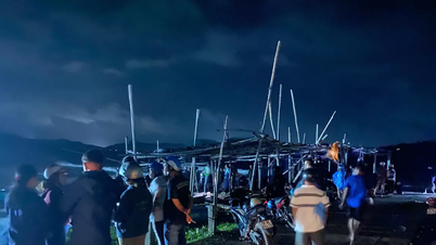
All vessels, anchorages, aquaculture areas, sea dykes and other activities in the above sea areas are at high risk of being affected by thunderstorms, strong winds and big waves.
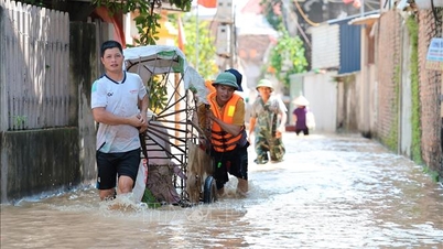
Due to the influence of the tropical convergence zone with its axis passing through the area between the Northern Delta and the North Central region connecting with storm 3 combined with strong high-altitude wind convergence, the Thanh Hoa area from the night of July 20 to July 24 is likely to experience a period of heavy to very heavy rain and thunderstorms; with total rainfall for the period generally ranging from 150 - 300mm, in the midlands and mountainous areas from 300 - 400mm, in some places over 450mm. Disaster risk level due to heavy rain: level 1.
The meteorological agency warns of a high risk of flash floods on small rivers and streams, landslides, especially in areas with steep terrain. Heavy rains may be accompanied by thunderstorms, tornadoes, lightning, hail and strong gusts of wind that can break trees, damage houses, traffic works and infrastructure. Causing flooding of crops, making the soil saturated with water, or causing trees to fall, causing damage to crops. Overloading the urban drainage system, causing flooding in residential areas, traffic jams due to flooded roads and reduced visibility when driving, causing slippery roads and traffic accidents...
NDS
Source: https://baothanhhoa.vn/anh-huong-bao-so-3-tu-dem-nay-20-7-thanh-hoa-mua-to-den-rat-to-255386.htm
![[Photo] President Luong Cuong chaired the welcoming ceremony and held talks with United Nations Secretary-General Antonio Guterres](https://vphoto.vietnam.vn/thumb/1200x675/vietnam/resource/IMAGE/2025/10/24/1761304699186_ndo_br_1-jpg.webp)

![[Photo] Prime Minister Pham Minh Chinh chairs conference on breakthrough solutions for social housing development](https://vphoto.vietnam.vn/thumb/1200x675/vietnam/resource/IMAGE/2025/10/24/1761294193033_dsc-0146-7834-jpg.webp)

![[Photo] Solemn funeral of former Vice Chairman of the Council of Ministers Tran Phuong](https://vphoto.vietnam.vn/thumb/1200x675/vietnam/resource/IMAGE/2025/10/24/1761295093441_tang-le-tran-phuong-1998-4576-jpg.webp)
![[Photo] Prime Minister Pham Minh Chinh and South African President Matamela Cyril Ramaphosa attend the business forum](https://vphoto.vietnam.vn/thumb/1200x675/vietnam/resource/IMAGE/2025/10/24/1761302295638_dsc-0409-jpg.webp)


Comment (0)