
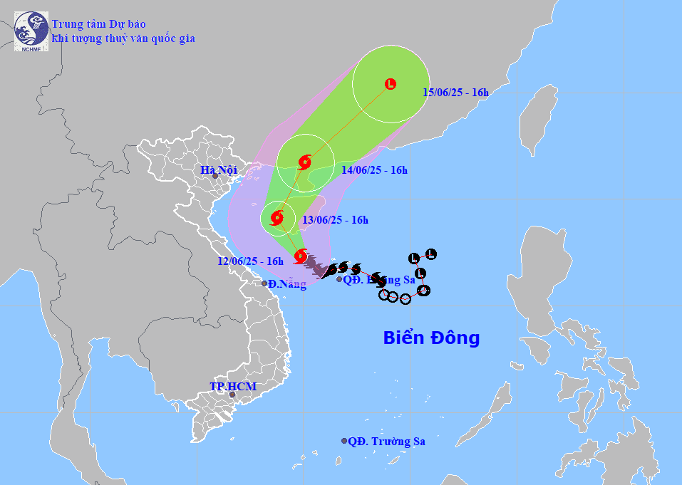
On the afternoon of June 12, storm No. 1 (storm Wutip) was in the west of Hoang Sa archipelago, with a level 9 intensity and gusts of level 11. It is forecasted that in the next 24 hours, the storm will move northwest at a speed of 10 km/h and tend to strengthen.
Mr. Phung Tien Dung, Head of Hydrological Forecasting Department (National Center for Hydro-Meteorological Forecasting) said: "Our assessment is that in the next 2-3 days, storm No. 1 will move north, make landfall in Guangdong, China and gradually dissipate."
According to Mr. Dung, storm No. 1 will cause strong winds in the entire North East Sea, Hoang Sa archipelago as well as the Gulf of Tonkin, the sea area from Quang Tri to Quang Nam .
From Hai Phong to Nghe An, sea level rises abnormally: Hon Dau: 3.9 m; Hon Ngu: 2.8 m. Risk of flooding in low-lying coastal areas and river mouths from 5-7 pm on June 12 and 13.
Storm No. 1 also continued to cause heavy to very heavy rain in the Central Central provinces. From the evening of June 12 to June 13, the area from Ha Tinh to Hue had an average rainfall of 100 - 180 mm, with some places having over 350 mm.
In the evening and tonight of June 12, the area from Da Nang to Quang Ngai will have rain from 40 - 90 mm, some places over 150 mm; the northern Central Highlands and Binh Dinh will have rain from 15 - 30 mm, some places over 50 mm.
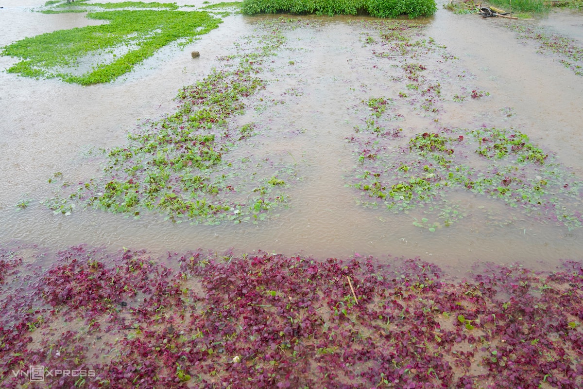
Landslides, crops flooded due to storm
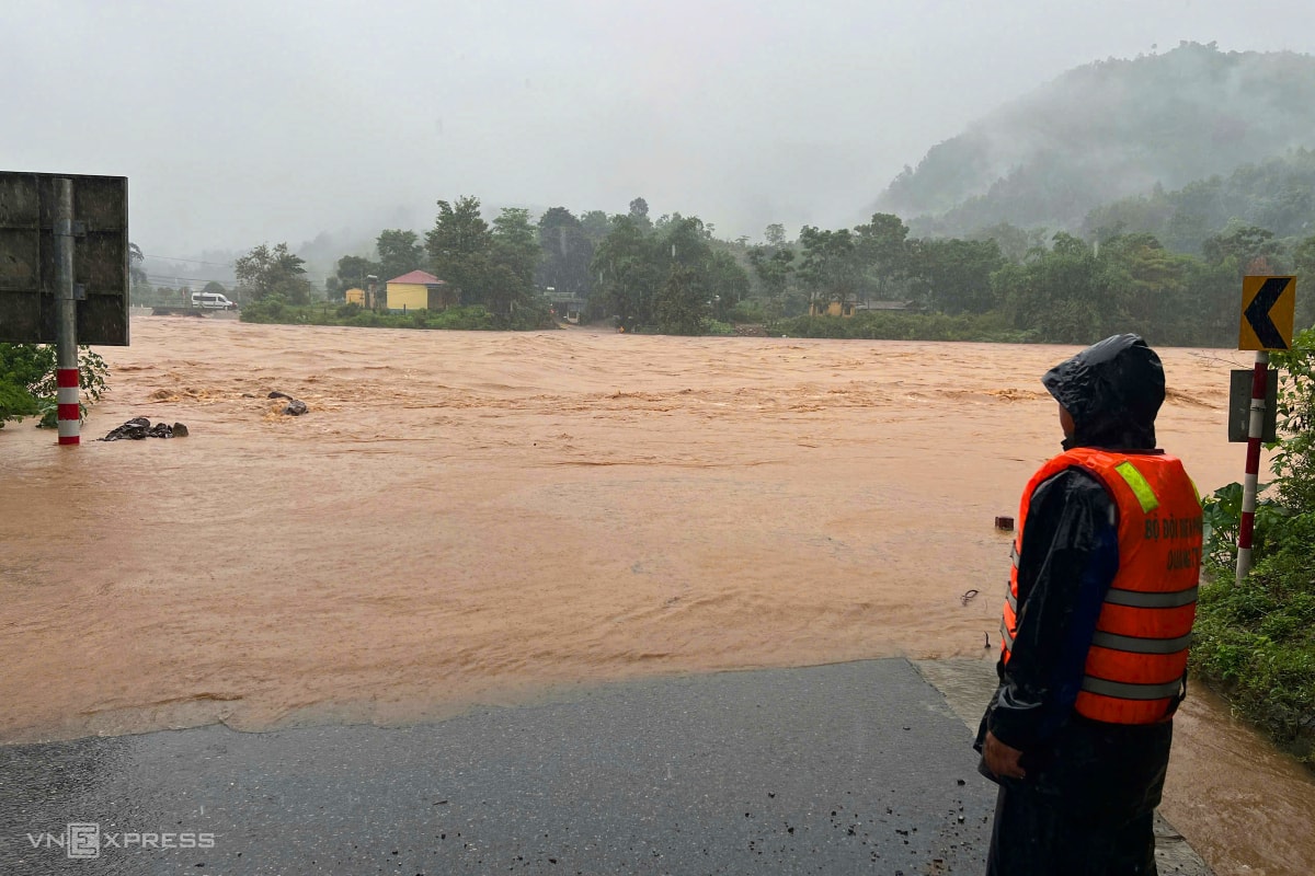
Storm No. 1 has caused heavy rain in the Central provinces for the past two days. The steep mountainous terrain combined with heavy rain caused many spillways and dams in Dakrong district ( Quang Tri ) to be flooded. The provincial border guards have set up checkpoints at the spillways on National Highway 15D, where the water level has risen by 0.5 - 1 m, prohibiting people and vehicles from passing.


Source: https://baohaiduong.vn/bao-so-1-dang-manh-len-di-chuyen-nguoc-len-phia-bac-413935.html


Comment (0)