
Slow sign replacement
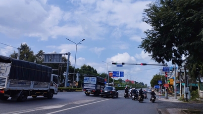
It has been noted that many signs on major roads and highways through Da Nang still list the addresses of localities by their old names. This makes it difficult to navigate, especially for those who are coming to the city for the first time or are not aware of the changes.
On Cach Mang Thang Tam Street, many signs still point to “Hoa Vang District”, even though the unit has been divided into 3 communes including Hoa Tien, Hoa Vang and Ba Na. Or in the Hoa Cam overpass area, signs pointing to “ Quang Nam ” or “Quang Nam Province” are still present, even though this place name has been merged.
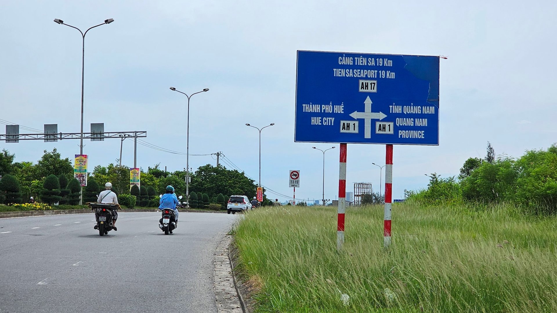
On Highway 1A, the “administrative boundary” signs still use the old name; some signs still in circulation come with the transportation regulation “no fixed route to Da Nang”, causing difficulties for new drivers.
Notably, at the old administrative boundary points, the signs still say "Quang Nam territory" and "Da Nang territory", very messy.
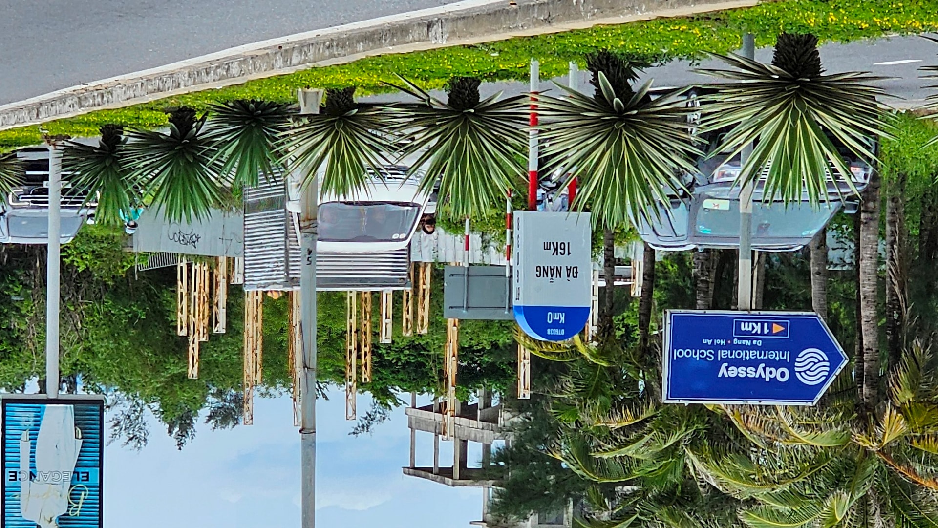
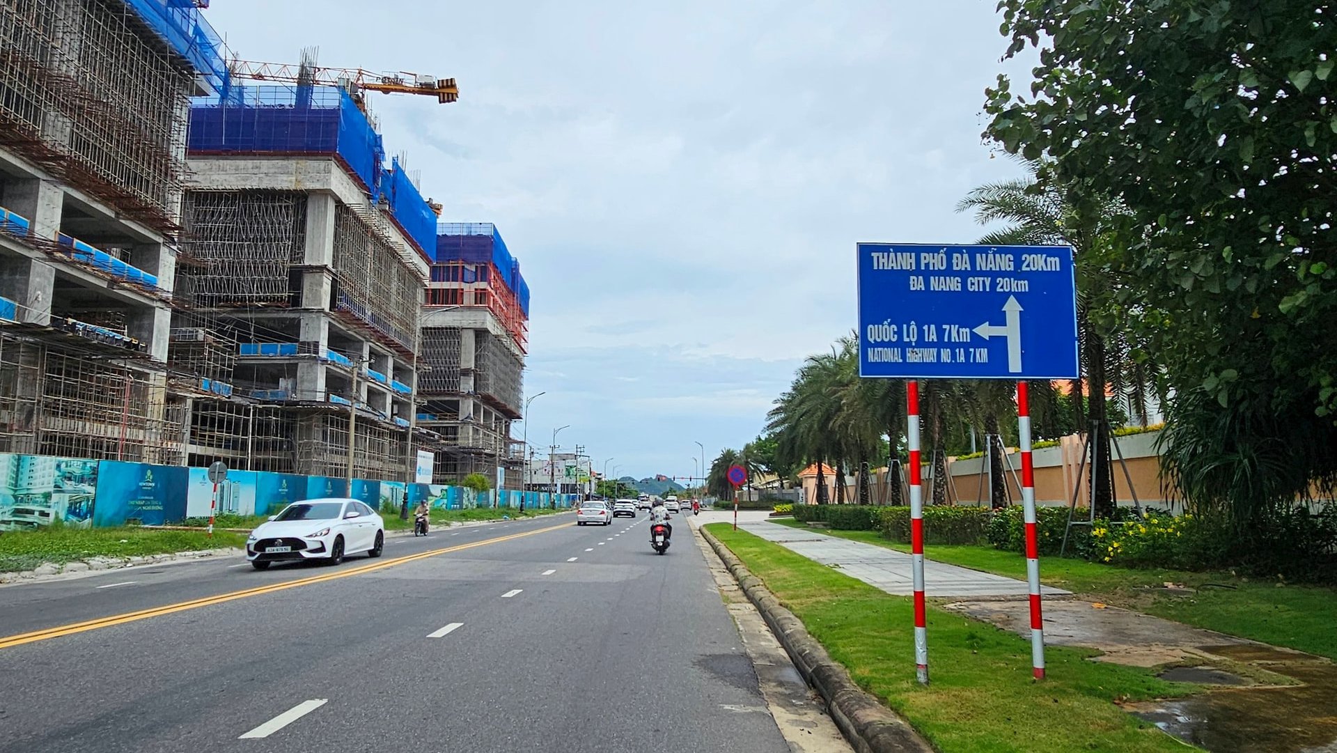
In addition, the signs are still inconsistent in terms of kilometer distance. For example, the sign at the border point of Quang Nam province (old) and Da Nang city (old) on the Truong Sa - Hoi An coastal route, some places say Da Nang city is 16km, some places say Da Nang city is 20km, even though the distance between the two signs is close together...
Many drivers have reported that such signs affect traffic experience and can reduce the effectiveness of post-merger information dissemination.
Mr. Pham Nhu Hung ( Hue city) said: "As a long-distance freight driver, having to find the way, ask for directions or re-check information makes my travel time longer, affecting my schedule and work efficiency."
In addition, some drivers say that having to stop suddenly to check information causes traffic obstruction and is potentially dangerous, especially on high-speed routes.
Signage synchronization solution
According to the Department of Construction, the unit is reviewing all signboards, aiming to complete them in July, such as unifying new place names; updating accurate distances; removing inappropriate signs...
Authorities need to conduct a comprehensive review of the entire signage system in the city, especially at hotspots where accidents frequently occur or where unreasonable behavior is reported.
In addition, it is necessary to adjust the location, quantity and content of signs to make them easy to understand, easy to observe and suitable to traffic reality; urgently adjust and replace signs that still use old place names and incorrect information to ensure accuracy and consistency.
In addition, homemade signs by people need to be dismantled and strictly handled according to the law, while propaganda needs to be increased and public awareness about the use of public spaces needs to be raised.
Research and application of modern technological solutions in the management, monitoring and maintenance of traffic signs and light systems as well as updating on the city's website, map lookup apps (google maps, zalo map...) to synchronize new place names to contribute to automation and improve management efficiency.
Thoroughly resolving the existing shortcomings in traffic signs will contribute to building a civilized and modern traffic system, ensuring convenience and safety for residents and tourists when coming to Da Nang city.
Source: https://baodanang.vn/can-xu-ly-bat-cap-ve-bien-bao-giao-thong-3298439.html


![Dong Nai OCOP transition: [Part 2] Opening new distribution channel](https://vphoto.vietnam.vn/thumb/402x226/vietnam/resource/IMAGE/2025/11/09/1762655780766_4613-anh-1_20240803100041-nongnghiep-154608.jpeg)


Comment (0)