
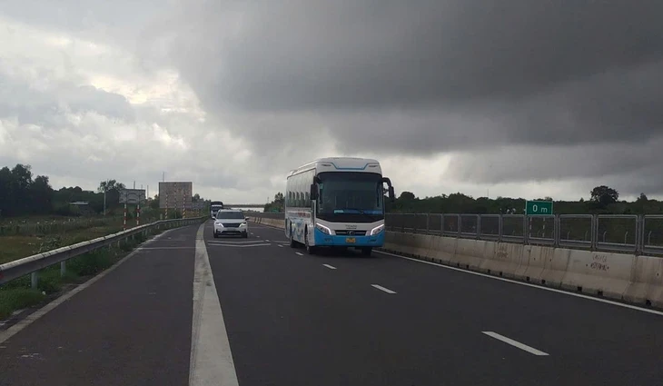
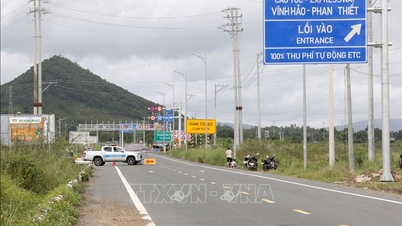
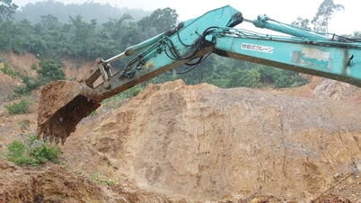
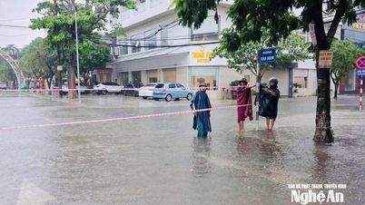
Vinh Hao - Phan Thiet Expressway was opened to traffic in both directions from 4 p.m. on October 30 - Photo: Road Management Area IV
Information from Road Management Area IV said that by 4pm on October 30, the water had completely drained, the mud had been completely cleared, and the Vinh Hao - Phan Thiet highway had been reopened. Traffic was running normally in both directions to ensure safety.
However, according to the road management force, it is still raining in Binh Thuan area, some positive slope locations still have water seeping and flowing down to the Vinh Hao - Phan Thiet highway.
Therefore, Road Management Area IV continues to maintain a 24/7 force on duty at the scene, ready to handle any unusual situations that arise.
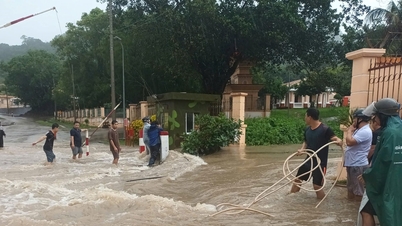
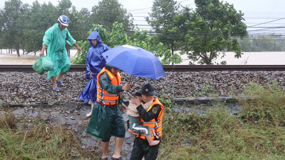
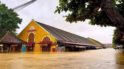
Previously, due to prolonged heavy rain, at 9:45 a.m. on October 30, water from the positive slope carried rocks and soil down the longitudinal drainage ditch, overflowing across the Vinh Hao - Phan Thiet highway from km215+200 to km215+700.
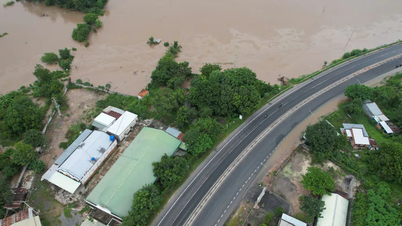
At the same time, the rainwater poured down, causing flooding in the entire area. The section from km233+250 - km233+500 of Vinh Hao - Phan Thiet highway was flooded 60 - 70cm deep in both directions.
Road Management Office IV.1 has coordinated with relevant units to set up a system of signs, implement road closures, and close the Ma Lam intersection (km208+701) and Phan Thiet intersection (km234+617). Vehicles traveling on the Vinh Hao - Phan Thiet expressway to this area are diverted to National Highway 28 and National Highway 1.
At 3:30 p.m. on October 30, at the flooded point from km233+250 to km233+500, the water receded from the road surface, so the Vinh Hao - Phan Thiet expressway management unit organized traffic on the left side of the route (from Phan Thiet to Vinh Hao).
Source: https://tuoitre.vn/cao-toc-vinh-hao-phan-thiet-da-thong-duong-sau-khi-nuoc-rut-20251030170813327.htm
![[Photo] General Secretary To Lam meets former British Prime Minister Tony Blair](https://vphoto.vietnam.vn/thumb/1200x675/vietnam/resource/IMAGE/2025/10/30/1761821573624_tbt-tl1-jpg.webp)
![[Photo] Touching scene of thousands of people saving the embankment from the raging water](https://vphoto.vietnam.vn/thumb/1200x675/vietnam/resource/IMAGE/2025/10/30/1761825173837_ndo_br_ho-de-3-jpg.webp)
![[Photo] General Secretary To Lam attends the Vietnam-UK High-Level Economic Conference](https://vphoto.vietnam.vn/thumb/1200x675/vietnam/resource/IMAGE/2025/10/30/1761825773922_anh-1-3371-jpg.webp)
![[Photo] The Third Patriotic Emulation Congress of the Central Internal Affairs Commission](https://vphoto.vietnam.vn/thumb/1200x675/vietnam/resource/IMAGE/2025/10/30/1761831176178_dh-thi-dua-yeu-nuoc-5076-2710-jpg.webp)


Comment (0)