
Accordingly, the People's Committee of Dong Nai province sent documents to the following hydropower plants: Tri An, Phu Tan 2, Dong Nai 2, Dong Nai 3, Dong Nai 4, Dong Nai 5, Dai Ninh, Da Nhim - Ham Thuan - Da Mi, Can Don, Thac Mo, Dak U, Srok Phu Mieng, Dak Glun, Thong Nhat, Dak Glun 2, Bu Ca Mau , Dak Kar.

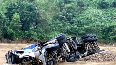
The water level rose due to heavy rain in the upstream area and the overflow regulation of the Da Nhim - Ham Thuan - Da Mi Hydropower Reservoir. However, the reservoir owner has not coordinated to provide information and warnings to the Dong Nai Province Civil Defense Command, the Department of Agriculture and Environment and the People's Committees of communes downstream of the dam in Dong Nai Province, causing difficulties in flood response work, causing damage to people's rice and crop production.

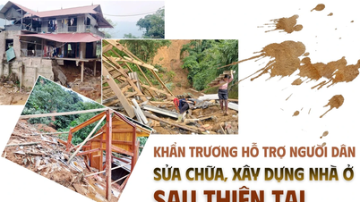
To proactively prevent and promptly respond to flooding, flash floods, and landslides in areas along the Dong Nai, La Nga, and Song Be rivers and reduce damage caused by natural disasters, Dong Nai province requested hydropower plants to review operating procedures, coordination regulations, assign responsible staff, notify and provide timely information on the time to start discharging water downstream, flow to the lake, water level of the lake, and expected discharge flow.
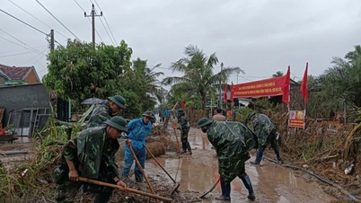
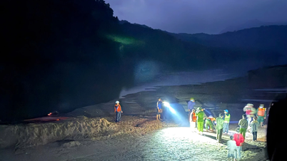
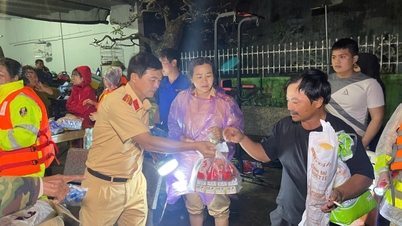
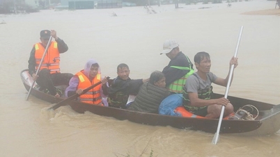
Notifications are made via warning systems, loudspeakers, text messages, social networks or other communication channels so that people downstream can receive information quickly, proactively harvest agricultural products, and evacuate people and property from areas at risk of deep flooding and landslides, in order to minimize damage.
In particular, the Da Nhim - Ham Thuan - Da Mi Hydropower Plant in the upper La Nga River coordinates to send timely information to serve propaganda and warning work to help local authorities, functional agencies and people have plans to respond, evacuate and overcome consequences when natural disasters occur.
The Provincial Hydrometeorological Station monitors weather, natural disasters, and water levels at measuring stations in the Dong Nai, La Nga, and Be river basins; provides information and quick warnings about the risk level in areas at risk of natural disasters after flood discharge from hydroelectric reservoirs.
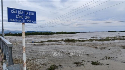
At noon of the same day, Dong Nai Hydrometeorological Station said: Water level on Dong Nai river system is changing slowly. It is forecasted that in the next 24 hours, water level at Phu Hiep station will decrease slowly, at level above alert 1; at Tri An station, water level will change slowly, at alert 1; at Bien Hoa station, peak tide water level will change slowly, high tide peak is likely to reach approximately alert level 2.
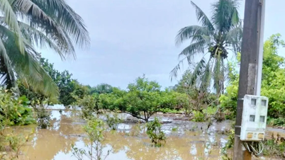
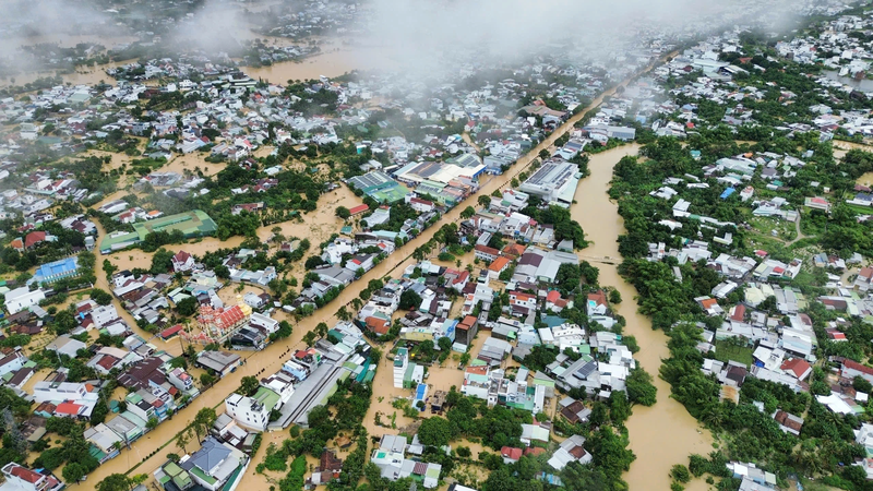
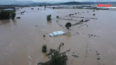
Authorities warn of the risk of flooding, low-lying areas along the Dong Nai and La Nga rivers in the communes of Dak Lua, Nam Cat Tien, Ta Lai, Thanh Son, Phu Vinh, Phu Lam, Tan Phu, Phu Hoa, and Dinh Quan in Dong Nai province are inundated by floods.
Low-lying areas along Tri An Lake, in the communes of Phu Ly, Thanh Son, Dinh Quan, Xuan Bac, La Nga, Thong Nhat, Bau Ham, Tri An in Dong Nai province are at risk of flooding. Low-lying areas along the river in the lower reaches of Dong Nai River, in the wards and communes of Tri An, Tan An, Trang Dai, Tan Trieu, Bien Hoa, Tran Bien, Tam Hiep, Long Hung, Phuoc Tan, Tam Phuoc, An Phuoc, Nhon Trach, Dai Phuoc, Phuoc An in Dong Nai province and neighboring areas are at risk of flooding due to floods (high tides).
Source: https://www.sggp.org.vn/dong-nai-de-nghi-17-nha-may-thuy-dien-cung-cap-thong-tin-xa-lu-post824843.html


Comment (0)