
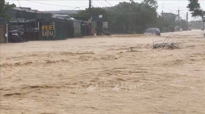
According to information from the Ha Tinh Province Hydrometeorological Station, from the night of October 29 to the morning of October 31, the whole province had rain; especially, the southern coastal plain recorded moderate rain, heavy rain, and some places had very heavy rain. It is forecasted that from the morning of October 31 to the end of the night of November 2, heavy rain in the province will continue, with rainfall in some places possibly exceeding 500mm, threatening complicated developments of the flood situation.
In just 36 hours (from 5:00 p.m. on October 29 to 7:00 a.m. on October 31), many measuring stations recorded very large amounts of rainfall, typically: Thuong Song Tri: 576mm, Thuong Tuy Lake: 494mm, Mac Khe Lake: 436mm, Ky Thuong: 363mm, Ke Go: 348mm. As of 7:00 a.m. on October 31, the water level at many large reservoirs was at a very high level; of which, Song Rac Lake had reached 100% of its design capacity (124.5/124.5 million m³).
Ke Go Lake reached 91.9% (317/345 million m³). Other medium and small reservoirs also reached from 90% to 100% of the design capacity. In this situation, large reservoirs have deployed flood discharge regulation with specific flows: Song Rac Lake: 353 m³/s, Ke Go Lake: 150 m³/s, Thuong Song Tri: 100 m³/s. Ho Ho Hydropower Plant: regulating through spillway 200 m³/s
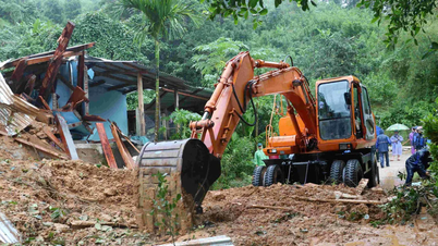
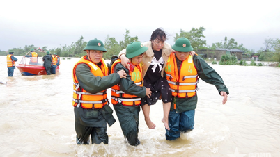
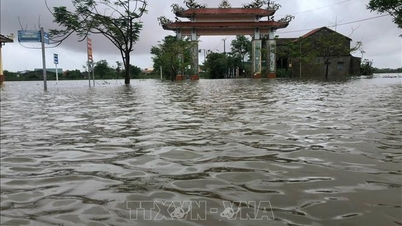
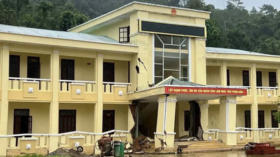
Heavy rains and floods have caused flooding in a number of communes and wards in the southern part of Ha Tinh province. Initial statistics show that about 250 households were flooded, mainly concentrated in Vung Ang ward (146 households), Ky Xuan commune (59 households), Ky Thuong commune (24 households) and Hoanh Son ward (20 households). Many inter-village and inter-commune roads were cut off, such as in Hai Ninh ward (6 flooded routes, 4.2km long), Vung Ang ward (5 flooded routes, 2km long), Ky Xuan commune (8 flooded routes, 0.63km long), etc.
To ensure the safety of people, evacuation was urgently carried out. Specifically, the People's Committee of Vung Ang Ward evacuated 146 households/334 people and Ky Thuong Commune evacuated 135 households/166 people to safety.
Faced with complicated developments, the People's Committee of Ha Tinh province promptly issued Official Dispatch No. 49/CD-UBND dated October 30, 2025 on focusing on responding to floods. Relevant departments and branches, especially the Department of Agriculture and Environment (with Document No. 6667/SNNMT-TL) and the Irrigation Sub-Department (Document No. 1010/TL-PCTT), have strengthened direction and implemented proactive plans to respond to heavy rains and floods.
Authorities in Ha Tinh province are continuing to closely monitor weather developments, strictly control flood discharge from reservoirs, and are ready to evacuate residents in dangerous areas to minimize damage to people and property.
Source: https://baotintuc.vn/xa-hoi/ha-tinh-khan-truong-ung-pho-voi-mua-lon-gay-ngap-lut-cuc-bo-20251031095637365.htm

![[Photo] Prime Minister Pham Minh Chinh attends the 5th National Press Awards Ceremony on preventing and combating corruption, waste and negativity](https://vphoto.vietnam.vn/thumb/1200x675/vietnam/resource/IMAGE/2025/10/31/1761881588160_dsc-8359-jpg.webp)
![[Photo] Da Nang: Water gradually recedes, local authorities take advantage of the cleanup](https://vphoto.vietnam.vn/thumb/1200x675/vietnam/resource/IMAGE/2025/10/31/1761897188943_ndo_tr_2-jpg.webp)


Comment (0)