
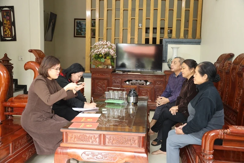
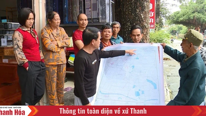
The working group of Hoang Loc commune organized land data collection for the people.
The collection of information on land use certificates (GCN), housing certificates, and ID cards/citizen identification cards (CCCD) is divided into two groups: List of GCNs and CCCDs collected from land registration offices, branches and at the commune-level People's Committees; list of GCNs and CCCDs that need to be collected from people and organizations. It is noted that in many wards and communes in the province, people have proactively brought GCNs and CCCDs to villages and residential groups to update information. Grassroots staff work overtime, including weekends, and many localities even organize collection in the evening to ensure progress.
Hoang Hoa Commune is a locality composed of 6 old communes and towns, with a population of nearly 44,000 people, distributed in 42 villages, with the number of land use right certificates needed to collect about 12,000 plots of land. The workload is large, so to ensure progress, the commune has established working groups to collect data by village.
Ms. Nguyen Thi Hong, an official of the Economic Department of the Commune People's Committee, said: "Civil servants of specialized departments must perform many tasks at the same time, while the campaign requires many people to participate at the same time, so the commune's working groups often have to take advantage of time in the evenings and on weekends to meet the schedule. As of October 24, the whole commune has collected more than 6,000 certificates, of which more than 3,000 certificates have been scanned, processed into PDF files and entered into form information to transfer to the competent unit to carry out the next steps."
After the first 3 weeks of data collection, in Hoang Hoa commune, there are more than 800 GCN being mortgaged at banks and credit institutions. The collection team has compiled a list and reported to the People's Committee at the commune level, and sent a document to credit institutions to coordinate in providing information. However, a current problem is that many residential areas have been auctioned, and the land users are not local people, which also affects the collection of data information for these plots of land.
In Hoang Loc commune, after more than 3 weeks of launching the campaign in 34 villages in the commune, the locality has collected, scanned, and processed into PDF format about 70% of the number of GCNs.
Ms. Nguyen Thi Mai, a civil servant of the Economic Department of Hoang Loc Commune, said: “For the people, the immediate benefits are that land procedures will be more transparent; transactions of transfer, inheritance, mortgage, and bank loans will be conducted smoothly, minimizing legal risks. Therefore, the locality is focusing on mobilizing human resources, promptly removing arising obstacles to contribute to completing the campaign.”
Ms. Mai also shared that most of the land use right certificates were issued before 2010, the land user information was often taken from the previous paper household registration book, so the declared information in many cases was inaccurate, leading to errors in middle names, mismatched ID card numbers... During the data collection process, nearly 30 cases of incorrect information on the certificates were discovered in the commune. Members of the data collection team guided people to carry out the procedure of correcting the certificates to synchronize personal information before uploading to the database. This is also a step in the data cleaning process. The correction of certificates is currently under the authority of the People's Committee at the commune level, people only need to provide correct documents, complete with the file components. Based on the documents, the People's Committee of the commune will correct the information on the back of the certificate, the procedure of correcting the certificate is carried out within 5 working days.
Quang Phu Ward was established on the basis of merging 7 administrative units, with a population of more than 77,000 people, and the number of land plot certificates that need to be collected is relatively large. In Thanh Yen Street alone, there are over 1,000 households living, not to mention households with plots of land in new residential areas. When implementing the campaign, the residential group officials propagated and clearly explained the purpose, rights and responsibilities of the people, and most of the people in the street supported and cooperated. However, many people still have concerns about the process of providing information. "Collecting documents manually, it is inevitable that people have to wait a long time. Moreover, the number of documents such as GCN, CCCD that need to be collected and processed is relatively large, whether the data entry process is accurate and information is confidential for the people", Mr. Hoang Van Diep, a resident of Thanh Yen Street, Quang Phu Ward expressed his concerns.
According to the report of the Department of Agriculture and Environment, out of 166 communes and wards in the province, there are currently 26 units that have implemented the construction of land databases (20 units have completed the cadastral database, 6 units have only partially built). The whole province has 1,729,968 land plots that need to enrich and clean up the land database, of which 732,924 land plots have built land databases; 997,004 residential land plots and houses with issued certificates have not built databases. As of October 26, data on certificates and CCCDs has been collected for 401,789/1,729,968 land plots, reaching a rate of 23.2%. After being collected and compared by localities, the data will be transferred to the land registration office for processing, standardization and integration into the centralized management system. The Department of Agriculture and Environment has continuously directed and closely coordinated with localities to promptly remove difficulties in the process of implementing the campaign.
According to the instructions of the Department of Agriculture and Environment, the digitization and creation of a database for residential land plots and houses that have been granted a Certificate of Land Use Rights is carried out in the following steps: Scanning/Photographing the Certificate of Land Use Rights and Citizen Identification Cards and processing them according to regulations on unstructured land data; The Certificate of Land Use Rights and Citizen Identification Cards are scanned/photographed, each document is stored as 01 file in PDF format, the file name of the scanned/photographed file is in uniform uppercase letters named after the issuance number of the Certificate of Land Use Rights. After the Certificate of Land Use Rights and Citizen Identification Cards have been collected and digitized, the collection team will enter all information from the Certificate of Land Use Rights and Citizen Identification Cards into Form No. 01 according to regulations. The People's Committee at the commune level is responsible for synthesizing, reporting the results (according to Form No. 01) and handing over the digitized Certificate of Land Use Rights and Citizen Identification Cards data to the branch of the land registration office for inspection, reconciliation and synthesis. The land registration office branch reviews and processes information and data before updating it to the land information system software currently deployed and used locally and connecting and sharing with the National Land Database... |
Article and photos: Viet Huong
Source: https://baothanhhoa.vn/hieu-dung-ve-chien-dich-lam-giau-lam-sach-du-lieu-dat-dai-267140.htm
![[Photo] Prime Minister Pham Minh Chinh attends the 5th National Press Awards Ceremony on preventing and combating corruption, waste and negativity](https://vphoto.vietnam.vn/thumb/1200x675/vietnam/resource/IMAGE/2025/10/31/1761881588160_dsc-8359-jpg.webp)


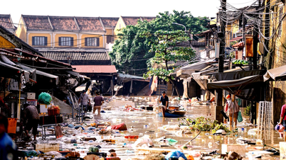
![[Photo] Da Nang: Water gradually recedes, local authorities take advantage of the cleanup](https://vphoto.vietnam.vn/thumb/1200x675/vietnam/resource/IMAGE/2025/10/31/1761897188943_ndo_tr_2-jpg.webp)


Comment (0)