

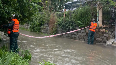
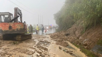
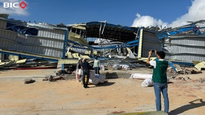
Since the morning of the same day, heavy rain has been falling in Bac Cam Ranh ward, causing many roads to be partially flooded. At this point, dozens of authorities are on duty, clearing the flow, placing warning signs, and setting up checkpoints on roads and flooded areas to warn people.

The Military Command of Bac Cam Ranh Ward has also established three mobile working groups to regularly patrol and inspect key routes in the area.
On November 16, prolonged heavy rains caused many areas of Khanh Hoa province to be flooded with water up to 200mm deep. Besides Bac Cam Ranh ward, in the wards of Bac Nha Trang, Nam Nha Trang and Tay Nha Trang, localized flooding also occurred on many roads.

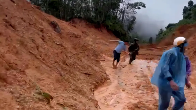
According to the forecast of Khanh Hoa Hydrometeorological Station, the risk of flash floods and landslides in the province has been raised to level 1 natural disaster risk. In the next 6 hours, rainfall in the South of Khanh Hoa may reach 50 - 100mm, in some places exceeding 150mm; in the North of Khanh Hoa it will fluctuate 40 - 70mm, in some places it may exceed 100mm.
Locations warned of very high risk of landslides include: Phuong Hoang Pass on Highway 26; Khanh Le Pass connecting Nha Trang - Da Lat on Highway 27C; Chai Lay and Chai Ma Bai - Ninh Hoa mountain slopes; Hon Giao - Khanh Vinh cliffs and Khanh Son mountain slope area.
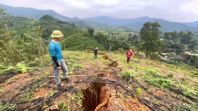
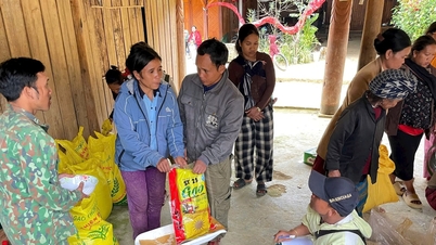
Evacuate Xom Nui residents to safety
By the afternoon of November 16, many households living at the foot of Hon Ro Mountain (also known as Xom Nui, Nam Nha Trang Ward) had been moved to safety, to guard against landslides during prolonged heavy rain. The force also dredged drainage canals in the area to reduce the risk of flooding and landslides.
Source: https://www.sggp.org.vn/khanh-hoa-can-bo-chien-si-dam-mua-ho-tro-nguoi-dan-ung-pho-mua-lu-post823774.html


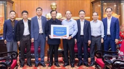
![[Photo] General Secretary To Lam receives Vice President of Luxshare-ICT Group (China)](https://vphoto.vietnam.vn/thumb/1200x675/vietnam/resource/IMAGE/2025/11/15/1763211137119_a1-bnd-7809-8939-jpg.webp)
![[Photo] Prime Minister Pham Minh Chinh meets with representatives of outstanding teachers](https://vphoto.vietnam.vn/thumb/1200x675/vietnam/resource/IMAGE/2025/11/15/1763215934276_dsc-0578-jpg.webp)


Comment (0)