

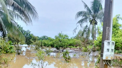
From about 4:30 p.m., the Hau River flooded, causing Binh Thuy market (Binh Thuy ward), Ninh Kieu wharf (Ninh Kieu ward) and some sections on Cach Mang Thang Tam street along the river to be heavily flooded.
It is forecasted that on October 8, the tide will rise higher, many areas in Binh Thuy and Ninh Kieu districts will continue to be deeply flooded in the morning and evening.


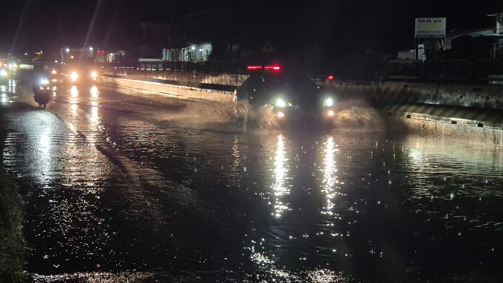

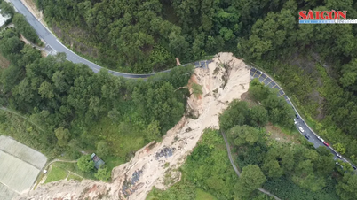
According to SGGP reporters, at 6 p.m. the same day, on National Highway 1A, passing through Nga Bay Ward, Can Tho City, the floodwaters were about 1km long, with some points being nearly 0.5m deep, causing difficulties for vehicles and posing a potential risk of accidents. Authorities have deployed warnings and instructions for people and vehicles passing through this area.
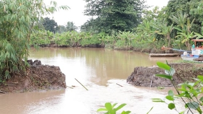
In Vinh Long province, on National Highway 1A through Binh Minh ward, water was about 300m deep, affecting traffic.
According to the Vinh Long Province Hydrometeorological Station, the October 2025 high tide will last from October 6 to 12. Water levels on rivers and canals are rising rapidly and are forecast to peak on October 9 (August 18 of the lunar calendar).

In the past 24 hours, the peak water level at My Thuan station reached 203cm (23cm higher than alarm level III), Cho Lach station reached 190cm (approximately alarm level III). Other stations fluctuated from below alarm level I to near alarm level II. It is forecasted that on October 9, the water level at My Thuan could reach 217cm (37cm higher than alarm level III), at Cho Lach 206cm (16cm higher than alarm level III).
The peak tide at My Thuan and Cho Lach stations is forecast to occur between 4-7am and 4-8pm, from October 8 to 10. The Vinh Long Province Hydrometeorological Station warns of level 2 natural disaster risk.
Source: https://www.sggp.org.vn/lu-dang-cao-ket-hop-trieu-cuong-gay-ngap-nang-nhieu-noi-o-dbscl-post816821.html

![[Photo] Close-up of heavy damage at the school located on the banks of the Ban Thach River](/_next/image?url=https%3A%2F%2Fvphoto.vietnam.vn%2Fthumb%2F1200x675%2Fvietnam%2Fresource%2FIMAGE%2F2025%2F11%2F26%2F1764152130492_ndo_bl_img-8188-8805-jpg.webp&w=3840&q=75)


Comment (0)