
The foundation and surface have been severely degraded over the years, making National Highway 14D a "road of suffering" not only for the people of Ben Giang, Nam Giang and La Dee communes, but also for drivers participating in traffic on the route.
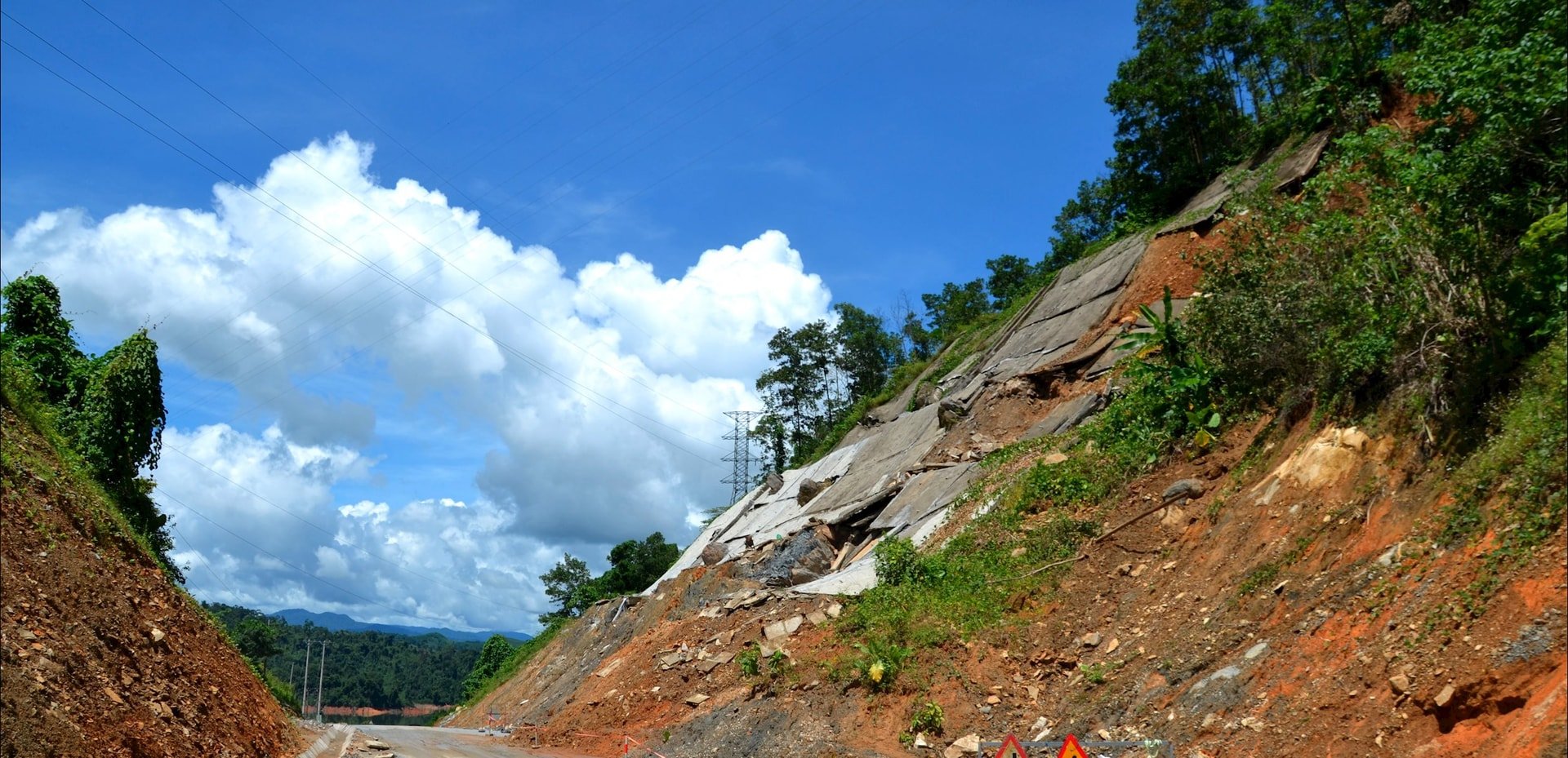
During the rainy season, people are worried about the risk of rocks and trees suddenly falling from the slope. The location of the slope landslides is on Highway 14D in Ben Giang commune.
However, in other areas, the reality is that mountainous land has been soaked with water for a long time, and water flowing down from above can "pull" the soil and rocks down.
Another vital cross-road, National Highway 14E, is also frequently subject to landslides, especially the section passing through Phuoc Tra and Phuoc Hiep communes.
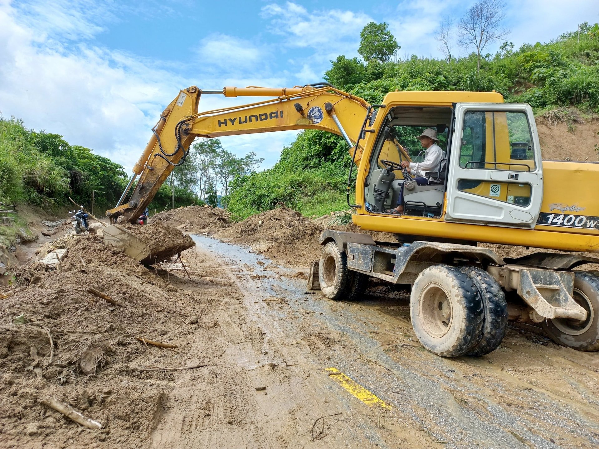
At the beginning of the 2025 rainy season, the slope at km84+500 - km84+700 (Phuoc Hiep commune) collapsed again, although the hill's roof had been reinforced with cement concrete. On September 28, heavy rain due to the impact of storm No. 10 caused the slope at km84+500 - km84+700 of this national highway to collapse.
The above situation has been happening for many years, threatening the safety of road users. The investor of the Highway 14E Improvement and Upgrade Project has directed the design consultant to survey and develop a plan to stabilize this positive slope.
But from design to construction, verifying actual stability takes time, so the risk of landslides on this route is still latent.
Landslides on the positive slope, or road cuts due to landslides on the negative slope of National Highway 40B may recur in the section passing through Bac Tra My and Nam Tra My (old). Meanwhile, the route connecting to Quang Ngai province, National Highway 24C through the area of Bac Tra My (old), is often congested during the rainy season due to landslides. On National Highway 14G, the risk of landslides is always present, especially paying attention to the section passing through Hoa Vang and Song Kon communes.
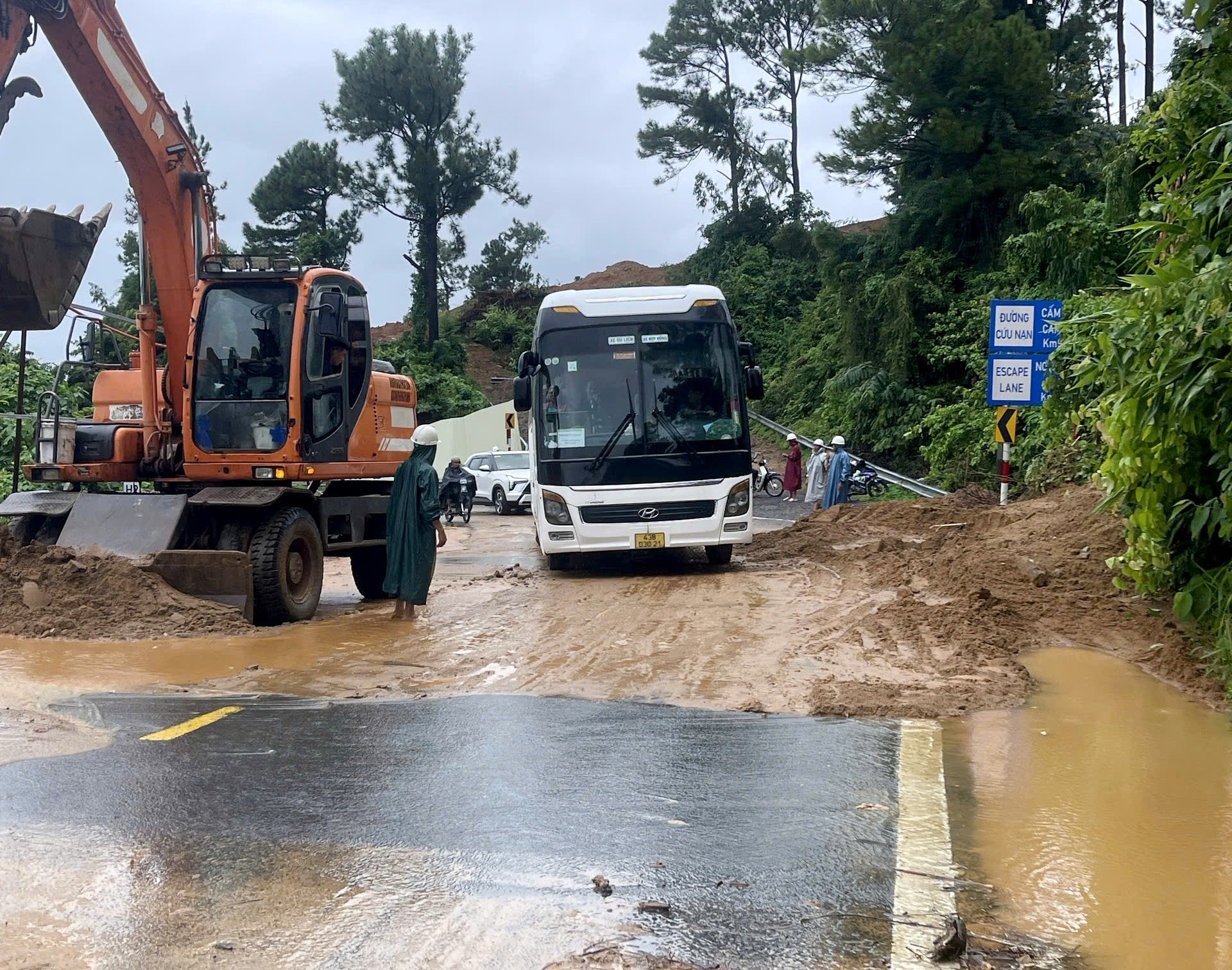
As usual, during the rainy season, the DT606 route through the old Tay Giang area is jammed due to landslides. During the recent rains caused by storm No. 10, rocks and soil from the positive slopes at 3 locations of DT606, in the Hung Son commune area, fell onto the road, causing traffic jams.
In previous years, landslides occurred almost everywhere on this road during the rainy season, especially the section connecting from Ho Chi Minh Road to the center of Tay Giang commune today. The section mentioned above has never been upgraded or expanded comprehensively, so the risk of landslides during the rainy season is very high.
On the national highways, the risk of landslides is lurking in the sections that have not been upgraded or expanded, such as Highway 611, Highway 614, Highway 615, Highway 615B, Highway 617... The risk of an accident is even greater when people arbitrarily dig roads to exploit acacia trees, accidentally creating artificial streams for rainwater to flow down, carrying soil and rocks.
One location on the DT611 route that people need to pay attention to is the section passing through Le Pass, in Que Son commune. If the rain continues for a long time, the slope in this area is vulnerable, posing a danger to road users.
Although it has been upgraded and expanded, road users need to be careful when traveling on DT609, the section passing through Thuong Duc and Ben Hien communes during the rainy season. Previously, the slope was stable but landslides often occurred, even blocking the road due to floods.
Now, the new road axis has just been upgraded and expanded, so the durability and stability of the slope cannot be assessed immediately but needs time to be verified. In fact, the positive slope in the western section of Dong Giang Heaven Gate Eco- tourism Area (Ben Hien commune) has collapsed many times in the rainy season of 2023 and 2024.
During the rainy season, the road surface will be slippery, potholes “hiding” under stagnant water are also a high risk of causing traffic accidents. If flooding occurs, some national highways will be cut off due to water flowing through.
Typically, on the DT609B route (Dai Loc commune), the water flowing across Dai Hiep bridge, the area of Dai An - Dai Hoa (old) empty fields, has swept away many people. Therefore, people need to be extremely careful when traveling, especially choosing a safe time.
The risk of landslides on the East Truong Son road and the Ho Chi Minh road is always present. In Dong Giang commune, there is a slope on the left side of the Ho Chi Minh road, in the old Za Hung commune, that collapses every rainy season.
Meanwhile, many national highways are at risk of flooding, such as National Highway 1 through the communes of Thang Dien, Tay Ho, and Chien Dan; or National Highway 14H through Que Phuoc commune. The slope of the road through Hai Van Pass (in Hai Van ward) is also often eroded, threatening the lives of road users.
Source: https://baodanang.vn/nguy-co-sat-lo-ach-tac-tren-nhieu-tuyen-giao-thong-3305788.html
![[Photo] Dan Mountain Ginseng, a precious gift from nature to Kinh Bac land](/_next/image?url=https%3A%2F%2Fvphoto.vietnam.vn%2Fthumb%2F1200x675%2Fvietnam%2Fresource%2FIMAGE%2F2025%2F11%2F30%2F1764493588163_ndo_br_anh-longform-jpg.webp&w=3840&q=75)


Comment (0)