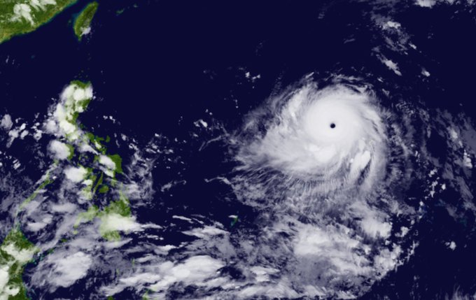
According to the Joint Typhoon Warning Center (JTWC - USA) on May 26, after strengthening to level 5 in the Atlantic Ocean, Mawar has become the strongest storm globally since the beginning of the year.
As it moved towards the Philippines, Mawar brought wind gusts of up to 280 km/h. In its latest update, the Philippine National Weather Service said the storm had strengthened as it moved west across the Philippine Sea after becoming a super typhoon.
Weather experts also confirmed to The Independent that Mawar's strength has surpassed any previous storms in 2022.

Typhoon Mawar has strengthened to a Category 5 storm in the Atlantic Ocean as it moves towards the Philippines. Photo: Twitter
Previously, on May 24, Mawar weakened briefly as it passed over Guam Island in the US, causing heavy rain and strong winds that uprooted trees and blew away roofs and cars.
The Guam Electric Power Authority said nearly the entire island of 52,000 homes and businesses were without power. There were no reports of fatalities, but Mawar caused extensive damage.
CNN quoted Governor Lou Leon Guerrero as saying that much of Guam was damaged. Many local residents had no electricity or clean water.
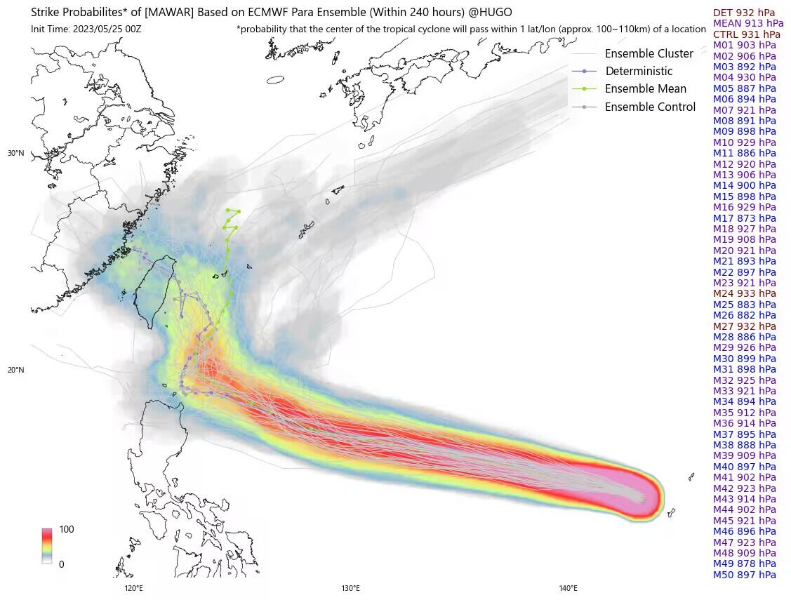
It is forecasted that in the coming days, the possibility of Mawar landing in China is increasing.
If Mawar makes landfall in China's Fujian province, it will become the first typhoon on record to hit the province in May, Jim Yang, a researcher at the China Meteorological Association (CMA), wrote on Twitter.
In addition, if Mawar makes landfall in Taiwan (China), it will also become the first typhoon to hit Taiwan in May since 33 years ago. Researcher Jim Yang added that Mawar will maintain its strength for 2-3 days.

Super Typhoon Mawar is likely to make landfall in China. Photo: Twitter
Source


![[Photo] Ho Chi Minh City holds funeral for former President Tran Duc Luong](https://vphoto.vietnam.vn/thumb/1200x675/vietnam/resource/IMAGE/2025/5/24/9c1858ebd3d04170b6cef2e6bcb2019e)


![[Photo] The Government Standing Committee works with ministries and branches on the real estate market situation.](https://vphoto.vietnam.vn/thumb/1200x675/vietnam/resource/IMAGE/2025/5/24/e9b5bc2313d14c9499b8c9b83226adba)


![[Photo] Party and State leaders visit former President Tran Duc Luong](https://vphoto.vietnam.vn/thumb/1200x675/vietnam/resource/IMAGE/2025/5/24/960db9b19102400e8df68d5a6caadcf6)


Comment (0)