

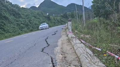
There are many causes of subsidence such as weak geology, too much traffic. Along with that is the rapid urbanization, the situation of exploiting groundwater beyond the allowable limit, or due to concreting which reduces the ability to replenish rainwater for groundwater, causing the groundwater level to lower, causing the phenomenon of ground subsidence.
In order to prevent the risk of land subsidence, the City has paid attention very early. In 2010, the City implemented the project "Monitoring ground deformation in the Ho Chi Minh City area using differential INSAR technique" (analyzing SPOT-5 optical satellite images and RADA satellite images).

As a result of the project, the City has established a Land Subsidence Zoning Map for the Ho Chi Minh City area and built two long-term monitoring stations for ground subsidence.
At the end of 2019, the City area continued to experience land subsidence, with the largest subsidence area measured at 31 mm.
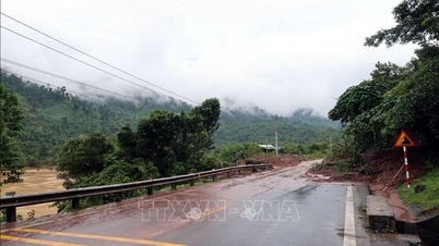
In addition, according to a recent survey by the Japan International Cooperation Agency (JICA), ground subsidence in Ho Chi Minh City has been occurring continuously since 1990, with the cumulative subsidence estimated at about 100cm. The current subsidence rate is about 2-5cm per year.
Particularly in areas with concentrated commercial buildings, the subsidence rate is about 7-8cm per year. The rate of land subsidence is about twice as high as sea level rise (about 1cm per year). Land subsidence combined with high tides and rising sea levels makes Ho Chi Minh City increasingly "sinking" and directly affects the long-term development of Ho Chi Minh City in the context of adapting to climate change.

The Ministry of Agriculture and Environment is implementing the project "Modernizing the national elevation system", aiming to build a long-term stable high-speed system and determine the average sea level. The project will be implemented from 2022 to 2025, with the construction of 4 century elevation markers at Ho Chi Minh City National University, Nhuan Duc Commune People's Committee, Lang Le Cultural Area and the Children's House in Can Gio Commune, along with 2 border markers in Dong Nai and Long An provinces. The hydrometric measurement work was completed in 2023, the next measurement and monitoring cycles will take place in 2024 and 2025, after which the data will be handed over to localities for exploitation and use.
The representative of the Department of Agriculture and Environment said that the Department of Science and Technology is also implementing the task of "Simulating and predicting ground deformation in the Ho Chi Minh City area", along with the "Technical support project to promote solutions to respond to the problem of ground subsidence in Ho Chi Minh City", which will be implemented to comprehensively assess and identify the main causes of ground subsidence in the city, from which there will be a comprehensive solution to reduce ground subsidence in the city.
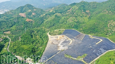
In the current period, to monitor, evaluate and limit ground subsidence, the City is implementing groups of solutions such as: Continuing to monitor ground deformation at 2 stations in Tan Tao Industrial Park and Binh Hung commune combined with the use of differential INSAR technique. At the same time, implementing the reduction of groundwater exploitation in the city.
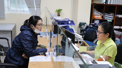
The city has issued a list and map of restricted areas for groundwater exploitation, which is an important legal basis for the city to consider and grant licenses for effective groundwater exploitation associated with ground subsidence protection work in the coming years.
To effectively respond to subsidence, the City needs to build a system to regularly monitor and forecast ground subsidence, applying modern technology to support the government in making decisions appropriate to natural conditions and sustainable development.
Source: https://www.sggp.org.vn/so-nong-nghiep-moi-truong-tphcm-neu-ly-do-thanh-pho-dang-lun-nhanh-post823320.html


![[Photo] Deep sea sand deposits, ancient wooden ship An Bang faces the risk of being buried again](https://vphoto.vietnam.vn/thumb/1200x675/vietnam/resource/IMAGE/2025/11/13/1763033175715_ndo_br_thuyen-1-jpg.webp)


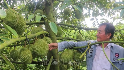


![Dong Nai OCOP transition: [Article 3] Linking tourism with OCOP product consumption](https://vphoto.vietnam.vn/thumb/402x226/vietnam/resource/IMAGE/2025/11/10/1762739199309_1324-2740-7_n-162543_981.jpeg)


Comment (0)