
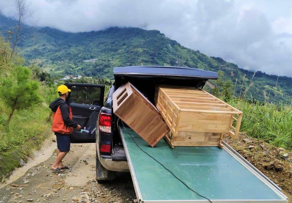
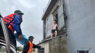
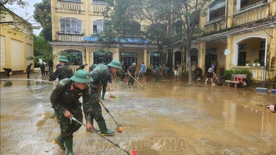
* On November 3, in Tra Linh commune , the weather had just cleared up, teachers and parents of students at Tak Ngo school, part of Ngoc Linh Primary Boarding School for Ethnic Minorities, urgently cleaned up and moved furniture, tables, chairs and teaching equipment out of the landslide area.
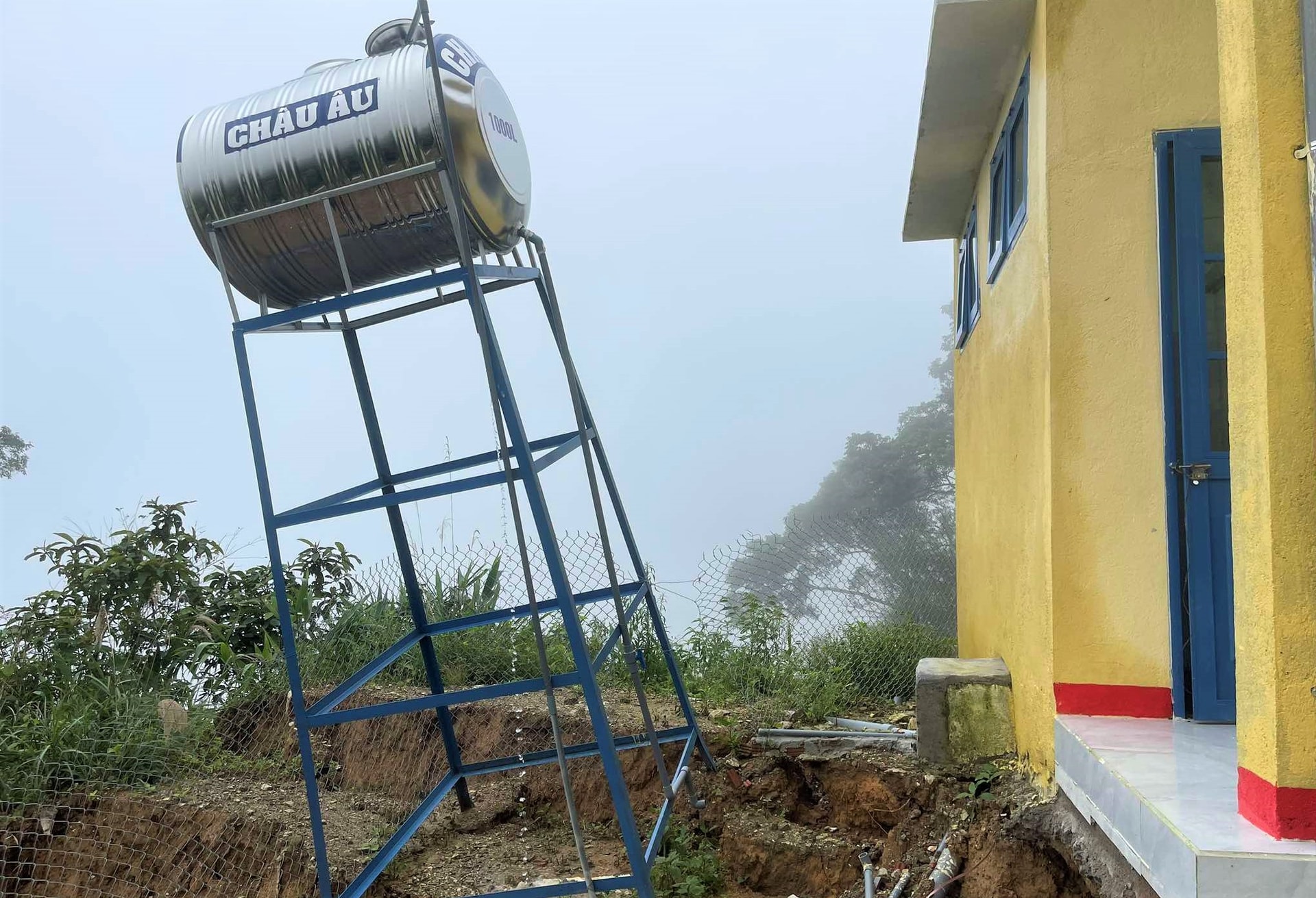
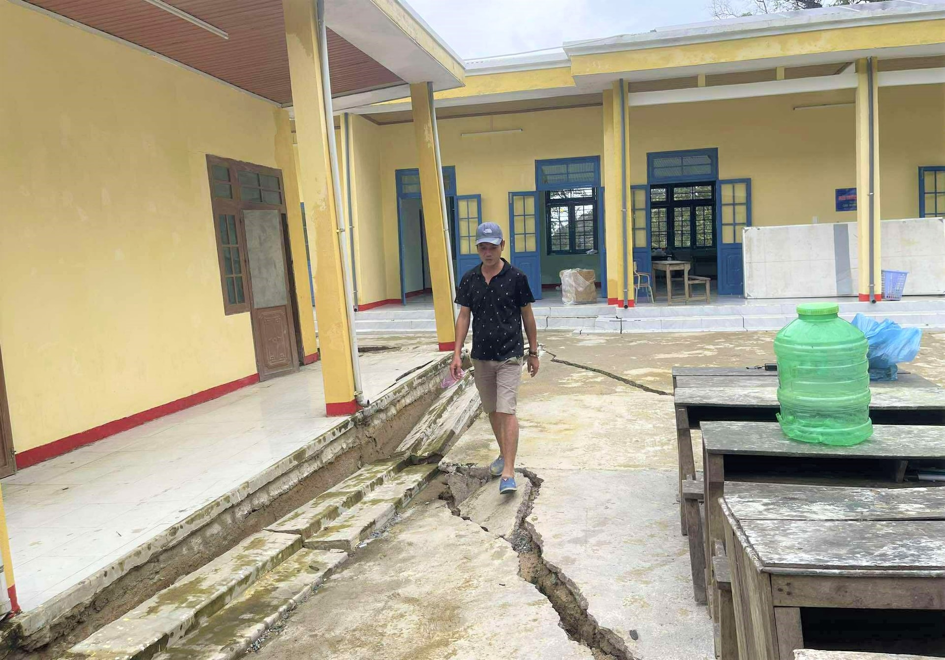
Teacher Nguyen Tran Vy, Principal of Ngoc Linh Primary Boarding School for Ethnic Minorities, said that in recent days, prolonged heavy rains have caused the entire hill of the school to slide down, with many cracks appearing along the foundation, threatening to collapse at any time.
Due to the serious landslide, taking advantage of the temporarily clear weather, the school mobilized staff, teachers and parents to transport all equipment, tables, chairs and learning materials to the village cultural house for preservation, to avoid mold and damage.
Mr. Vy said that currently the road leading to the school is not completely open, cars cannot access. Therefore, transportation must be done by motorbike and human power, which takes a lot of time and effort.
Based on the current situation, the school has determined that Tak Ngo school is no longer safe enough to continue teaching. In the coming time, all students of the school will be arranged to study at the boarding school in the commune center, at the main campus of Ngoc Linh Primary Boarding School for Ethnic Minorities. (ALANG NGUOC)
[ VIDEO ] - Teachers and parents move property from Tak Ngo school:
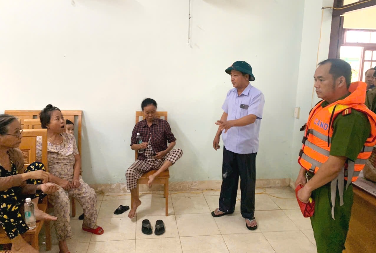
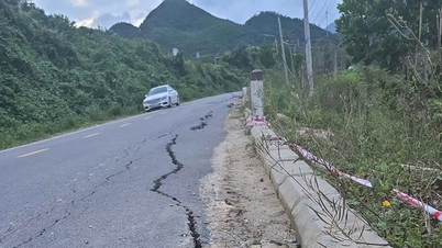
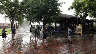
* The same morning, residents of Que Phuoc commune discovered a large crack on a high hill. Local authorities urgently evacuated 17 households to safety.
.jpg)
A large crack was discovered on a high hillside in Duoi hamlet (Xuan Hoa village) measuring more than 50m long, over 1m wide, and about 2m deep.
Leaders of Que Phuoc Commune People's Committee and local militia forces quickly arrived at the scene to inspect and mobilize, urgently evacuate 17 households with 30 people to a safe place at the village cultural house, school...
The evacuation was carried out urgently, striving to be completed before 5 p.m. on November 3, to ensure absolute safety for the people. Previously, during the recent flood, this area also suffered landslides, causing damage to many houses and people's property.
Mr. Nguyen Van Lanh, Vice Chairman of Que Phuoc Commune People's Committee, said that in the face of complicated developments of floods and storm No. 13, the locality has deployed forces on duty 24/7 in areas at risk of landslides. At the same time, it is encouraging people to proactively move to safe places and not be subjective in any situation.
The locality is continuing to review vulnerable points, prepare means, materials and response plans to protect people's lives and property. (MINH THONG)
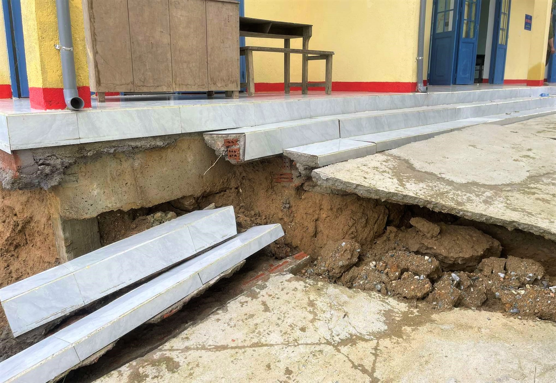
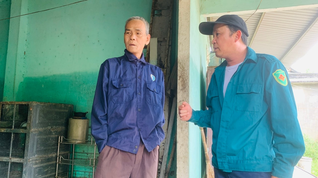
* On the morning of November 3, leaders of Dai Loc commune inspected the negative slope of the Northern Mountainous Region General Hospital of Quang Nam, which is at high risk of landslides due to the impact of rain and floods.
.jpg)
The location next to the negative slope of the Northern Mountainous Region General Hospital of Quang Nam is the area of solidarity group No. 4 (Phuoc My village, Dai Loc commune), where about 10 households are living. Behind the houses of the households is a high hill, within the scope of the hospital.
Through a field inspection, Secretary of the Party Committee of Dai Loc commune Nguyen Hao said that the negative slope bank had cracks and subsidence of the concrete embankment, threatening the safety of people's lives and property.
The Party Committee leaders of the commune propagandized and mobilized, 10 households with 45 people here agreed to evacuate to Administrative Area No. 2.
Mr. Huynh Hung Quang, Vice Chairman of Dai Loc Commune People's Committee, said that the commune's functional forces will support people to move their assets to a safe place. The locality will support food, necessary necessities, and drinking water so that people can feel secure while taking shelter. (CONG TU)
* On the same morning, Nong Son commune authorities promptly transported two cases to a higher-level hospital for treatment, in conditions where water was still deep in many areas and traffic was cut off.

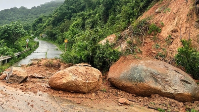
Mr. Tran Van Doan, Vice Chairman of Nong Son Commune People's Committee, said that on the morning of November 3, more landslides continued to appear in the area of Phuong Ranh Pass, on the route from Nong Son to Thu Bon Commune. Up to this point, the whole commune has recorded more than 30 large and small landslides, many of which have fallen onto the road, causing local traffic disruption.
Routes DT611 (section through Le Pass), DH4, National Highway 14H (section Trung Phuoc - Trung An) and Dai Binh area were all seriously affected. Currently, there are 4 households that cannot be resettled on the spot due to high risk of landslides. A total of 1,536 households in the area were evacuated to safety.
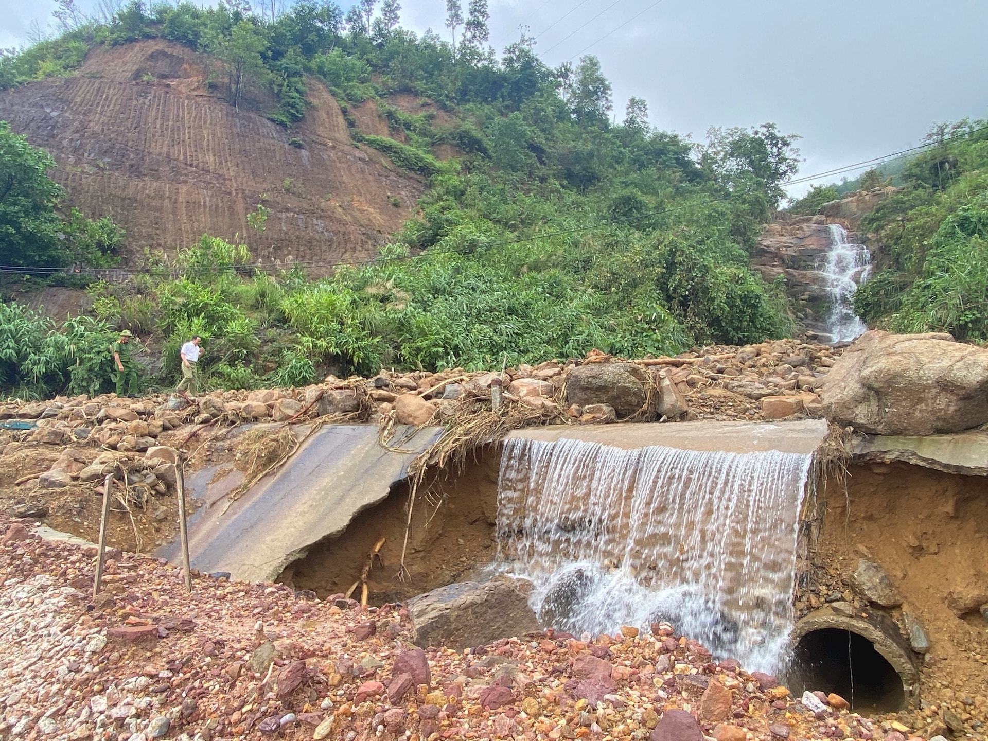
After many days of heavy rain, the soil was soaked with water, combined with the hydroelectric reservoirs regulating the water, causing many areas in Nong Son to continue to be isolated. In just one week, the locality suffered widespread flooding three times.

Currently, the commune authorities are urgently inspecting, putting up warning signs and barricades in the landslide area. At the same time, they are supporting people in cleaning up and clearing the flow.
The commune government continues to review the damage, mobilize resources and propose financial support to quickly overcome the consequences of natural disasters, helping people quickly stabilize their lives. (THU PHUONG)
Source: https://baodanang.vn/tiep-tuc-so-tan-hang-tram-ho-dan-va-cac-diem-truong-mien-nui-truoc-nguy-co-sat-lo-cao-3309069.html


![[Photo] Panorama of the Patriotic Emulation Congress of Nhan Dan Newspaper for the period 2025-2030](https://vphoto.vietnam.vn/thumb/1200x675/vietnam/resource/IMAGE/2025/11/04/1762252775462_ndo_br_dhthiduayeuncbaond-6125-jpg.webp)


![[Photo] Opening of the 14th Conference of the 13th Party Central Committee](https://vphoto.vietnam.vn/thumb/1200x675/vietnam/resource/IMAGE/2025/11/05/1762310995216_a5-bnd-5742-5255-jpg.webp)


Comment (0)