
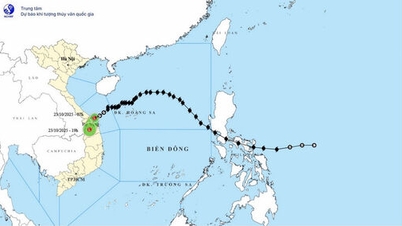
At 1 a.m. the same day, the center of the low pressure area was at about 17.4 degrees North latitude, 117.5 degrees East longitude, the strongest wind speed decreased to below level 6 (below 39 km/h). In the next 12 hours, this low pressure area will continue to move southwest and gradually dissipate.
Due to the influence of the weakened low pressure circulation combined with the strengthening cold air, strong winds were recorded at coastal stations. Specifically, Bach Long Vi station had strong northeast winds of level 6 - 7, gusts of level 9; Con Co station had winds of level 6, gusts of level 8. It is forecasted that during the day and night of October 24, the North East Sea area (including Hoang Sa sea area) will have strong northeast winds of level 6 - 7, gusts of level 8 - 9; waves 3.0 - 5.0m high, rough seas.
The sea area from South Quang Tri to Quang Ngai has Northeast wind level 6, gusting to level 8, waves 2.5 - 4.5m high, rough sea. The Gulf of Tonkin has Northeast wind level 5, sometimes level 6, gusting to level 7 - 8; waves 2.0 - 3.5m high, rough sea. In addition, the area from South Quang Tri to Ca Mau, from Ca Mau to Kien Giang , the Gulf of Thailand, the North and the middle of the East Sea (including Hoang Sa) as well as the South of the East Sea (including Truong Sa) has scattered showers and thunderstorms; in thunderstorms there is a possibility of tornadoes, strong gusts of level 6 - 7, waves over 2.0m high.
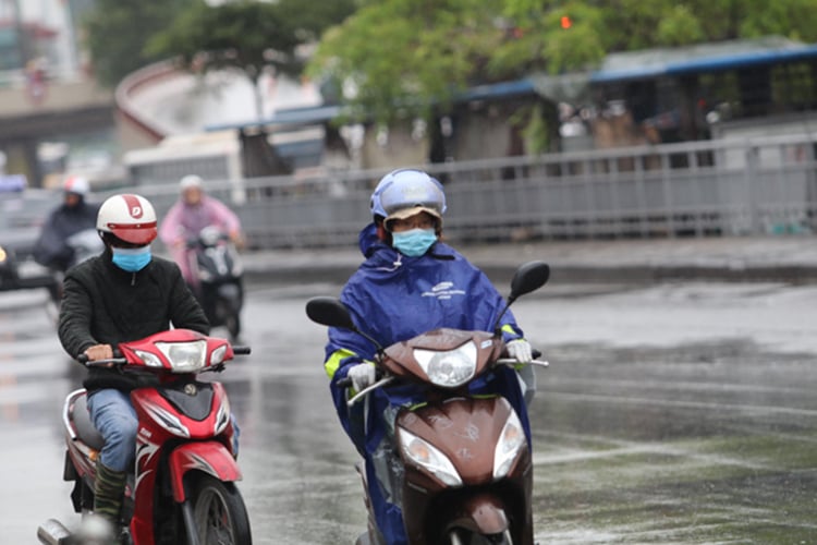
On land, the North, Thanh Hoa and Nghe An will have rain in some places on October 24, especially in the plains and coastal areas, it will rain at night and early morning, it will be cold, and it will be cold during the day. The provinces from Ha Tinh to Quang Ngai will have moderate rain, heavy rain, locally very heavy rain and thunderstorms, mainly concentrated in coastal areas. The South will have moderate rain, heavy rain, some places very heavy rain; other areas will have showers and thunderstorms in some places, the rain will increase in the afternoon and at night.
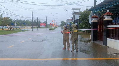
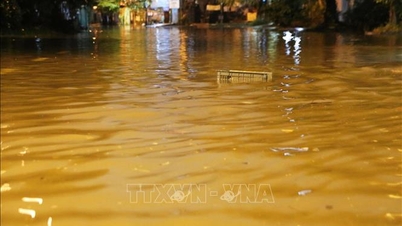
The meteorological agency warns that heavy rains pose a risk of flooding in low-lying areas, urban areas and industrial zones; flash floods on small rivers and streams; and landslides in mountainous areas. During thunderstorms, be on guard against tornadoes, lightning, hail and strong gusts of wind.
Weather forecast for regions across the country:
Hanoi is cloudy, with occasional rain in the morning and no rain later. Northeast wind level 2-3. Cold in the early morning and at night, cold during the day. Lowest temperature 19-21 degrees Celsius. Highest temperature 22-24 degrees Celsius.
The Northwestern provinces are cloudy with some rain. Light wind. Cold in the early morning and at night. Lowest temperature 18-21 degrees Celsius, some places below 17 degrees Celsius. Highest temperature 24-27 degrees Celsius, some places above 27 degrees Celsius.
The Northeastern region is cloudy, with scattered rain in the morning and rain in some places later. Northeast wind level 2-3, coastal areas level 3-4. Early morning and night are cold, daytime is cold. Lowest temperature 18-21 degrees Celsius, in mountainous areas below 17 degrees Celsius. Highest temperature 21-24 degrees Celsius, in some places above 24 degrees Celsius.
Provinces from Thanh Hoa to Hue are cloudy, with scattered rain in the North, locally heavy rain in some places; in the South (South Quang Tri to Hue City) there is moderate rain, heavy rain, locally very heavy rain and thunderstorms. North to northwest wind level 2 - 3. Early morning and night is cold, day is cold. Lowest temperature 18 - 21 degrees Celsius. Highest temperature 21 - 24 degrees Celsius, some places above 24 degrees Celsius.
The North Central Coast region is cloudy with moderate to heavy rain, locally very heavy rain and thunderstorms; the South is cloudy with scattered showers and thunderstorms, locally heavy to very heavy rain. Northeast wind level 2 - 3. During thunderstorms, there is a possibility of tornadoes, lightning and strong gusts. The lowest temperature is 23 - 26 degrees Celsius. The highest temperature in the North is 26 - 29 degrees Celsius, in the South is 29 - 31 degrees Celsius.
The Central Highlands is cloudy with scattered showers and thunderstorms, with some places experiencing heavy rain. Northeast wind level 2-3. During thunderstorms, there is a possibility of tornadoes, lightning, hail and strong gusts of wind. The lowest temperature is 19-22 degrees Celsius. The highest temperature is 27-30 degrees Celsius, with some places above 30 degrees Celsius.
The South is cloudy with scattered showers and thunderstorms, with some places experiencing heavy rain. Northeast to east winds at level 2-3. During thunderstorms, there is a possibility of tornadoes, lightning, hail and strong gusts of wind. Lowest temperature 23-26 degrees Celsius. Highest temperature 30-33 degrees Celsius, with some places above 33 degrees Celsius.
Ho Chi Minh City is cloudy with scattered showers and thunderstorms, with some heavy rain in some places. Northeast to east winds at level 2-3. During thunderstorms, there is a possibility of tornadoes, lightning and strong gusts of wind. Lowest temperature 24-26 degrees Celsius. Highest temperature 31-33 degrees Celsius.
Source: https://baotintuc.vn/xa-hoi/thoi-tiet-ngay-2410-ap-thap-nhiet-doi-suy-yeu-mien-trung-va-nam-bo-tiep-tuc-mua-lon-20251024060338351.htm
![[Photo] President Luong Cuong chaired the welcoming ceremony and held talks with United Nations Secretary-General Antonio Guterres](https://vphoto.vietnam.vn/thumb/1200x675/vietnam/resource/IMAGE/2025/10/24/1761304699186_ndo_br_1-jpg.webp)

![[Photo] Prime Minister Pham Minh Chinh chairs conference on breakthrough solutions for social housing development](https://vphoto.vietnam.vn/thumb/1200x675/vietnam/resource/IMAGE/2025/10/24/1761294193033_dsc-0146-7834-jpg.webp)

![[Photo] Solemn funeral of former Vice Chairman of the Council of Ministers Tran Phuong](https://vphoto.vietnam.vn/thumb/1200x675/vietnam/resource/IMAGE/2025/10/24/1761295093441_tang-le-tran-phuong-1998-4576-jpg.webp)
![[Photo] Prime Minister Pham Minh Chinh and South African President Matamela Cyril Ramaphosa attend the business forum](https://vphoto.vietnam.vn/thumb/1200x675/vietnam/resource/IMAGE/2025/10/24/1761302295638_dsc-0409-jpg.webp)


Comment (0)