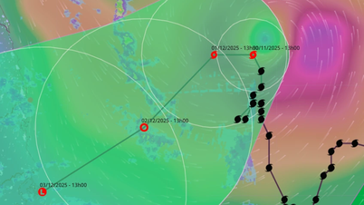
The National Center for Hydro-Meteorological Forecasting said that in the next 24 hours, the tropical depression will mainly move in the east-northeast direction at a speed of about 15km/h. After that, it will likely weaken and dissipate in the eastern sea area of the southern East Sea and will not affect the mainland of the South.
Regarding the “strange” tropical depression rising from Malaysia, according to the National Center for Hydro-Meteorological Forecasting, this cyclone originated from the remnants of storm Senyar, moving from the Indian Ocean, through Malaysia to the northwest Pacific Ocean. In the past, there have been tropical depressions or storms moving from the West Pacific Ocean to the Indian Ocean, but the opposite direction has never been recorded in meteorological history.
Although it does not affect Vietnam, we need to be extremely cautious about the impact at sea due to strong winds of level 6-7, gusts of level 9, waves 2.5-4m high, and rough seas in the southern East Sea (the sea area west of Truong Sa special zone).
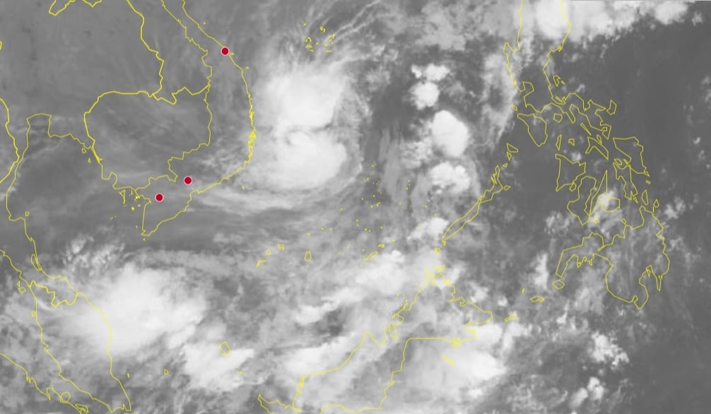
Satellite cloud images show that storm No. 15 and a new tropical depression are affecting the weather in the central and southern seas. Photo: hymetnet .
Regarding storm No. 15, it is forecasted that today and tomorrow (November 30), the storm will continue to move north and start to change direction west from December 1. The moving speed will only be about 3-5km/h and the intensity will gradually weaken.
From December 2, the storm will move west-southwest, then move south. It is likely to weaken into a tropical depression/low pressure before moving inland to the Central region.
Storm No. 15 is forecast to cause strong winds of level 6-7, then increasing to level 8, gusts of level 9-10, waves 4-6m high, rough seas in the sea area from Gia Lai to Khanh Hoa. The storm causes thunderstorms, strong gusts of wind and large waves, posing a danger to ships.
On land from December 2-3, the area from Hue City to Khanh Hoa (focusing on the coast) will have moderate to heavy rain (rainfall in 2 days is about 70-150mm).
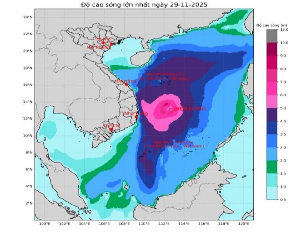
Forecast of the highest wave height at sea on November 29. Photo: NCHMF .
According to a quick report from the Border Guard Command, as of 4:30 p.m. on November 28, the forces had notified, counted, and instructed 48,380 vehicles/246,758 workers. The vehicles have received warning information, and currently there are no vehicles operating in the danger zone.
Dak Lak province has banned the sea since the morning of November 26, Khanh Hoa and Lam Dong have banned the sea since the morning of November 28.
Source: https://nongnghiepmoitruong.vn/ap-thap-nhiet-doi-la-vao-bien-dong-bao-so-15-gay-song-cao-8m-d787188.html


![[Photo] Dan Mountain Ginseng, a precious gift from nature to Kinh Bac land](/_next/image?url=https%3A%2F%2Fvphoto.vietnam.vn%2Fthumb%2F1200x675%2Fvietnam%2Fresource%2FIMAGE%2F2025%2F11%2F30%2F1764493588163_ndo_br_anh-longform-jpg.webp&w=3840&q=75)












Comment (0)