
")
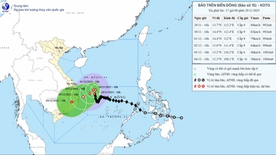
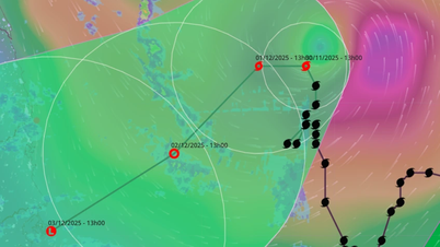
According to the National Center for Hydro-Meteorological Forecasting, at 1:00 p.m. on August 28, the center of the tropical depression was located at about 15.3 degrees north latitude; 115.7 degrees east longitude in the northern East Sea, about 420 km east-southeast of Hoang Sa special zone. The strongest wind near the center of the tropical depression was level 6-7 (39-61 km/h), gusting to level 9. Moving southwest at a speed of 10-15 km/h.
Forecast, at 1:00 p.m. on August 29, the center of the tropical depression is at about 16.7 degrees north latitude; 112.3 degrees east longitude, in the Hoang Sa special zone sea area. The strongest wind near the center of the tropical depression is at level 7, gusting to level 9. The northern East Sea area (including Hoang Sa special zone), the northern part of the central East Sea area is affected by level 3 natural disaster risk.
In the next 24 to 36 hours, the tropical depression will continue to move west-northwest at a speed of about 20km/h, and is likely to strengthen into a storm. If it strengthens into a storm, this will be the 6th storm in the East Sea this year.
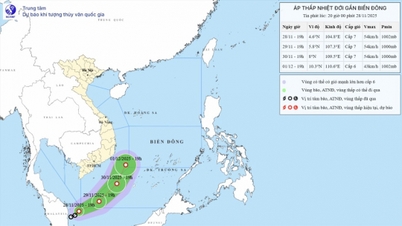
At 1:00 p.m. on August 30, the center of the tropical depression was located right on the sea area of provinces from Nghe An to Da Nang , the storm intensity remained at level 8, gusting to level 10.
From the next 48 to 72 hours, the tropical depression will continue to move mainly westward, about 20km per hour and gradually weaken.
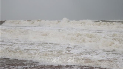
Due to the influence of the tropical depression, at sea, the northern East Sea area (including Hoang Sa special zone) and the sea area north of the central East Sea area have strong winds of level 6-7, gusting to level 9; waves 2-4m high, rough seas.
Vessels operating in the above mentioned dangerous areas are susceptible to the impact of storms, whirlwinds, strong winds and large waves.
Source: https://baolaocai.vn/ap-thap-nhiet-doi-tren-bien-dong-co-kha-nang-manh-len-thanh-bao-do-bo-vao-mien-trung-post880727.html


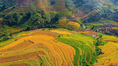
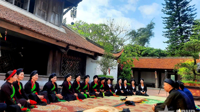
![[Photo] Dan Mountain Ginseng, a precious gift from nature to Kinh Bac land](/_next/image?url=https%3A%2F%2Fvphoto.vietnam.vn%2Fthumb%2F1200x675%2Fvietnam%2Fresource%2FIMAGE%2F2025%2F11%2F30%2F1764493588163_ndo_br_anh-longform-jpg.webp&w=3840&q=75)


Comment (0)