
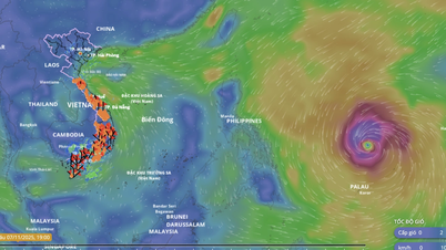
It is forecasted that by around September 22, the storm will likely move into the East Sea and directly affect Vietnam's mainland, causing strong winds and heavy rain in the Northern region and the Central provinces from Thanh Hoa to Hue.
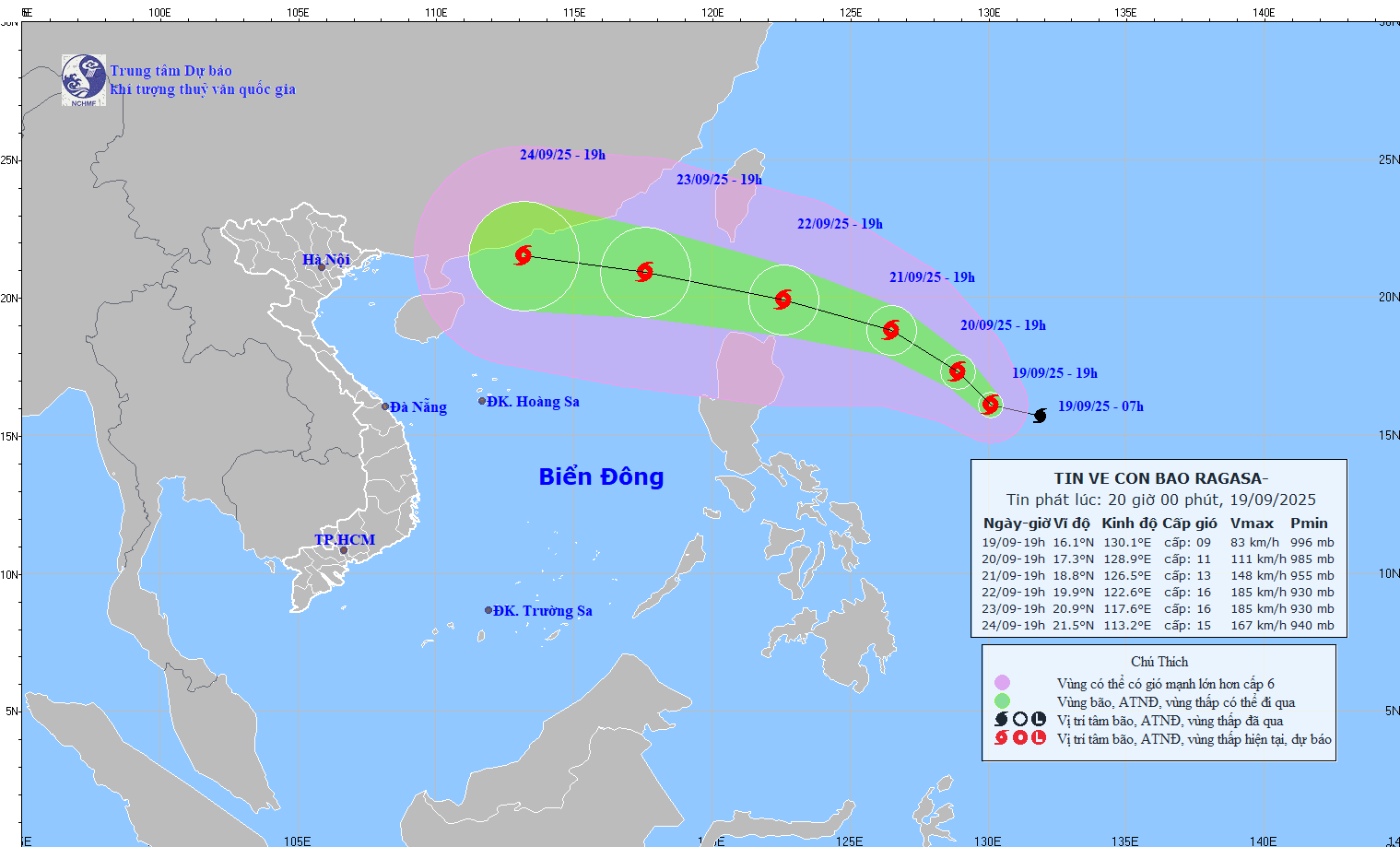
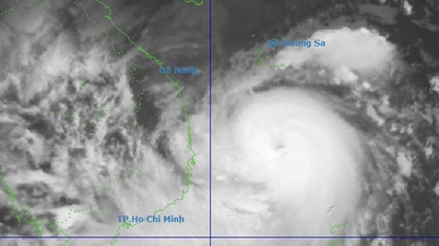
According to the National Center for Hydro-Meteorological Forecasting, at 7:00 p.m. on September 19, the center of storm RAGASA was at about 16.1 degrees North latitude; 130.1 degrees East longitude, about 820 km east of Luzon Island (Philippines). The strongest wind near the center of the storm was level 9 (75 - 88 km/h), gusting to level 11. Moving in the West Northwest direction at a speed of about 15 km/h.
It is forecasted that by 7:00 p.m. on September 20, the storm will move northwest at a speed of about 10 km/hour, with the possibility of strengthening further. The storm will be located at 17.3N - 128.9E; about 680 km east of Luzon Island (Philippines), with a storm intensity of level 11, gusting to level 13.
At 7:00 p.m. on September 21, the storm moved northwest at a speed of 10-15 km/hour, continuing to strengthen. The storm was located at 18.8N - 126.5E; about 480 km east of Luzon Island (Philippines), with a storm intensity of level 13, gusting to level 16.
Forecast at around 7pm on September 22, the storm will move in the West Northwest direction, speed 15 - 20 km/h, continue to strengthen, storm position at 19.9N - 122.6E; about 150km North Northeast of Luzon Island (Philippines), storm intensity level 15 - 16, gusting above level 17.
From the next 72 to 120 hours, the storm will move mainly in the West Northwest direction, 20 - 25 km per hour, with little change in intensity.
Due to the influence of storm RAGASA's circulation from the afternoon and night of September 22, the eastern sea area of the North East Sea will have strong winds of level 6 - 7, then increasing to level 8 - 9; from September 23, the North East Sea area (including Hoang Sa special zone) may be affected by storm RAGASA with the strongest intensity of up to level 14 - 16, gusts above level 17, waves over 10m high, rough seas, especially dangerous for ships operating in the North and middle of the East Sea.
Experts say that around September 22, the storm is likely to move into the East Sea and directly affect Vietnam's mainland from September 24 to 26. This is a strong storm, capable of causing strong winds and heavy rain in the Northern region and the Central provinces from Thanh Hoa to Hue .
Along with that, the National Center for Hydro-Meteorological Forecasting also issued a bulletin on storm No. 8, accordingly, at 7:00 p.m. on September 19, the center of the storm was at about 23.1 degrees North latitude; 115.0 degrees East longitude, on the mainland south of Guangdong province (China). The strongest wind near the center of the storm was level 8 (62 - 74 km/h), gusting to level 10. Moving northwest, speed 5 - 10 km/h.
At 7:00 a.m. on September 20, the storm moved in the West-Northwest direction at a speed of 10-15 km/h, gradually weakening into a tropical depression and then a low-pressure area, located at 23.3N-113.7E; on the mainland south of Guangdong province (China), the storm intensity was below level 6, the natural disaster risk level was level 3, the affected area was the northern sea area of the North East Sea.
Due to the influence of storm No. 8, the northern sea area of the North East Sea has strong winds of level 6 - 7, gusts of level 9; the area near the storm center has strong winds of level 8, gusts of level 10, waves 3 - 4.5m high. Rough seas.
Vessels operating in the above mentioned dangerous areas are susceptible to the impact of storms, whirlwinds, strong winds and large waves.
Source: https://baotintuc.vn/xa-hoi/bao-ragasa-rat-manh-tang-cap-nhanh-huong-vao-bien-dong-20250919213136470.htm
![[Photo] Da Nang: Hundreds of people join hands to clean up a vital tourist route after storm No. 13](https://vphoto.vietnam.vn/thumb/1200x675/vietnam/resource/IMAGE/2025/11/07/1762491638903_image-3-1353-jpg.webp)


Comment (0)