
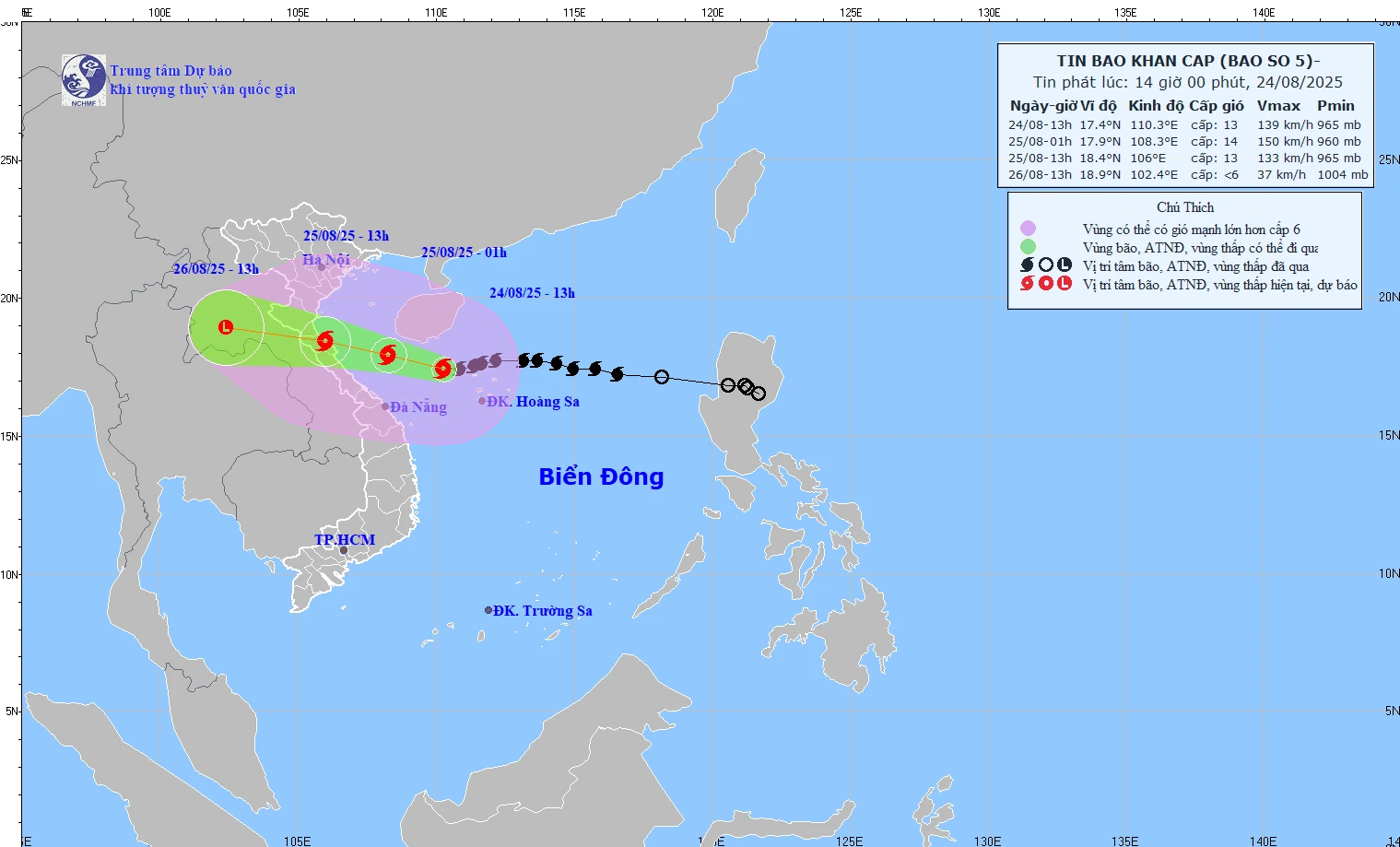
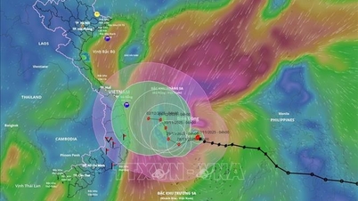
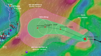
Forecast map of storm No. 5's path at 2:00 p.m. on August 24, 2025.
According to the National Center for Hydro-Meteorological Forecasting, at 1 p.m. on August 24, the center of storm No. 5 was at 17.4 degrees North latitude, 110.3 degrees East longitude, in the sea northwest of Hoang Sa special zone; 520km from Nghe An, 500km from Ha Tinh , and 430km from Quang Tri. The strongest wind was level 13 (134-149km/h), gusting to level 15.
The storm is moving west at 20km/h and is likely to strengthen.
Storm forecast :
At 1:00 a.m. on August 25 : the storm center was at 17.9 degrees North latitude, 108.3 degrees East longitude (South of Bac Bo Gulf), 260km from Nghe An , 230km from Ha Tinh, and 180km from North Quang Tri. Wind level 13-14, gust level 16.
Level 3 risk warning in the western sea area of the North East Sea, Gulf of Tonkin, sea area of South Quang Tri - Hue); level 4 in the coastal area of Thanh Hoa - Quang Tri.
At 1:00 p.m. on August 25 : the storm center is at 18.4 degrees North latitude, 106.0 degrees East longitude (coastal Thanh Hoa - Quang Tri). Wind level 12-13, gust level 15.
Level 3 risk warning in the western sea area of the North East Sea, Gulf of Tonkin, South Quang Tri-Hue sea); level 4 in the coastal area of Thanh Hoa - Quang Tri and mainland Thanh Hoa - North Quang Tri.
At 1:00 p.m. on August 26 : the storm center was at 18.9 degrees North latitude, 102.4 degrees East longitude (Central Laos) and weakened to below level 6.
Level 3 risk warning in the Gulf of Tonkin, the sea south of Quang Tri-Hue); level 4 in the coastal area of Thanh Hoa-Quang Tri and the mainland of Thanh Hoa - North Quang Tri.
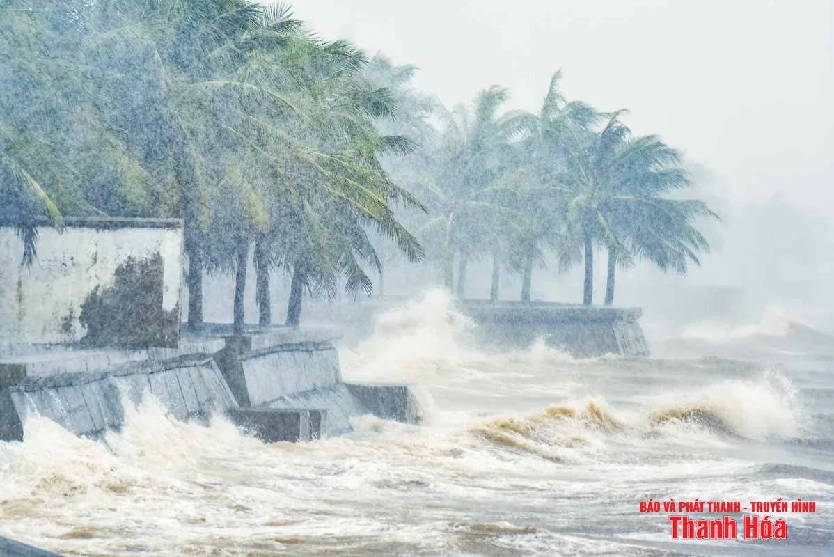
Illustration photo.
Thanh Hoa area heavy rain, strong wind
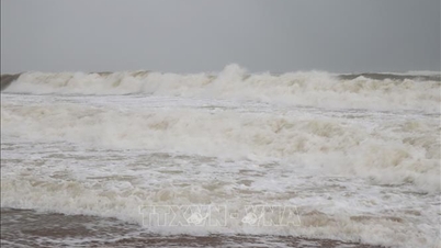
Due to the impact of the storm, the Thanh Hoa sea area is forecast to have strong winds of level 7 to level 9, increasing to level 10-11, near the storm center level 12-14, gusting to level 16. Waves are 5-7m high, near the storm center 8-10m high.
On land, from the night of August 24, there will be strong winds of level 8-10, near the storm center of level 11-13, gusting to level 14-15.
In addition, from the night of August 24 to August 26, 2025, Thanh Hoa province will have moderate rain, heavy rain, and very heavy rain and thunderstorms in some places. Rainfall in coastal plains and mountainous areas in the West and Southwest is generally from 150 - 300mm, in some places over 350mm, in mountainous areas in the North and Northwest is generally from 100 - 200mm, in some places over 200mm. Heavy rain will be concentrated on the day and night of August 25.
Warning of risk of heavy rain (>200mm/6h). Thunderstorms may cause tornadoes, lightning, hail and strong gusts of wind.
NM
Source: https://baothanhhoa.vn/bao-so-5-giu-nguyen-huong-di-chuyen-vung-bien-thanh-hoa-song-cao-5-7m-259252.htm

![[Photo] Dan Mountain Ginseng, a precious gift from nature to Kinh Bac land](/_next/image?url=https%3A%2F%2Fvphoto.vietnam.vn%2Fthumb%2F1200x675%2Fvietnam%2Fresource%2FIMAGE%2F2025%2F11%2F30%2F1764493588163_ndo_br_anh-longform-jpg.webp&w=3840&q=75)


Comment (0)