
 |
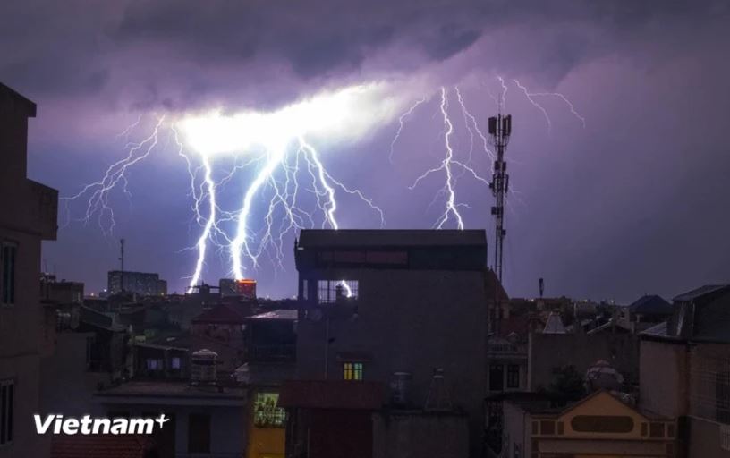
| (Illustrative photo. Source: Vietnam+) |
According to the National Center for Hydro-Meteorological Forecasting (Department of Hydro-Meteorology, Ministry of Agriculture and Environment ), from now until early May 2025, is the transitional season, so weather phenomena such as thunderstorms, lightning, and hail can greatly affect production and people's activities.
In addition, in late April and early May, some areas are at risk of drought, water shortages and potentially very high risks of fire and explosion.
Specifically, at noon on April 11, expert Nguyen Duc Hoa - Deputy Head of Climate Forecast Department, National Center for Hydro-Meteorological Forecasting, said that in the period from April 11 to May 10, the average temperature across the country was generally 0.5-1 degree Celsius higher; in particular, the North Central and South regions were approximately the same as the average of many years.
Also during the forecast period, cold air activity will gradually decrease in both intensity and frequency.
In late April, heat waves tend to increase in the Northern, North Central and Central regions; gradually increasing in the Central Highlands and the Southwest. In the Southeast, heat waves also continue to appear widely.
Regarding the rain trend, the meteorological agency forecasts that from April 11 to May 10, there is a possibility of widespread showers and thunderstorms in the Northern, Central Highlands and Southern regions.
Total rainfall nationwide is generally 20-40mm lower than the average of many years; in the North Central region alone, it is 5-10mm lower than the average of many years in the same period.
With the above weather trend, the National Center for Hydro-Meteorological Forecasting warns that from now until mid-May, there will continue to be the possibility of dangerous weather phenomena such as thunderstorms, tornadoes, lightning, and hail nationwide, which can greatly affect production and people's activities.
According to the meteorological agency, these dangerous weather phenomena occur very quickly in a short period of time, making it difficult to forecast far in advance. By monitoring satellite cloud images and radar images, the meteorological agency can give warnings about 30 minutes to 1 hour in advance.
Therefore, people need to be careful, when seeing strong winds, sudden drops in temperature, and dark clouds surrounding, there is a high possibility of hail occurring in that area.
In addition, with the lack of rain and the possibility of increased heat, some areas are at risk of drought, water shortage and potential fire and explosion risks, especially in the Central and South Central regions./.
Source: https://huengaynay.vn/chinh-tri-xa-hoi/theo-dong-thoi-su/canh-bao-nguy-co-dong-loc-mua-da-va-chay-rung-tu-nay-den-giua-thang-nam-152496.html
![[Photo] Top players gather at the 2025 Nhan Dan Newspaper National Table Tennis Championship](https://vphoto.vietnam.vn/thumb/1200x675/vietnam/resource/IMAGE/2025/5/23/9ad5f6f4faf146b08335e5c446edb107)
![[Photo] Anh Hoang - Dinh Duc successfully defended the men's doubles championship of the National Table Tennis Championship of Nhan Dan Newspaper](https://vphoto.vietnam.vn/thumb/1200x675/vietnam/resource/IMAGE/2025/5/23/d6ab3bcac02c49928b38c729d795cac6)


Comment (0)